Old Maps of Weber County, Utah for Academic Research
Study the evolution of Weber County with 196 high-resolution historic maps. Whether you're teaching, researching, or modeling changes in land use, these maps provide essential visual documentation of urban, environmental, and geographic change.
- Analyze long-term change: Track patterns in development, transportation, and natural features.
- Ideal for environmental or urban studies: Support academic projects with primary historical map data.
- Use in the classroom or lab: Educators and researchers rely on these maps to bring historical context to life.
These maps are a powerful tool for teaching, research, and visualizing how Weber County has changed over the decades.
Weber County, UT maps
(196)- 1954 Map of Ogden, 1967 Print
 1954 Ogden1967 Print · USGSThe northern Utah corridor and Wyoming borderlands are captured here in the mid-1950s, showing the region's transition from mountain wilderness to settled valleys. Researchers can trace historic institutions like Utah State University or locate vanished points like Church Butte Station and the Trappist Monastery.3 unique versions available
 - 1954 Map of Brigham City, 1968 Print
 1954 Brigham City1968 Print · USGSNorthern Utah and the edges of the Great Salt Lake are captured here during the mid-fifties, showing the region's transition from pioneer rail hubs to modern military ranges. Researchers can find old sidings like Lemay Siding, the Golden Spike Monument, and settlements like Washakie.4 unique versions available
 - 1955 Map of Ogden, 1956 Print
 1955 Ogden1956 Print · USGSOgden thrived as a rail and military hub in the mid-fifties, squeezed between the river basins and the high peaks of the Wasatch Range. Genealogists and researchers can trace the urban development of South Ogden and Riverdale or locate family sites near the City Cemetery and Sacred Heart Academy.5 unique versions available
 - 1955 Map of Plain City, 1956 Print
 1955 Plain City1956 Print · USGSAgricultural life in mid-fifties Weber County is captured through its extensive irrigation systems and local hubs like Plain City and Farr West. Trace the path of the Ogden Railroad Grade or locate the West Weber Cem and Utah Hot Springs.2 unique versions available
 - 1955 Map of Roy, 1956 Print
 1955 Roy1956 Print · USGSSettlements along the Weber River valley were rapidly evolving in the mid-fifties as military and rail hubs expanded. Genealogists and historians can trace the foundations of Roy and Clinton, locating family-named landmarks like the Clinton Cemetery and Lakeview School.4 unique versions available
 - 1955 Map of Mantua, 1956 Print
 1955 Mantua1956 Print · USGSThe mountain town of Mantua and the surrounding national forest are captured here in the mid-1950s. Genealogists and researchers can locate the Mantua Cemetery, trace mining sites like the Holton Mine, and find youth camps such as Camp Utaba.4 unique versions available
 - 1955 Map of Huntsville, 1956 Print
 1955 Huntsville1956 Print · USGSHuntsville and the Ogden Valley are shown in the mid-fifties just as the region's river-fed agriculture began to blend with new lakeside recreation. Genealogists and local historians can trace family plots at Mountain View Cemetery or locate early industrial sites like Shanghai Creek No 1 Mine and Patio Springs.4 unique versions available
 - 1955 Map of Willard Spur, 1956 Print
 1955 Willard Spur1956 Print · USGSThe northern Utah coastline in the mid-1950s reveals a shifting landscape of water and silt. Trace the historic county line across the Salt Flat and locate the June 1951 water level recorded near Bear River Bay and Little Mtn.
 - 1955 Map of Plain City SW, 1956 Print
 1955 Plain City SW1956 Print · USGSWest Warren sat at the edge of the great flats in the mid-1950s, where desert hydrology met early infrastructure. Genealogists and historians can locate Warren Cemetery, the John C Fremont Historic Marker, and numerous Artesian Wells.
 - 1955 Map of James Peak, 1956 Print
 1955 James Peak1956 Print · USGSThe high wilderness of the Cache National Forest is documented here in the mid-fifties, showing a landscape defined by canyons and peaks. Researchers can locate remote sites like the Honey Bee Mine, Fourmile Ranch, and the Davenport Jeep Trail.4 unique versions available
 - 1955 Map of North Ogden, 1956 Print
 1955 North Ogden1956 Print · USGSThe Wasatch Front's transition from orchard lands to residential neighborhoods is captured here in the mid-fifties. Genealogists and researchers can trace family landmarks like the Ben Lomond Cemetery, the State Industrial School, and the Utah Idaho Central rail lines.5 unique versions available
 - 1955 Map of Ogden Bay, 1956 Print
 1955 Ogden Bay1956 Print · USGSThe eastern shores of the Great Salt Lake are captured here in the mid-fifties as water management transformed the Weber River delta. Genealogists and local historians can trace the irrigation networks around Hooper and find sites like Hooper Hot Springs and Hales Bend (Site).
 - 1955 Map of Snow Basin, 1956 Print
 1955 Snow Basin1956 Print · USGSThe Wasatch Range and Weber Canyon are documented here during the mid-1950s, showing early ski infrastructure and mountain industry. Trace local genealogy at the Mtn Green Cemetery or locate the Strawberry Mine and Union Pacific rail line.3 unique versions available
 - 1955 Map of Fremont Island, 1956 Print
 1955 Fremont Island1956 Print · USGSFremont Island sits isolated in the Great Salt Lake during the mid-fifties, bisected by the long rail causeway of the Southern Pacific. Genealogists and historians can trace the remote Graves and Ruins on the island's southern tip or locate the rail station at Bagley.
 - 1958 Map of Ogden
 1958 Ogden1958 Print · USGSNorthern Utah and southwestern Wyoming are captured here during a period of steady growth and military expansion. You can trace the Union Pacific rail lines and early road networks connecting Ogden and Logan to Bear Lake and Evanston.
 - 1958 Map of Brigham City
 1958 Brigham City1958 Print · USGSNorthern Utah in the late fifties shows a landscape of extremes, from the salt flats to the bustling Bear River Valley. Trace historical routes like the Old Immigrant Trail and locate local landmarks such as the Brigham Sugar Mill and Booth Valley School.
 - 1960 Map of Ogden
 1960 Ogden1960 Print · USGSIn the mid-1950s, this region of the American West balanced military expansion with frontier history along the Union Pacific RR. Genealogists and historians can trace old settlements like Fort Bridger, the residential growth of Washington Terrace, and industrial sites from the Hill AFB complex to the coal mines of Kemmerer.
 - 1961 Map of Morgan, 1963 Print
 1961 Morgan1963 Print · USGSThe Weber River valley in the early sixties was a critical junction of rail industry and mountain agriculture. Local historians can trace the industrial footprint of the Cement Plant near Devils Slide and find vanished rural landmarks like the Monastery and Como Springs.2 unique versions available
 - 1962 Map of Brigham City
 1962 Brigham City1962 Print · USGSNorthern Utah in the early sixties reveals a landscape of vast salt flats and growing towns along the Wasatch Front. Researchers can trace the Southern Pacific line past the Golden Spike Monument or locate landmarks like Indian Cave and Donner-Reed Pass.
 - 1964 Map of Lost Creek Dam
 1964 Lost Creek Dam1964 Print · USGSThe mountains of Morgan County appear in the mid-sixties just as the Lost Creek Dam and Lost Creek Reservoir reshaped the high country. Historians can trace the Guilder Road or locate landmarks like Robinson Mine Hollow and Big Flat.2 unique versions available
 - 1964 Map of Monte Cristo PK, 1965 Print
 1964 Monte Cristo PK1965 Print · USGSThe northern Utah highlands and the Cache National Forest are shown here in the mid-1960s at a moment of intense topographic detail. Researchers can trace remote high-country water sources and landmarks like Monte Cristo Peak, Dry Bread Pond, and Bullpecker Spring.2 unique versions available
 - 1964 Map of Sharp Mountain, 1966 Print
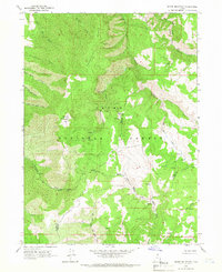 1964 Sharp Mountain1966 Print · USGSThe high ridge country of the Wasatch Range is captured here in the mid-1960s, showing the intersection of Cache and Weber counties. Local historians can locate the La Plata Mine and trace the headwaters of the Little Bear River and Cinnamon Creek.3 unique versions available
 - 1964 Map of Browns Hole, 1966 Print
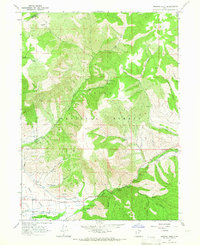 1964 Browns Hole1966 Print · USGSThe Ogden Valley hinterlands during the mid-sixties show a balance of irrigation agriculture and forest recreation near the Weber County line. You can trace early canyon access and recreation spots like Meadows Campground, Diversion Dam, and the winding Geertson Canyon.2 unique versions available
 - 1964 Map of Causey Dam, 1966 Print
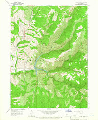 1964 Causey Dam1966 Print · USGSWeber County high country in the mid-1960s reveals a landscape centered on the recently completed Causey Dam. You can trace the rugged drainages of Skull Creek and Dry Bread Hollow or locate the holdings at Red Rock Ranch.3 unique versions available
 - 1968 Map of Horse Ridge, 1970 Print
 1968 Horse Ridge1970 Print · USGSThe high Wasatch backcountry of Weber and Rich counties comes into focus in this late 1960s survey. Researchers can trace historic access routes via Jeep Trails and Pack Trails across Horse Ridge and near the headwaters of the South Fork Ogden River.3 unique versions available
Showing maps 1-25 of 196
Top cities of Weber County
- Ogden historical maps
- Roy historical maps
- North Ogden historical maps
- South Ogden historical maps
- Pleasant View historical maps
- Riverdale historical maps
See more
Frequently asked questions
- What are the different types of historical maps available for Weber County?
- What is the oldest map of Weber County?
- Where can I purchase historical maps of Weber County for my home or office?
- Where can I download high-res historical maps of Weber County?
- Are there historical topographic maps available for Weber County?
- Is there historical aerial imagery available for Weber County?
- Where are historical maps of Weber County sourced from?