Old Maps of Ogden, Utah for Academic Research
Study the evolution of Ogden with 41 high-resolution historic maps. Whether you're teaching, researching, or modeling changes in land use, these maps provide essential visual documentation of urban, environmental, and geographic change.
- Analyze long-term change: Track patterns in development, transportation, and natural features.
- Ideal for environmental or urban studies: Support academic projects with primary historical map data.
- Use in the classroom or lab: Educators and researchers rely on these maps to bring historical context to life.
These maps are a powerful tool for teaching, research, and visualizing how Ogden has changed over the decades.
Ogden, UT maps
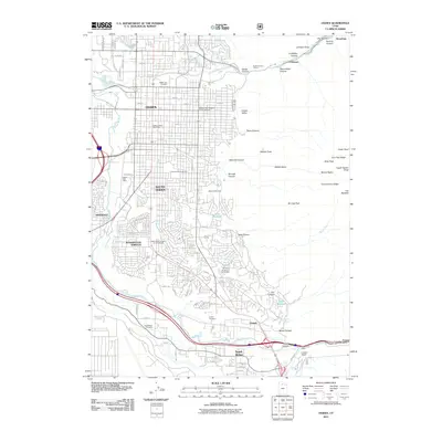
(41)- 1954 Map of Ogden, 1967 Print
 1954 Ogden1967 Print · USGSThe northern Utah corridor and Wyoming borderlands are captured here in the mid-1950s, showing the region's transition from mountain wilderness to settled valleys. Researchers can trace historic institutions like Utah State University or locate vanished points like Church Butte Station and the Trappist Monastery.3 unique versions available
 - 1954 Map of Brigham City, 1968 Print
 1954 Brigham City1968 Print · USGSNorthern Utah and the edges of the Great Salt Lake are captured here during the mid-fifties, showing the region's transition from pioneer rail hubs to modern military ranges. Researchers can find old sidings like Lemay Siding, the Golden Spike Monument, and settlements like Washakie.4 unique versions available
 - 1955 Map of Ogden, 1956 Print
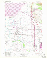
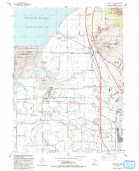
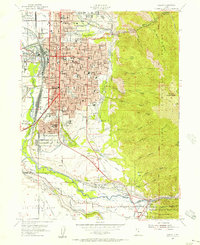 1955 Ogden1956 Print · USGSOgden thrived as a rail and military hub in the mid-fifties, squeezed between the river basins and the high peaks of the Wasatch Range. Genealogists and researchers can trace the urban development of South Ogden and Riverdale or locate family sites near the City Cemetery and Sacred Heart Academy.5 unique versions available
 - 1955 Map of Plain City, 1956 Print
 1955 Plain City1956 Print · USGSAgricultural life in mid-fifties Weber County is captured through its extensive irrigation systems and local hubs like Plain City and Farr West. Trace the path of the Ogden Railroad Grade or locate the West Weber Cem and Utah Hot Springs.2 unique versions available
 - 1955 Map of Roy, 1956 Print
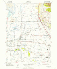
 1955 Roy1956 Print · USGSSettlements along the Weber River valley were rapidly evolving in the mid-fifties as military and rail hubs expanded. Genealogists and historians can trace the foundations of Roy and Clinton, locating family-named landmarks like the Clinton Cemetery and Lakeview School.4 unique versions available
 - 1955 Map of North Ogden, 1956 Print
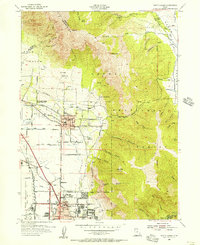 1955 North Ogden1956 Print · USGSThe Wasatch Front's transition from orchard lands to residential neighborhoods is captured here in the mid-fifties. Genealogists and researchers can trace family landmarks like the Ben Lomond Cemetery, the State Industrial School, and the Utah Idaho Central rail lines.5 unique versions available
 - 1958 Map of Ogden
 1958 Ogden1958 Print · USGSNorthern Utah and southwestern Wyoming are captured here during a period of steady growth and military expansion. You can trace the Union Pacific rail lines and early road networks connecting Ogden and Logan to Bear Lake and Evanston.
 - 1958 Map of Brigham City
 1958 Brigham City1958 Print · USGSNorthern Utah in the late fifties shows a landscape of extremes, from the salt flats to the bustling Bear River Valley. Trace historical routes like the Old Immigrant Trail and locate local landmarks such as the Brigham Sugar Mill and Booth Valley School.
 - 1960 Map of Ogden
 1960 Ogden1960 Print · USGSIn the mid-1950s, this region of the American West balanced military expansion with frontier history along the Union Pacific RR. Genealogists and historians can trace old settlements like Fort Bridger, the residential growth of Washington Terrace, and industrial sites from the Hill AFB complex to the coal mines of Kemmerer.
 - 1962 Map of Brigham City
 1962 Brigham City1962 Print · USGSNorthern Utah in the early sixties reveals a landscape of vast salt flats and growing towns along the Wasatch Front. Researchers can trace the Southern Pacific line past the Golden Spike Monument or locate landmarks like Indian Cave and Donner-Reed Pass.
 - 1969 Map of Plain City, 1971 Print
 1969 Plain City1971 Print · USGSNorth of Ogden in the late sixties, this landscape shows the complex water systems and rail corridors of the Weber River delta. Genealogists and local historians can trace the irrigation canals serving Plain City or locate the West Weber Cem and Utah Hot Springs.
 - 1986 Map of Ogden, 1987 Print
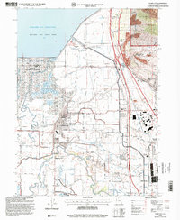
 1986 Ogden1987 Print · USGSThe Wasatch Front was undergoing significant development in the mid-eighties as the urban corridor stretched from Ogden toward the Great Salt Lake. Researchers can trace the legacy of regional transport and defense via Hill Air Force Base, the Union Pacific line, and mountain passes near Snow Basin.
 - 1987 Map of Promontory Point
 1987 Promontory Point1987 Print · USGSThe Wasatch Front meets the great salt desert in the late eighties, showing the rapid growth of towns from Brigham City to Layton. Follow the Southern Pacific (Lucin Cutoff) across the water and explore the remote terrain of Antelope Island and Promontory Point.
 - 1990 Map of Roy
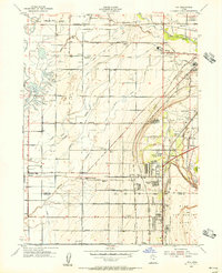
 1990 Roy1990 Print · USGSThe corridor between Ogden and Clinton is shown here in the 1990s, defined by its massive military installations and expanding suburban grid. Researchers can trace local landmarks like Clinton Cem, the Ogden Municipal Airport, and the former Old Railroad Grade.2 unique versions available
 - 1992 Map of North Ogden
 1992 North Ogden1992 Print · USGSNorth Ogden and the northern reaches of the Weber County valley are shown in the early 1990s as suburban expansion meets the Wasatch peaks. Researchers can trace local development through the Ben Lomond Cemetery, Lincoln Sch, and federal sites like the Defense Depot Ogden.2 unique versions available
 - 1992 Map of Ogden
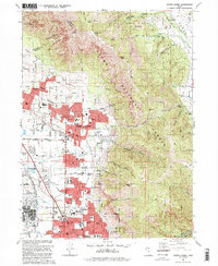
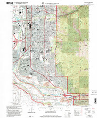
 1992 Ogden1992 Print · USGSThe Ogden area in the early nineties shows a thriving urban corridor bordered by the peaks of the Wasatch Range. Genealogists and historians can trace the development of Weber State University, the sprawling Defense Depot Ogden, and many local schools including St Josephs High Sch.2 unique versions available
 - 1992 Map of Plain City
 1992 Plain City1992 Print · USGSWeber County at the start of the nineties shows a landscape of engineered waterways and growing communities between the Wasatch foothills and the Great Salt Lake. Researchers can locate family sites and local landmarks like Plain City, Wahlquist Jr High Sch, and the Defense Depot Ogden.
 - 1998 Map of North Ogden, 2001 Print
 1998 North Ogden2001 Print · USGSThe northern reaches of the Wasatch Front are captured here in the late nineties as residential growth meets the forest edge. Genealogists and local historians can locate Ben Lomond Cemetery, Harrisville, and the Golden Spike Arena.
 - 1998 Map of Plain City, 2001 Print
 1998 Plain City2001 Print · USGSThe Weber County lowlands come into focus in the late nineties as irrigation and recreation reshape the valley. Genealogists can trace family plots at Plain City Cem or follow the historic Ogden and Brigham City Electric RR through Farr West.
 - 1998 Map of Ogden, 2001 Print
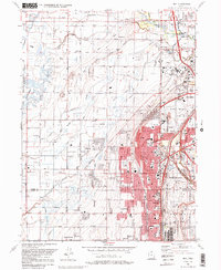
 1998 Ogden2001 Print · USGSOgden at the end of the millennium shows a bustling urban center transitioning into the peaks of the Wasatch Range. Researchers can trace family sites at City Cemetery and Uintah Cemetery or locate historic schools like Ben Lomond High Sch.
 - 1999 Map of Roy, 2001 Print
 1999 Roy2001 Print · USGSWeber County's growing suburban and military landscape is captured here during the late 1990s as cities like Roy and Clinton expand. Researchers can trace family history at Stoker Memorial Cemetery or locate landmarks like Hill Air Force Base and the Aerospace Museum.
 - 2011 Map of Roy, 2011 Print
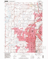
 2011 Roy2011 Print · USGSCovers Ogden, including Roy, Clearfield, and other nearby areas
 - 2011 Map of Plain City, 2011 Print
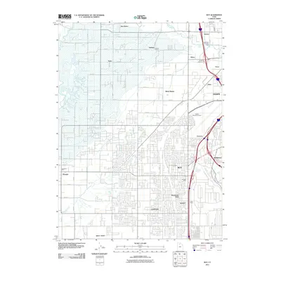
 2011 Plain City2011 Print · USGSCovers Ogden, including Pleasant View, Farr West, and other nearby areas
 - 2011 Map of North Ogden, 2011 Print
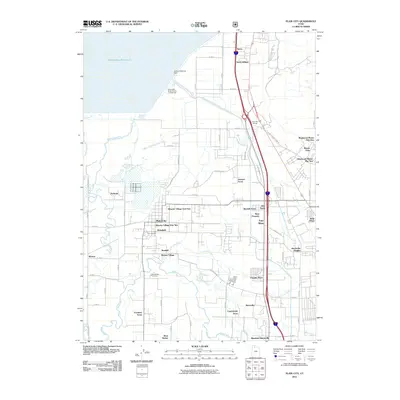
 2011 North Ogden2011 Print · USGSCovers Ogden, including North Ogden, Pleasant View, and other nearby areas
 - 2011 Map of Ogden, 2011 Print
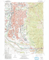
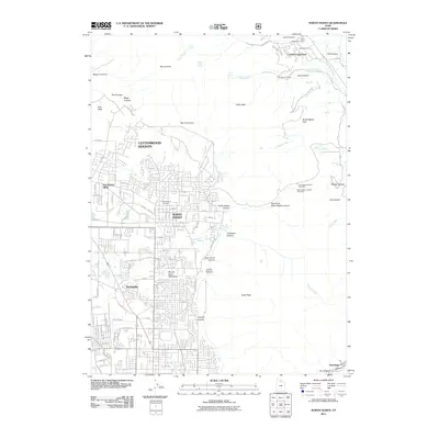
 2011 Ogden2011 Print · USGSCovers Ogden, including South Ogden, Riverdale, and other nearby areas
Showing maps 1-25 of 41
Top cities near Ogden
- Layton historical maps
- Roy historical maps
- Kaysville historical maps
- Syracuse historical maps
- Clearfield historical maps
- Farmington historical maps
See more
Top neighborhoods of Ogden
Frequently asked questions
- What are the different types of historical maps available for Ogden?
- What is the oldest map of Ogden?
- Where can I purchase historical maps of Ogden for my home or office?
- Where can I download high-res historical maps of Ogden?
- Are there historical topographic maps available for Ogden?
- Is there historical aerial imagery available for Ogden?
- Where are historical maps of Ogden sourced from?