2010s Maps of Prince Edward County, Virginia
Explore 60 historic maps of Prince Edward County from the 2010s. These maps offer a rare glimpse into what life looked like during the 2010s — showing old roads, neighborhoods, homes, and landmarks that have changed or disappeared over time.
Whether you're researching your family's past, planning a metal detecting trip, or studying how Prince Edward County's landscape evolved across the 2010s, these high-resolution maps are a powerful tool for exploring the history of this region.
- Focus on a specific era: All maps on this page are from the 2010s, giving you a focused view of this time period.
- See what’s changed: Compare century-old streets, trails, and buildings to today's modern landscape using overlays and satellite layers.
- Research with precision: Use these maps for genealogy, historical research, land use analysis, or educational projects.
- View, download, or print: Maps are fully viewable online in high resolution, and can be downloaded or printed for your own records.
Start exploring Prince Edward County's history through authentic maps from the 2010s. This is your window into the past.
Prince Edward County, VA maps
(60)- 2010 Map of Hampden Sydney, 2010 Print
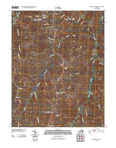 2010 Hampden Sydney2010 Print · USGSHampden Sydney and the surrounding Prince Edward County countryside are captured here just after the first decade of the millennium. Local historians can locate ancestral sites at Mount Pleasant Cemetery or trace the early development of Worsham and Redd Shop.
 - 2010 Map of Deatonville, 2010 Print
 2010 Deatonville2010 Print · USGSAmelia County’s rural character is preserved in this study of the landscape near the turn of the decade. Genealogists and local historians can trace legacy sites like Pilgrim Cemetery, the Southall Cemetery, and the community of Deatonville.
 - 2010 Map of Eureka, 2010 Print
 2010 Eureka2010 Print · USGSCharlotte County at the dawn of the 2010s reveals a rural landscape focused on water management and agricultural research. Genealogists and local historians can trace family-named roads and landmarks like the Virginia Polytechnic Institute Experimental Farm, Henry, and Roanoke Creek Site 67 Lake.
 - 2010 Map of Madisonville, 2010 Print
 2010 Madisonville2010 Print · USGSCentral Charlotte County comes into focus in the early 21st century, showing a rural landscape defined by creek headwaters and upland ridges. Genealogists can locate family sites at Mount Lyle Cemetery or Oaks Cemetery while tracing landmarks like Wards Fork Mill.
 - 2010 Map of Prospect, 2010 Print
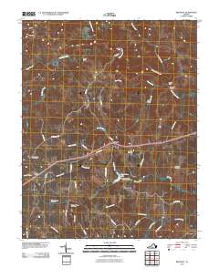 2010 Prospect2010 Print · USGSPrince Edward County's rural character is preserved in this 2010 survey of the settlements and waterways east of Appomattox. Researchers can locate specific family burial sites like Sulphur Spring Cemetery and trace historical river crossings at Beazley Ford.
 - 2010 Map of Pamplin, 2010 Print
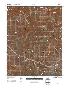 2010 Pamplin2010 Print · USGSThis part of Prince Edward County in 2010 reveals a landscape of enduring rural crossroads and protected forests. Researchers can trace the layout of small communities like Shields and Flood, or follow the winding Appomattox River as it passes near Hixburg.
 - 2010 Map of Farmville, 2010 Print
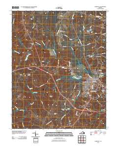 2010 Farmville2010 Print · USGSFarmville and the surrounding Prince Edward County countryside are captured here in the early twenty-first century, centered on the Appomattox River. Researchers can locate historic burial sites like the Confederate Cemetery and trace the outskirts near Tuggle and Raines Tavern.
 - 2010 Map of Andersonville, 2010 Print
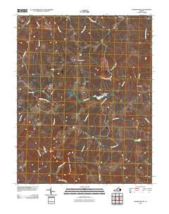 2010 Andersonville2010 Print · USGSBuckingham County's interior at the start of the 2010s reveals a landscape of protected forests and quiet crossroads. Genealogists and hikers can trace old routes near Bethel Cemetery, find crossings at Cut Banks Ford, or explore the heights of Woods Mountain.
 - 2010 Map of Rice, 2010 Print
 2010 Rice2010 Print · USGSThe Appomattox River valley in Prince Edward County comes into focus in the early 2000s, centered on the landmark High Bridge. Researchers can trace old family footprints through numerous local burial grounds like Pisgah Cemetery and High Bridge Cemetery.
 - 2010 Map of Meherrin, 2010 Print
 2010 Meherrin2010 Print · USGSSouthern Virginia’s rural interior remains preserved here in the early twenty-first century, showcasing a landscape of river-fed valleys and quiet crossroads. Researchers can trace family history through the Bruce Cemetery, Arvins Store, and the village of Meherrin.
 - 2010 Map of Green Bay, 2010 Print
 2010 Green Bay2010 Print · USGSSouthern Prince Edward County at the start of the 2010s is defined by its deep forests and network of small lakes. Researchers can locate family landmarks like Liberty Cemetery or trace the boundaries of the Prince Edward Gallion Sf near Green Bay.
 - 2010 Map of Rubermont, 2010 Print
 2010 Rubermont2010 Print · USGSLunenburg County at the start of the 2010s shows a quiet landscape of rural crossroads and river bottomlands. Genealogists and local historians can trace the road networks connecting Victoria and Rubermont to landmarks like Saint Marks Cemetery and Martins Corner.
 - 2010 Map of Crewe West, 2010 Print
 2010 Crewe West2010 Print · USGSNottoway County’s rail and road junctions are captured here in the early twenty-first century as they pass through historically significant crossroads. Genealogists can locate family burial grounds including Downs Cemetery and Vaughns Cemetery near settlements like Burkeville and Jennings Ordinary.
 - 2010 Map of Keysville, 2010 Print
 2010 Keysville2010 Print · USGSKeysville and its surrounding rural hamlets are captured at the start of the 2010s, showing a landscape defined by the North Meherrin River. Researchers can locate family landmarks like Ash Camp Memorial Cemetery, Staples Cemetery, and the community at Simplicity.
 - 2010 Map of Abilene, 2010 Print
 2010 Abilene2010 Print · USGSCharlotte County’s rural crossroads are captured here during the early 2000s, showing a landscape defined by its waterways and small settlements. Genealogists can locate family burial sites at Bethpeor Cemetery or Saint Ann Cemetery, while tracing old routes like Old Mill Rd near Abilene.
 - 2013 Map of Andersonville, 2013 Print
 2013 Andersonville2013 Print · USGSBuckingham County's rural character is preserved in this recent survey of the lands between the Willis and Appomattox Rivers. Researchers can trace old routes and river crossings such as Banks Ford, the heights of Woods Mountain, and the small crossroads of Enonville.
 - 2013 Map of Rice, 2013 Print
 2013 Rice2013 Print · USGSThe rural landscape east of Farmville is captured here in the early 2000s, centered on the vital crossings of the Appomattox. Researchers can trace historic river points and local settlements like High Bridge, Raines Tavern, and Rice.
 - 2013 Map of Keysville, 2013 Print
 2013 Keysville2013 Print · USGSCharlotte County, Virginia, is captured in this modern survey during a period of steady rural character. Genealogists and local historians can trace the road networks connecting Keysville to outlying communities like Simplicity, Virso, and Briery.
 - 2013 Map of Green Bay, 2013 Print
 2013 Green Bay2013 Print · USGSPrince Edward County's rural heartland is documented here in the early twenty-first century, showing the crossroads of timber lands and forest preserves. Genealogists and local historians can trace family road names and sites near Green Bay, Leigh Mountain, and Hicks Lake.
 - 2013 Map of Farmville, 2013 Print
 2013 Farmville2013 Print · USGSThe town of Farmville and its surrounding Prince Edward County landscapes are captured here in the early twenty-first century. Researchers can trace the development of Farmville near the Appomattox River or locate outlying points like Raines Tavern and Tuggle.
 - 2013 Map of Deatonville, 2013 Print
 2013 Deatonville2013 Print · USGSAmelia County as it appeared in the early 2010s shows a landscape still deeply rooted in its rural crossroads and river-fed geography. Genealogists and researchers can trace the vicinity of Deatonville and Gills or follow old routes like Morrissetts Mill Rd.
 - 2013 Map of Prospect, 2013 Print
 2013 Prospect2013 Print · USGSIn the heart of Southside Virginia, this survey captures the rural character of Prince Edward County as the modern highway system matured. Genealogists and historians can trace local family landmarks and water crossings like Beazley Ford, Allens Mill, and Venables Bridge.
 - 2013 Map of Pamplin, 2013 Print
 2013 Pamplin2013 Print · USGSThe Appomattox River valley in central Virginia remains a landscape of quiet crossroads and family-named homesteads in this 2013 survey. Genealogists and local historians can trace the rural layout of Pamplin, Shields, and the timberlands of the Appomattox Buckingham SF.
 - 2013 Map of Eureka, 2013 Print
 2013 Eureka2013 Print · USGSCharlotte County’s rural landscape is captured here in the early twenty-first century, centered on the crossroads of Eureka and Henry. Researchers can trace agricultural roots at the Virginia Polytechnic Institute Experimental Farm or explore the network of local waterways like Twittys Creek and Ash Camp Creek.
 - 2013 Map of Abilene, 2013 Print
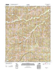 2013 Abilene2013 Print · USGSAbilene and the surrounding Charlotte County countryside appear in this survey from the early 2010s. Local historians can trace established rural road networks and water bodies like Stockton Lake and the crossroads at Five Forks.
Showing maps 1-25 of 60
Top cities of Prince Edward County
Frequently asked questions
- What are the different types of historical maps available for Prince Edward County?
- What is the oldest map of Prince Edward County?
- Where can I purchase historical maps of Prince Edward County for my home or office?
- Where can I download high-res historical maps of Prince Edward County?
- Are there historical topographic maps available for Prince Edward County?
- Is there historical aerial imagery available for Prince Edward County?
- Where are historical maps of Prince Edward County sourced from?