1950s Maps of Adams County, Washington
Explore 23 historic maps of Adams County from the 1950s. These maps offer a rare glimpse into what life looked like during the 1950s — showing old roads, neighborhoods, homes, and landmarks that have changed or disappeared over time.
Whether you're researching your family's past, planning a metal detecting trip, or studying how Adams County's landscape evolved across the 1950s, these high-resolution maps are a powerful tool for exploring the history of this region.
- Focus on a specific era: All maps on this page are from the 1950s, giving you a focused view of this time period.
- See what’s changed: Compare century-old streets, trails, and buildings to today's modern landscape using overlays and satellite layers.
- Research with precision: Use these maps for genealogy, historical research, land use analysis, or educational projects.
- View, download, or print: Maps are fully viewable online in high resolution, and can be downloaded or printed for your own records.
Start exploring Adams County's history through authentic maps from the 1950s. This is your window into the past.
Adams County, WA maps
(23)- 1950 Map of La Crosse
 1950 La Crosse1950 Print · USGSWhitman County's wheat-growing heartland is captured here in the mid-twentieth century as the rail-and-river economy flourished. You can trace the Union Pacific line through Winona and La Crosse, or locate rural landmarks like Pampa Pond and the Airway Beacon.2 unique versions available
 - 1950 Map of Starbuck
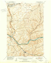 1950 Starbuck1950 Print · USGSSoutheast Washington during the late 1940s is defined by the winding Snake River and its rugged canyons. Genealogists and historians can trace the rail-and-river network of Starbuck and Riparia, or locate family sites like Gordon Farm and McGregor Ranch.
 - 1950 Map of Haas
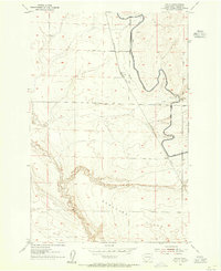
 1950 Haas1950 Print · USGSFranklin County at the midpoint of the century reveals a landscape shaped by the Snake River and competing rail lines. Genealogists and local historians can locate early homesteads like Davin Ranch and Nunamaker Farm alongside rail stops at Sperry and McAdam.
 - 1950 Map of Benge, 1970 Print
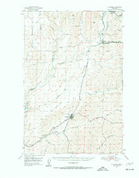
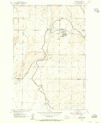
 1950 Benge1970 Print · USGSThe scabland coulees and rail corridors of Adams County are captured here in the mid-twentieth century. Researchers can trace the Old Military Trail or locate the rural hubs of Benge, Ankeny, and Hooper along the river and rail lines.2 unique versions available
 - 1951 Map of Scooteney Lake
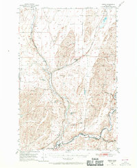
 1951 Scooteney Lake1951 Print · USGSFranklin County ranching and rail history are preserved in this mid-century survey of the Washington high desert. Genealogists and historians can trace family landmarks like Rickards Ranch and the early layout of Mesa along the Pacific Northern line.
 - 1951 Map of Corfu
 1951 Corfu1951 Print · USGSCentral Washington is seen here during the mid-century irrigation boom as the landscape began to shift under new water projects. Researchers can trace the original rail stops of Corfu and Taunton along the Chicago Milwaukee St Paul and Pacific line before the rising waters behind O'Sullivan Dam transformed the region.
 - 1951 Map of Hanford, 1955 Print
 1951 Hanford1955 Print · USGSThe Columbia River basin in the early fifties shows a landscape reshaped for the atomic era. Genealogists and local historians can trace the foundations of the Hanford Townsite, White Bluffs Townsite, and several family homesteads like Pioneer Ranch.
 - 1952 Map of La Crosse
 1952 La Crosse1952 Print · USGSWhitman County's Palouse hills and deep creek flats are captured here in the early fifties, showing a landscape shaped by water and rail. Genealogists and rail historians can trace the Union Pacific line through La Crosse, Winona, and the small siding at Pampa.
 - 1952 Map of Benge
 1952 Benge1952 Print · USGSThe scablands of Adams and Whitman counties are captured here in the early fifties, showing a landscape shaped by rail and river. Genealogists and rail historians can trace the tracks through Benge, Hooper, and Ankeny along the banks of the Palouse River.
 - 1953 Map of Walla Walla, 1964 Print
 1953 Walla Walla1964 Print · USGSSoutheast Washington enters the atomic and hydroelectric age in the mid-twentieth century as new dams reshape the desert landscape. You can trace the development of the Hanford Works, identify remote rail stops like Novara Siding, and locate the historic Dry Creek Cem.3 unique versions available
 - 1953 Map of Ritzville, 1966 Print
 1953 Ritzville1966 Print · USGSEastern Washington was undergoing a massive agricultural and industrial transformation in the mid-fifties as irrigation from the Grand Coulee Dam reached the plateau. Researchers can trace the mid-century rail network of the Great Northern and locate vital local sites like Larson Air Force Base and Odessa.3 unique versions available
 - 1954 Map of Bruce, 1955 Print
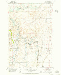
 1954 Bruce1955 Print · USGSAdams County’s high desert landscape is shown here in the mid-fifties during the expansion of the Columbia Basin Project. Genealogists and rail historians can trace the Northern Pacific route through Bruce and Koren alongside the East Low Canal.2 unique versions available
 - 1954 Map of Warden, 1956 Print
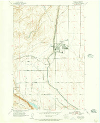
 1954 Warden1956 Print · USGSWarden and the surrounding Columbia Basin are shown in the mid-1950s, highlighting the massive arrival of irrigation and rail infrastructure. Trace the dual railroad lines of the Northern Pacific and trace the path of the East Low Canal as it passes West Warden.2 unique versions available
 - 1954 Map of Soda Lake, 1956 Print
 1954 Soda Lake1956 Print · USGSThe basalt coulees and water projects of central Washington are captured here in the mid-fifties, just as the regional irrigation infrastructure was maturing. Trace the historic route of the Chicago Milwaukee St Paul and Pacific railroad past the Columbia National Wildlife Refuge and the waters of Soda Lake.2 unique versions available
 - 1954 Map of Othello, 1956 Print
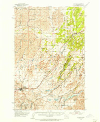
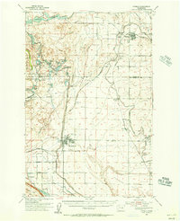
 1954 Othello1956 Print · USGSMid-century Othello was a hub of the Columbia Basin Project, where new irrigation canals met the transcontinental rail line. Genealogists and local historians can trace family road names like Loiselle Road and find landmarks such as Lutacaga Sch and Adams Cemetery.2 unique versions available
 - 1954 Map of Sprague, 1956 Print
 1954 Sprague1956 Print · USGSEastern Washington’s Channeled Scablands are captured in the mid-1950s, showing a complex network of four major railroads crossing the rocky terrain. Genealogists and rail historians can trace the foundations of Sprague, the community at Fishtrap, and the Aban'd Sch near Tyler.2 unique versions available
 - 1954 Map of Othello, 1956 Print
 1954 Othello1956 Print · USGSThe Columbia Basin is seen mid-century as irrigation projects transformed the landscape around Othello and Warden. Researchers can trace the development of the Potholes East Canal alongside local landmarks like Lutacaga Sch and the Adams Cem.
 - 1955 Map of Pullman, 1963 Print
 1955 Pullman1963 Print · USGSThe Palouse and Clearwater regions are captured here in the mid-1950s, showing the height of the rail-and-river economy. Genealogists and historians can trace rail lines like the Camas Prairie RR, find local landmarks like Whitman County Memorial Cem, and locate early academic centers at Washington State University and the University of Idaho.3 unique versions available
 - 1955 Map of Spokane, 1965 Print
 1955 Spokane1965 Print · USGSInland Empire life in the fifties and sixties centers on the growth of Spokane and the heavy mining industry of northern Idaho. Trace mid-century landmarks like Fairchild Air Force Base, the Bunker Hill Mine, and early campuses such as Gonzaga University.2 unique versions available
 - 1958 Map of Spokane
 1958 Spokane1958 Print · USGSThe Inland Empire is shown at a mid-century peak of industrial and military activity, from the rail hubs of Spokane to the deep silver mines of northern Idaho. Researchers can trace the sprawling rail lines of the Union Pacific RR or locate landmarks like Fairchild Air Force Base and the Bunker Hill Smelter & Mine.
 - 1958 Map of Pullman
 1958 Pullman1958 Print · USGSThe Palouse and Clearwater regions are captured here in the late fifties, showing the vital river-and-rail connection between eastern Washington and northern Idaho. Local historians can trace the paths of the Camas Prairie RR and Union Pacific RR as they serve towns like Colfax, Kamiah, and Nezperce.2 unique versions available
 - 1958 Map of Walla Walla
 1958 Walla Walla1958 Print · USGSThe Tri-Cities and Walla Walla region are captured here during the mid-century expansion of atomic energy and river infrastructure. Genealogists and historians can trace the early layout of Richland (AEC), the rural Hatton and Washtucna settlements, and landmarks like Palouse Falls State Park.
 - 1959 Map of Ritzville
 1959 Ritzville1959 Print · USGSEastern Washington in the late fifties reveals a landscape transformed by massive irrigation projects and postwar growth. Genealogists and historians can trace rail-line communities from Ritzville to Davenport and locate landmarks like Larson Air Force Base and Telford Station.
End of results
Showing maps 1-23 of 23
Top cities of Adams County
- Othello historical maps
- Ritzville historical maps
- Lind historical maps
- Washtucna historical maps
- Hatton historical maps
Frequently asked questions
- What are the different types of historical maps available for Adams County?
- What is the oldest map of Adams County?
- Where can I purchase historical maps of Adams County for my home or office?
- Where can I download high-res historical maps of Adams County?
- Are there historical topographic maps available for Adams County?
- Is there historical aerial imagery available for Adams County?
- Where are historical maps of Adams County sourced from?