1980s Maps of Adams County, Washington
Explore 19 historic maps of Adams County from the 1980s. These maps offer a rare glimpse into what life looked like during the 1980s — showing old roads, neighborhoods, homes, and landmarks that have changed or disappeared over time.
Whether you're researching your family's past, planning a metal detecting trip, or studying how Adams County's landscape evolved across the 1980s, these high-resolution maps are a powerful tool for exploring the history of this region.
- Focus on a specific era: All maps on this page are from the 1980s, giving you a focused view of this time period.
- See what’s changed: Compare century-old streets, trails, and buildings to today's modern landscape using overlays and satellite layers.
- Research with precision: Use these maps for genealogy, historical research, land use analysis, or educational projects.
- View, download, or print: Maps are fully viewable online in high resolution, and can be downloaded or printed for your own records.
Start exploring Adams County's history through authentic maps from the 1980s. This is your window into the past.
Adams County, WA maps
(19)- 1981 Map of La Crosse West
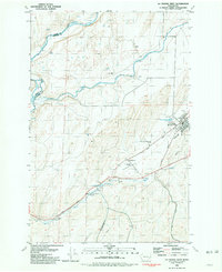 1981 La Crosse West1981 Print · USGSWhitman County agriculture and rail infrastructure are captured in the early 1980s as the town of La Crosse remains a hub for the local grain trade. Genealogists and researchers can trace the Union Pacific route, locate the Cem, and find rural landmarks like the Robert Camp Memorial Track.
 - 1981 Map of Sprague
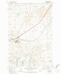 1981 Sprague1981 Print · USGSThe rail-centered town of Sprague is shown here in the early eighties at a significant junction of two major lines. Genealogists and researchers can trace local landmarks like Lake View Cem, Maccabee Cem, and the waters of Fourth of July Lake.
 - 1981 Map of Palouse Falls
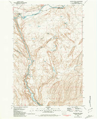 1981 Palouse Falls1981 Print · USGSThe scablands of Eastern Washington are captured here in the early eighties, showcasing a landscape defined by the Palouse River and heavy rail. Researchers can trace the lines of the Union Pacific through Hooper Junction or locate remote landmarks like Gildersleeve Spring.
 - 1981 Map of Sperry
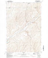 1981 Sperry1981 Print · USGSFranklin County grain-farming and rail history are highlighted here in the early eighties as the industrial corridor follows the dramatic geology of the Washtucna Coulee. Researchers can find Sperry with its Grain Elevators, the settlement of Harder, and a local Cem near Lake Kahlotus.
 - 1981 Map of Benge
 1981 Benge1981 Print · USGSBenge was a vital rail-side community in Adams County during the early 1980s, anchored by the Burlington Northern line. Genealogists and historians can trace local landmarks like Spider Lake, the old Gravel Pit, and Twelvemile Spring.
 - 1981 Map of Washtucna South
 1981 Washtucna South1981 Print · USGSFranklin and Adams County ranch lands are captured here in the early 1980s, centered on a critical rail corridor through the desert. Local researchers can trace family-named landmarks like H U Ranch and Davin Ranch alongside the busy Union Pacific rail lines.
 - 1981 Map of Honn Lakes
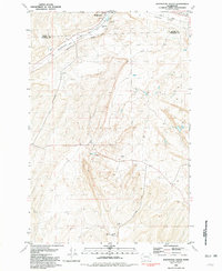
 1981 Honn Lakes1981 Print · USGSWhitman County's rugged coulee country is captured in the early 1980s as a landscape of basalt drainage and isolated ranching infrastructure. Genealogists and local historians can trace family-named sites like Lehrbas Spring and Honn Lakes alongside the Benge Winona Landing Strip.
 - 1981 Map of Coyote Butte
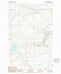
 1981 Coyote Butte1981 Print · USGSThe Washington-Adams county line was a landscape of remote rail sidings and cattle ranching in the early eighties. Genealogists and local historians can trace former settlement sites at Thavis and Mack, as well as the path of the Old Military Road.
 - 1981 Map of Rattlesnake Canyon
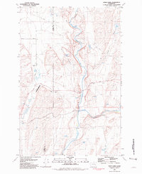
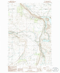
 1981 Rattlesnake Canyon1981 Print · USGSThe Palouse River valley in the early 1980s reveals a critical junction of rail and water infrastructure along the Adams and Whitman county line. Researchers can trace the Union Pacific line as it serves rural stations like Hooper and Willow, or locate isolated landmarks like Negro Lake and Rattlesnake Canyon.
 - 1981 Map of Hooper
 1981 Hooper1981 Print · USGSAdams and Whitman counties are captured here in the early eighties, defined by the winding course of the Palouse River. Researchers can trace the path of the Old Mullan Road and locate rural landmarks like the Bar U Ranch and the rail siding at Ankeny.
 - 1982 Map of Pullman
 1982 Pullman1982 Print · USGSThe Palouse region and Snake River valley are shown in the early eighties as the river navigation system matured. Trace the rail lines of the Union Pacific, locate rural centers like Johnson and Colton, and see the impact of the Lower Granite Dam.
 - 1982 Map of Ritzville, 1983 Print
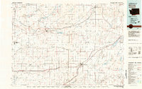 1982 Ritzville1983 Print · USGSEastern Washington's scabland landscape is captured here in the early eighties as a network of rail-towns and coulees. Researchers can trace the BURLINGTON NORTHERN route through Odessa, Lamona, and Ritzville or locate landmarks like Sprague Lake and Karakul Hills.
 - 1983 Map of Connell
 1983 Connell1983 Print · USGSEastern Washington's coulee country is captured here in the early eighties as a landscape of remote rail junctions and massive river engineering. Trace family roots in Connell or Kahlotus, and follow old transport lines like the Old Lind Road Grade and Burlington Northern tracks.
 - 1984 Map of Rosalia
 1984 Rosalia1984 Print · USGSThe Palouse region of Eastern Washington and the Idaho borderlands are shown here in the mid-1980s, a landscape of rolling wheat fields and vital rail corridors. Genealogists and historians can trace the early layout of Cheney, the rail junctions at Rosalia, and the distinct topography of Steptoe Butte.
 - 1986 Map of Scooteney Reservoir
 1986 Scooteney Reservoir1986 Print · USGSThe mid-1980s landscape of Franklin and Adams Counties is defined by the massive irrigation and energy works of the Columbia Basin Project. Researchers can trace the water and power network from the Potholes Canal to the Russell D Smith Powerplant.
 - 1986 Map of Taunton
 1986 Taunton1986 Print · USGSIn the high desert of the 1980s, this area shows the intersection of railroad history and massive irrigation projects. Researchers can trace the path of the Milwaukee Road past Taunton or explore the hydraulic engineering of the Wahluke Branch Canal and siphon.
 - 1986 Map of Hanford NE
 1986 Hanford NE1986 Print · USGSFranklin County's landscape in the mid-1980s reveals the intersection of irrigation engineering and the secure perimeter of the Hanford Site Habitat Management Area. Researchers can trace the path of the Old RR Grade or locate infrastructure like the Wahluke Branch Canal and a local substation.
 - 1986 Map of Eagle Lakes
 1986 Eagle Lakes1986 Print · USGSFranklin County and the high desert of the mid-eighties are captured here, showing the intersection of Cold War military sites and massive irrigation projects. Genealogists and historians can trace the Othello Air Force Sta, the Baillie Memorial Boys Ranch, and the complex network of the Wasteway.
 - 1986 Map of O'Sullivan Dam
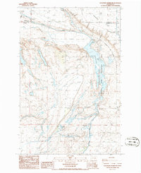
 1986 O'Sullivan Dam1986 Print · USGSCentral Washington in the mid-eighties was a landscape shaped by massive water management projects and wildlife conservation. You can trace the complex drainage systems and lake networks of the Columbia National Wildlife Refuge and the Potholes Reservoir.
End of results
Showing maps 1-19 of 19
Top cities of Adams County
- Othello historical maps
- Ritzville historical maps
- Lind historical maps
- Washtucna historical maps
- Hatton historical maps
Frequently asked questions
- What are the different types of historical maps available for Adams County?
- What is the oldest map of Adams County?
- Where can I purchase historical maps of Adams County for my home or office?
- Where can I download high-res historical maps of Adams County?
- Are there historical topographic maps available for Adams County?
- Is there historical aerial imagery available for Adams County?
- Where are historical maps of Adams County sourced from?