Old Maps of Adams County, Washington for Genealogy
Trace your family roots with 161 historic maps of Adams County. These high-res maps reveal old neighborhoods, homesites, landmarks, and streets — helping you uncover where your ancestors lived and how the area evolved over time.
- Explore historic neighborhoods: Identify where your relatives may have lived in the 1800s or 1900s.
- Compare maps over time: Trace the changes in streets, buildings, and landmarks for multi-generational research.
- Perfect for genealogy & ancestry research: Used by family historians and researchers to map out lineage and migration.
These maps are an incredible resource for exploring your personal connection to Adams County's past.
Adams County, WA maps
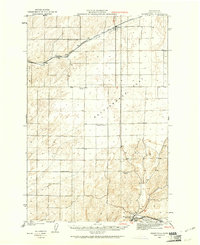
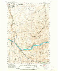
(161)- 1916 Map of Connell
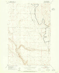
 1916 Connell1916 Print · USGSIn the decade before the region's landscape was further transformed by modern irrigation, this area shows a dense network of early schoolhouses and railroad stops. Genealogists can trace family footprints through sites like Roxboro School, Hatton, and Kahlotus along the Washtucna Lake shoreline.
 - 1918 Map of Connell
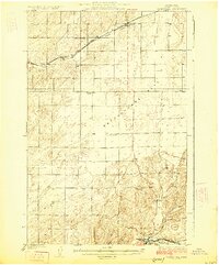
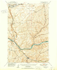
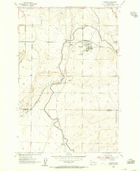
 1918 Connell1918 Print · USGSEastern Washington at the end of the Great War era shows a landscape shaped by emerging railroads and a dense network of rural school districts. Genealogists and historians can trace family-named sites across Paradise Flats and locate early community hubs like Kahlotus, Connell, and Stephenson School.
 - 1923 Map of Washtucna
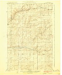
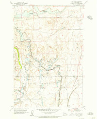
 1923 Washtucna1923 Print · USGSEastern Washington's wheat country and rail corridors are captured here during the early 1920s. Researchers can trace family ties to local landmarks like Hillcrest School or explore the rail networks of the Union Pacific and Ralston.
 - 1923 Map of Corfu
 1923 Corfu1923 Print · USGSThe high desert of Grant and Adams counties comes into focus in the early twenties, during the height of the transcontinental rail era. Genealogists and historians can locate rural landmarks like Hope Valley School and the rail stops at Corfu and Taunton.
 - 1924 Map of Othello
 1924 Othello1924 Print · USGSThe Columbia Basin during the mid-1920s shows a landscape of pioneering rail towns and remote schoolhouses. Genealogists and historians can trace family locations through rural landmarks like ADAMS CEM, Billington School, and the rail stops at Bruce and Hamlet Spur.2 unique versions available
 - 1924 Map of Hanford
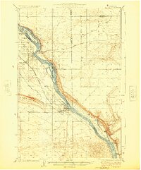 1924 Hanford1924 Print · USGSThe Columbia River valley in the early 1920s was a landscape of pioneering ranches and riverfront towns long before the atomic age. Genealogists and historians can trace the foundations of Hanford and White Bluffs, or locate rural landmarks like the Brick School and Maplehurst Ranch.2 unique versions available
 - 1925 Map of Schrag
 1925 Schrag1925 Print · USGSAdams County’s high desert plateau comes alive in the mid-twenties, showing a landscape of scattered grain elevators and family-named landmarks. Trace early rail life through Batum and Schrag, or locate rural schoolhouses like High Valley School and the Janke School.2 unique versions available
 - 1925 Map of Scooteney Lake
 1925 Scooteney Lake1925 Print · USGSFranklin County ranching and rail life are captured here in the mid-1920s, showing the early development of the Columbia Basin. Genealogists can locate family homesteads like Hendrix Sheep Ranch and Hezel Ranch or trace rural education at Kohler School.
 - 1925 Map of Washtucna
 1925 Washtucna1925 Print · USGSAdams County in the mid-twenties shows a landscape defined by expanding rail lines and a network of rural school districts. Genealogists can trace family proximities to Schaffer School, Burkhart School, and the rail siding at Pizarro.2 unique versions available
 - 1948 Map of Starbuck, 1968 Print
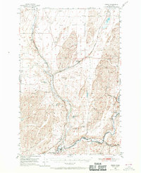
 1948 Starbuck1968 Print · USGSThe Snake River canyon and Palouse coulees defined this rail-and-ranching corridor in the late 1940s. Genealogists and historians can trace the foundations of Starbuck, the riverside settlement of Riparia, and family sites like Gordon Farm.
 - 1948 Map of Ayer, 1976 Print
 1948 Ayer1976 Print · USGSThe Snake River breaks through the basalt plateau in the late 1940s, serving as a vital corridor for the Union Pacific and various family operations. Researchers can trace the riverfront at Ayer and Magallon or locate named homesteads like the Tucker Farm and Davin Ranch.
 - 1950 Map of La Crosse
 1950 La Crosse1950 Print · USGSWhitman County's wheat-growing heartland is captured here in the mid-twentieth century as the rail-and-river economy flourished. You can trace the Union Pacific line through Winona and La Crosse, or locate rural landmarks like Pampa Pond and the Airway Beacon.2 unique versions available
 - 1950 Map of Starbuck
 1950 Starbuck1950 Print · USGSSoutheast Washington during the late 1940s is defined by the winding Snake River and its rugged canyons. Genealogists and historians can trace the rail-and-river network of Starbuck and Riparia, or locate family sites like Gordon Farm and McGregor Ranch.
 - 1950 Map of Haas
 1950 Haas1950 Print · USGSFranklin County at the midpoint of the century reveals a landscape shaped by the Snake River and competing rail lines. Genealogists and local historians can locate early homesteads like Davin Ranch and Nunamaker Farm alongside rail stops at Sperry and McAdam.
 - 1950 Map of Benge, 1970 Print
 1950 Benge1970 Print · USGSThe scabland coulees and rail corridors of Adams County are captured here in the mid-twentieth century. Researchers can trace the Old Military Trail or locate the rural hubs of Benge, Ankeny, and Hooper along the river and rail lines.2 unique versions available
 - 1951 Map of Scooteney Lake
 1951 Scooteney Lake1951 Print · USGSFranklin County ranching and rail history are preserved in this mid-century survey of the Washington high desert. Genealogists and historians can trace family landmarks like Rickards Ranch and the early layout of Mesa along the Pacific Northern line.
 - 1951 Map of Corfu
 1951 Corfu1951 Print · USGSCentral Washington is seen here during the mid-century irrigation boom as the landscape began to shift under new water projects. Researchers can trace the original rail stops of Corfu and Taunton along the Chicago Milwaukee St Paul and Pacific line before the rising waters behind O'Sullivan Dam transformed the region.
 - 1951 Map of Hanford, 1955 Print
 1951 Hanford1955 Print · USGSThe Columbia River basin in the early fifties shows a landscape reshaped for the atomic era. Genealogists and local historians can trace the foundations of the Hanford Townsite, White Bluffs Townsite, and several family homesteads like Pioneer Ranch.
 - 1952 Map of La Crosse
 1952 La Crosse1952 Print · USGSWhitman County's Palouse hills and deep creek flats are captured here in the early fifties, showing a landscape shaped by water and rail. Genealogists and rail historians can trace the Union Pacific line through La Crosse, Winona, and the small siding at Pampa.
 - 1952 Map of Benge
 1952 Benge1952 Print · USGSThe scablands of Adams and Whitman counties are captured here in the early fifties, showing a landscape shaped by rail and river. Genealogists and rail historians can trace the tracks through Benge, Hooper, and Ankeny along the banks of the Palouse River.
 - 1953 Map of Walla Walla, 1964 Print
 1953 Walla Walla1964 Print · USGSSoutheast Washington enters the atomic and hydroelectric age in the mid-twentieth century as new dams reshape the desert landscape. You can trace the development of the Hanford Works, identify remote rail stops like Novara Siding, and locate the historic Dry Creek Cem.3 unique versions available
 - 1953 Map of Ritzville, 1966 Print
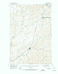
 1953 Ritzville1966 Print · USGSEastern Washington was undergoing a massive agricultural and industrial transformation in the mid-fifties as irrigation from the Grand Coulee Dam reached the plateau. Researchers can trace the mid-century rail network of the Great Northern and locate vital local sites like Larson Air Force Base and Odessa.3 unique versions available
 - 1954 Map of Bruce, 1955 Print
 1954 Bruce1955 Print · USGSAdams County’s high desert landscape is shown here in the mid-fifties during the expansion of the Columbia Basin Project. Genealogists and rail historians can trace the Northern Pacific route through Bruce and Koren alongside the East Low Canal.2 unique versions available
 - 1954 Map of Warden, 1956 Print
 1954 Warden1956 Print · USGSWarden and the surrounding Columbia Basin are shown in the mid-1950s, highlighting the massive arrival of irrigation and rail infrastructure. Trace the dual railroad lines of the Northern Pacific and trace the path of the East Low Canal as it passes West Warden.2 unique versions available
 - 1954 Map of Soda Lake, 1956 Print
 1954 Soda Lake1956 Print · USGSThe basalt coulees and water projects of central Washington are captured here in the mid-fifties, just as the regional irrigation infrastructure was maturing. Trace the historic route of the Chicago Milwaukee St Paul and Pacific railroad past the Columbia National Wildlife Refuge and the waters of Soda Lake.2 unique versions available
Showing maps 1-25 of 161
Top cities of Adams County
- Othello historical maps
- Ritzville historical maps
- Lind historical maps
- Washtucna historical maps
- Hatton historical maps
Frequently asked questions
- What are the different types of historical maps available for Adams County?
- What is the oldest map of Adams County?
- Where can I purchase historical maps of Adams County for my home or office?
- Where can I download high-res historical maps of Adams County?
- Are there historical topographic maps available for Adams County?
- Is there historical aerial imagery available for Adams County?
- Where are historical maps of Adams County sourced from?