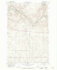
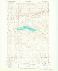
1960s Maps of Adams County, Washington
Explore 30 historic maps of Adams County from the 1960s. These maps offer a rare glimpse into what life looked like during the 1960s — showing old roads, neighborhoods, homes, and landmarks that have changed or disappeared over time.
Whether you're researching your family's past, planning a metal detecting trip, or studying how Adams County's landscape evolved across the 1960s, these high-resolution maps are a powerful tool for exploring the history of this region.
- Focus on a specific era: All maps on this page are from the 1960s, giving you a focused view of this time period.
- See what’s changed: Compare century-old streets, trails, and buildings to today's modern landscape using overlays and satellite layers.
- Research with precision: Use these maps for genealogy, historical research, land use analysis, or educational projects.
- View, download, or print: Maps are fully viewable online in high resolution, and can be downloaded or printed for your own records.
Start exploring Adams County's history through authentic maps from the 1960s. This is your window into the past.
Adams County, WA maps
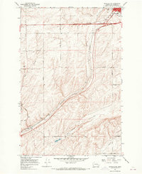
(30)- 1964 Map of Lamont NW, 1965 Print
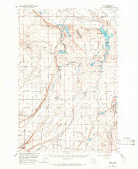
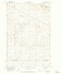
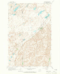 1964 Lamont NW1965 Print · USGSThe Scablands of the Whitman and Adams county line are captured here in the mid-1960s, centered on the railroad town of Lamont. Researchers can trace the Spokane Portland and Seattle rail line past Alkali Lake and Folsom Lake.
 - 1964 Map of Karakul Hills, 1965 Print
 1964 Karakul Hills1965 Print · USGSThe high plateau of the Washington-Adams county line is captured in the mid-1960s as industrial transport corridors began to reshape the landscape. Local historians can trace the Northern Pacific rail line through Keystone or locate agricultural landmarks like the Grain Elevator and Hallin Lake.2 unique versions available
 - 1964 Map of Revere, 1965 Print
 1964 Revere1965 Print · USGSThe Chicago Milwaukee St Paul and Pacific railroad defines this corner of the Palouse in the mid-1960s. Genealogists and local historians can trace the rail sidings and agricultural infrastructure at Revere, including its Grain Elevators and nearby Buffalo Spring.
 - 1964 Map of Macall, 1965 Print
 1964 Macall1965 Print · USGSRailroad junctions and scabland lakes define this pocket of eastern Washington in the early sixties. Genealogists and rail historians can trace the paths of the Milwaukee Road and Union Pacific as they pass through Macall and Paxton.
 - 1964 Map of Palm Lake, 1965 Print
 1964 Palm Lake1965 Print · USGSRailroad history and early transit routes define this mid-sixties survey of the Washington and Adams county border. Local historians can trace the paths of three major rail lines and find the specific locations of Ashby, Rockwell, and the Old Military Road.2 unique versions available
 - 1964 Map of Marengo, 1965 Print
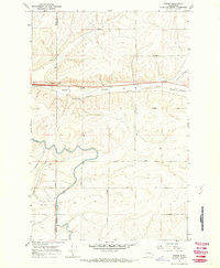
 1964 Marengo1965 Print · USGSAdams County’s high-desert grain country is captured here during the mid-sixties, when railroads were the lifeblood of local industry. Genealogists and historians can trace the tracks of the Union Pacific to rural outposts like Marengo and the Teske Grain Elevator.
 - 1965 Map of Ritzville
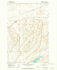
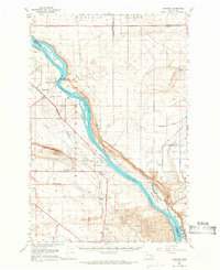
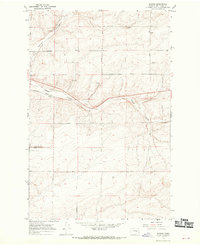
 1965 Ritzville1965 Print · USGSCentral Washington during the mid-sixties shows a landscape shaped by massive irrigation projects and the Cold War. Genealogists and historians can trace rail-town life and military presence through Ephrata Air Base, the Telford Station, and local schools.
 - 1965 Map of Mesa, 1966 Print
 1965 Mesa1966 Print · USGSCentral Washington's desert landscape was being reshaped by irrigation in the mid-sixties. Trace the growth of Basin City, the path of the Northern Pacific Railroad, and the operations at the Othello Air Force Sta.2 unique versions available
 - 1965 Map of Corfu, 1966 Print
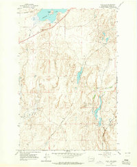
 1965 Corfu1966 Print · USGSThe high desert of Grant and Adams counties comes into focus in the mid-1960s, showing a landscape reshaped by massive irrigation projects. Researchers can trace the Milwaukee Road rail line through Corfu and Taunton or locate the Hope Cem near the Saddle Mountains.2 unique versions available
 - 1965 Map of Hanford, 1966 Print
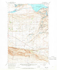
 1965 Hanford1966 Print · USGSThe mid-sixties Hanford area is captured here during its peak years as a secure federal site. Researchers can trace the U S Government Railroad and locate landmarks like Gable Mountain, Hanford, and the White Bluffs.2 unique versions available
 - 1967 Map of Reiman SW, 1969 Print
 1967 Reiman SW1969 Print · USGSThe Adams County plateau in the late 1960s reveals a structured agricultural landscape shaped by family-named roads and deep coulees. Genealogists and historians can locate early settlements such as Greenwalt and Melt or trace property boundaries along Lauer Road and Franz Road.2 unique versions available
 - 1967 Map of Ritzville SW, 1969 Print
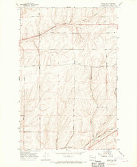
 1967 Ritzville SW1969 Print · USGSAdams County in the late 1960s was a hub of transit and ranching, dominated by the coulees and rail lines south of the county seat. Genealogists can trace family landmarks along Dewald Road and Urquhart Road or locate the Paha Cem.2 unique versions available
 - 1967 Map of Ruff, 1969 Print
 1967 Ruff1969 Print · USGSIn the late 1960s, the railroad and farm road network defined life in this corner of Adams County. Trace the winding Milwaukee Road through Rocky Coulee and locate family landmarks like Schultz Memorial Cem and the settlement of Ruff.2 unique versions available
 - 1967 Map of Ritzville SE, 1969 Print
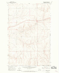
 1967 Ritzville SE1969 Print · USGSSoutheast of Ritzville in the late 1960s, the landscape is a grid of family-named roads and deep basalt coulees. Trace local history along Urquhart Road, locate the old Shorthorn settlement, and follow the Milwaukee Road railroad tracks.
 - 1967 Map of Schoonover, 1970 Print
 1967 Schoonover1970 Print · USGSThe rural landscape of Adams County in the late sixties reveals a network of family ranch roads and rail-side settlements. Researchers can trace the path of the Chicago Milwaukee St Paul and Pacific railroad through Rocky Coulee or locate family-named landmarks like Rosenoff Road and Neergaard Road.
 - 1967 Map of Ritzville NE, 1970 Print
 1967 Ritzville NE1970 Print · USGSIn the late sixties, the wheat-growing plateaus of Adams County were defined by the rail corridor between Tokio and Ritzville. Genealogists can trace family farm locations via Schafer Road and Neergaard Road, or locate the historic Evergreen Sch and Hawthorne Sch.
 - 1967 Map of Batum, 1970 Print
 1967 Batum1970 Print · USGSCentral Washington wheat country is captured here in the late sixties, centered on the rail-side settlement of Batum. Genealogists and local historians can trace family land via roads like Rosenoff Road and find the location of the Ammaus Cem.
 - 1967 Map of Weber, 1970 Print
 1967 Weber1970 Print · USGSLate 1960s Adams County comes into focus as the irrigation of the Columbia Basin transforms the dry coulees. Researchers can trace family-named routes like Urquhart Road, the rail siding at Schaeffer Spur, and the path of the East Low Canal.2 unique versions available
 - 1967 Map of Reiman, 1970 Print
 1967 Reiman1970 Print · USGSAdams County’s wheat-growing country is captured here in the late sixties, where the Milwaukee Road railroad links rural siding settlements. Researchers can trace family-named routes like Tokio Road and Lauer Road to find old Grain Elevators and small local landmarks like the Cem near Farrier.
 - 1967 Map of Ritzville NW, 1970 Print
 1967 Ritzville NW1970 Print · USGSAdams County agriculture and rail transport meet in the late 1960s across this Scablands landscape. You can trace the Milwaukee Road through Packard or locate family landmarks like Memorial Cemetery and Rosenoff Road.
 - 1967 Map of Schrag, 1970 Print
 1967 Schrag1970 Print · USGSAdams County’s high plateau is captured here in the late sixties, where the grain-growing economy relied on the Northern Pacific tracks. Researchers can find family-named landmarks like Deal Road and Leisle Road near the settlement of Schrag.2 unique versions available
 - 1967 Map of Reiman SE, 1970 Print
 1967 Reiman SE1970 Print · USGSAdams County’s high plateau agriculture and rail-dependent transit are captured here in the late sixties. Researchers can trace family-named routes like Wahl Road and Gering Road, or locate the historic Dryland Experiment Station.2 unique versions available
 - 1968 Map of Marlin SW, 1971 Print
 1968 Marlin SW1971 Print · USGSEastern Washington ranch land and the Channeled Scablands are captured here in the late sixties, showing a landscape defined by water and rail. Trace the historic route of the Burlington Northern Railroad along Crab Creek or locate local landmarks like Black Rock Coulee.2 unique versions available
 - 1968 Map of Irby, 1971 Print
 1968 Irby1971 Print · USGSLincoln County in the late 1960s shows a landscape of railroads and remote settlements along the Crab Creek valley. Trace the old Burlington Northern line through Irby and find rural landmarks like Bungalow and Bobs Lakes.
 - 1968 Map of Sylvan Lake, 1971 Print
 1968 Sylvan Lake1971 Print · USGSThe Lincoln and Adams county line comes into focus in the late 1960s, showing a quiet landscape of water gaps and rail lines. Genealogists and historians can trace the paths of Davis Road and Nielson Road near the settlement of Nemo.
Showing maps 1-25 of 30
Top cities of Adams County
- Othello historical maps
- Ritzville historical maps
- Lind historical maps
- Washtucna historical maps
- Hatton historical maps
Frequently asked questions
- What are the different types of historical maps available for Adams County?
- What is the oldest map of Adams County?
- Where can I purchase historical maps of Adams County for my home or office?
- Where can I download high-res historical maps of Adams County?
- Are there historical topographic maps available for Adams County?
- Is there historical aerial imagery available for Adams County?
- Where are historical maps of Adams County sourced from?