Old Maps of Telma, Washington for Genealogy
Trace your family roots with 12 historic maps of Telma. These high-res maps reveal old neighborhoods, homesites, landmarks, and streets — helping you uncover where your ancestors lived and how the area evolved over time.
- Explore historic neighborhoods: Identify where your relatives may have lived in the 1800s or 1900s.
- Compare maps over time: Trace the changes in streets, buildings, and landmarks for multi-generational research.
- Perfect for genealogy & ancestry research: Used by family historians and researchers to map out lineage and migration.
These maps are an incredible resource for exploring your personal connection to Telma's past.
Telma, WA maps
(12)- 1901 Map of Chiwaukum, 1956 Print
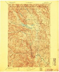
 1901 Chiwaukum1956 Print · USGSChelan County is captured at the dawn of the twentieth century as the railroad began to transform the high Cascades. Researchers can trace the original Great Northern R.R. route through mountain hamlets like Merritt, Winton, and the Dardanelles P O.2 unique versions available
 - 1904 Map of Chiwaukum
 1904 Chiwaukum1904 Print · USGSThe Great Northern corridor and the eastern slopes of the Cascades appear here just after the turn of the century. Trace the rail line through Leavenworth and Merritt, or locate remote landmarks like Soda Spring and Wenatchee Lake.6 unique versions available
 - 1957 Map of Wenatchee, 1973 Print
 1957 Wenatchee1973 Print · USGSThe northern Cascades and Columbia River valley appear here in the mid-fifties, showing the region's critical rail and transit corridors. Researchers can trace the routes of the Great Northern RR and Milwaukee Road through settlements like Skykomish, Baring, and Dryden.2 unique versions available
 - 1965 Map of Wenatchee Lake, 1967 Print
 1965 Wenatchee Lake1967 Print · USGSUpper Chelan County in the mid-1960s is captured here at a height of mountain railroading and early alpine recreation. Genealogists and historians can trace the Great Northern rail line through Berne or locate seasonal sites like Camp Zanika Lache and Telma.2 unique versions available
 - 1975 Map of Chelan, 1977 Print
 1975 Chelan1977 Print · USGSThe northern Cascades meet the Columbia River in the mid-seventies, showing the deep glacial valleys and high plateaus of central Washington. Trace the legacy of mountain railroading through Tumwater Canyon and explore the lakeshore communities of Manson and Lakeside.2 unique versions available
 - 1989 Map of Lake Wenatchee
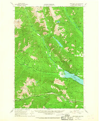
 1989 Lake Wenatchee1989 Print · USGSChelan County in the late eighties shows a landscape of deep alpine lakes and vital transport corridors. Researchers can trace the Burlington Northern railroad through Merritt or locate recreational landmarks like Camp Zanika Lache and Glacier View Campground.2 unique versions available
 - 2004 Map of Lake Wenatchee, 2008 Print
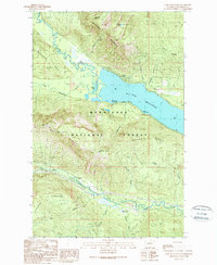
 2004 Lake Wenatchee2008 Print · USGSThe North Cascades wilderness near the turn of the millennium is centered here on the confluence of the White River and Lake Wenatchee. Researchers can trace old transport routes through Merritt or locate high-country landmarks like Alpine Lookout and Camp Zanika Lache.
 - 2011 Map of Lake Wenatchee, 2011 Print
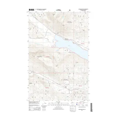
 2011 Lake Wenatchee2011 Print · USGSCovers Telma, including Merritt, Chelan County, and other nearby areas
 - 2014 Map of Lake Wenatchee, 2014 Print
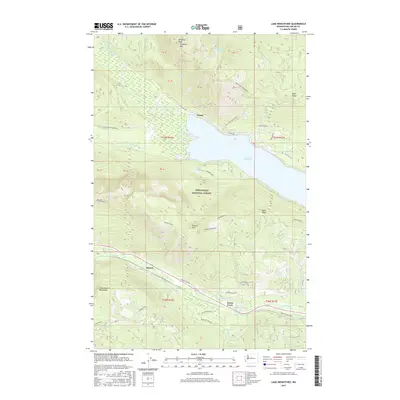
 2014 Lake Wenatchee2014 Print · USGSCovers Telma, including Merritt, Chelan County, and other nearby areas
 - 2017 Map of Lake Wenatchee, 2017 Print
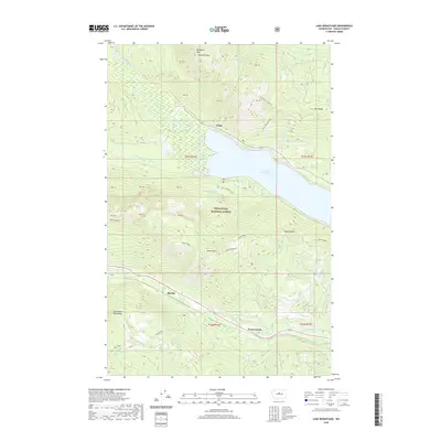
 2017 Lake Wenatchee2017 Print · USGSCovers Telma, including Merritt, Chelan County, and other nearby areas
 - 2020 Map of Lake Wenatchee, 2020 Print
 2020 Lake Wenatchee2020 Print · USGSCovers Telma, including Merritt, Chelan County, and other nearby areas
 - 2023 Map of Lake Wenatchee, 2023 Print
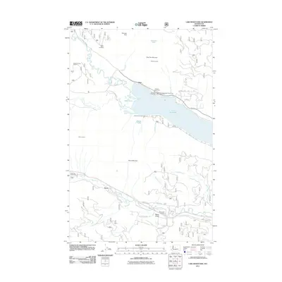
 2023 Lake Wenatchee2023 Print · USGSChelan County and the Wenatchee National Forest are shown in high detail in this recent survey of the North Cascades. Local historians and hikers can trace the routes between Telma and Merritt, or follow trails to Hidden Lake and Dirtyface Mtn.
End of results
Showing maps 1-12 of 12
Frequently asked questions
- What are the different types of historical maps available for Telma?
- What is the oldest map of Telma?
- Where can I purchase historical maps of Telma for my home or office?
- Where can I download high-res historical maps of Telma?
- Are there historical topographic maps available for Telma?
- Is there historical aerial imagery available for Telma?
- Where are historical maps of Telma sourced from?