1990s Maps of Ferry County, Washington
Explore 29 historic maps of Ferry County from the 1990s. These maps offer a rare glimpse into what life looked like during the 1990s — showing old roads, neighborhoods, homes, and landmarks that have changed or disappeared over time.
Whether you're researching your family's past, planning a metal detecting trip, or studying how Ferry County's landscape evolved across the 1990s, these high-resolution maps are a powerful tool for exploring the history of this region.
- Focus on a specific era: All maps on this page are from the 1990s, giving you a focused view of this time period.
- See what’s changed: Compare century-old streets, trails, and buildings to today's modern landscape using overlays and satellite layers.
- Research with precision: Use these maps for genealogy, historical research, land use analysis, or educational projects.
- View, download, or print: Maps are fully viewable online in high resolution, and can be downloaded or printed for your own records.
Start exploring Ferry County's history through authentic maps from the 1990s. This is your window into the past.
Ferry County, WA maps
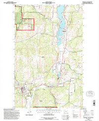
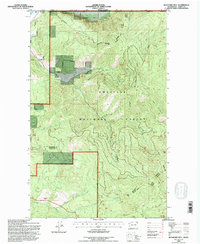
(29)- 1992 Map of Swan Lake, 1996 Print
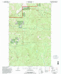
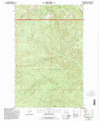
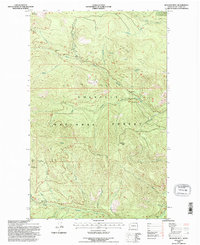
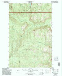
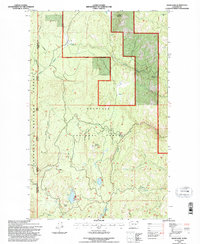 1992 Swan Lake1996 Print · USGSFerry County, Washington, is shown in the early nineties as a high-country landscape defined by national forest boundaries and scattered alpine lakes. Trace the drainages of Scatter Creek and Tenmile Creek or locate landmarks like Swan Butte and the Quarry near Ferry Lake.
 - 1992 Map of Sherman Peak, 1996 Print
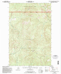
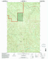
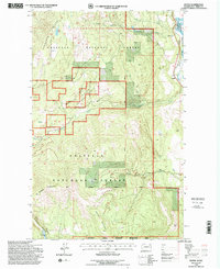
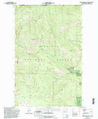
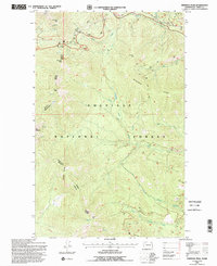 1992 Sherman Peak1996 Print · USGSHigh in the mountains of Ferry County during the early nineties, this area was a hub of forest management and backcountry travel. Modern researchers can trace the rugged network of 4WD trails connecting Sherman Pass to landmarks like Columbia Mtn and Sherman Peak.
 - 1992 Map of Vulcan Mountain, 1996 Print
 1992 Vulcan Mountain1996 Print · USGSFerry County’s mountainous borderlands are captured here in the early nineties, showing where the national forest meets the international line. Researchers can trace the winding Kettle River, locate remote Quarries, and find the Landing Strip nestled below Little Vulcan Mountain.
 - 1992 Map of Cooke Mountain, 1996 Print
 1992 Cooke Mountain1996 Print · USGSHigh in the Colville National Forest during the early nineties, this survey documents a landscape of industrial activity and water management. Trace old extraction sites like a Mineshaft and Mine near Cooke Mountain and the Diversion Dam.
 - 1992 Map of Edds Mountain, 1996 Print
 1992 Edds Mountain1996 Print · USGSFerry County's high forest lands are captured here in the early nineties, showing a landscape defined by timber and mineral interests. Researchers can trace the California Mine and high peaks like Edds Mountain and Iron Mountain.
 - 1992 Map of Seventeenmile Mountain, 1996 Print
 1992 Seventeenmile Mountain1996 Print · USGSThe northern reaches of the Okanogan Highlands in the early nineties show the intersection of tribal and federal lands. Researchers can trace boundary lines and mountain drainages from Seventeenmile Mountain down to West Fork Hall Creek.
 - 1992 Map of Orient, 1996 Print
 1992 Orient1996 Print · USGSNortheastern Washington’s river-and-rail corridor is captured here in the 1990s as the Kettle River snakes through the canyonlands. Genealogists and historians can locate the Kelly Hill Cemetery and trace the mining sites of Globe Mine and Hidden Treasure Mine.
 - 1992 Map of Copper Butte, 1996 Print
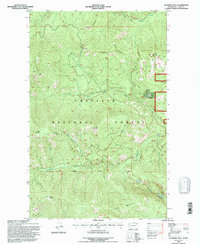
 1992 Copper Butte1996 Print · USGSThe Kettle River Range comes into focus during the early 1990s, showcasing the high-country peaks of the Colville National Forest. Genealogists and historians can trace the path of the Old Stage Rd or locate remote landmarks like Copper Butte and Jungle Hill.2 unique versions available
 - 1992 Map of Sitdown Mtn., 1996 Print
 1992 Sitdown Mtn.1996 Print · USGSThe northern reaches of the Colville Indian Reservation and the national forest meet here in Ferry County during the early 1990s. Trace the remote drainages of Sitdown Creek and CCC Creek among peaks like Grizzly Mountain and Sitdown Mountain.
 - 1992 Map of Jackknife Mtn, 1996 Print
 1992 Jackknife Mtn1996 Print · USGSFerry County’s high country in the early nineties is defined by the deep drainages and sharp peaks of the Colville National Forest. Researchers can trace remote forest access via 4WD roads and locate high-altitude landmarks like Jackknife Mtn and Emerald Lake.
 - 1992 Map of La Fleur Lake, 1996 Print
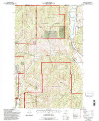
 1992 La Fleur Lake1996 Print · USGSFerry County ranchlands and tribal territories are captured here in the early nineties, where the Colville Indian Reservation meets national forest land. Genealogists and local historians can trace family-named sites like Chief Barnaby Ranch and Banning Ranch near La Fleur Lake.
 - 1992 Map of South Huckleberry Mtn., 1996 Print
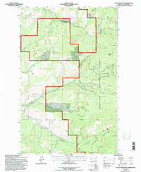
 1992 South Huckleberry Mtn.1996 Print · USGSFerry County, Washington, is documented here in the early nineties as a landscape of managed timberlands and wildlife preserves. Researchers can trace the layout of Growden Camp or explore the heights of South Huckleberry Mountain and the waters of Lake Ellen.
 - 1992 Map of Bulldog Mtn, 1996 Print
 1992 Bulldog Mtn1996 Print · USGSFerry County's timbered highlands are captured here in the early nineties, showing a landscape defined by deep drainages and sharp ridges. Researchers can trace the water networks of North Fork Boulder Creek and Laddie Creek between Bulldog Mtn and Taylor Ridge.
 - 1992 Map of Republic, 1996 Print
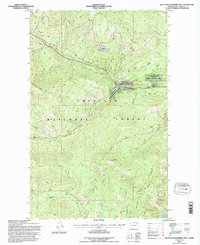
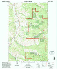
 1992 Republic1996 Print · USGSIn the early 1990s, the mountainous landscape around Republic remained a hub of mining and forestry. Researchers can trace historic industrial activity through mineshafts near Gold Hill and the route of the Old RR Gr near Curlew Lake.
 - 1992 Map of Mt. Leona, 1996 Print
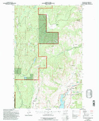
 1992 Mt. Leona1996 Print · USGSFerry County's high country is captured here in the early 1990s, showcasing the high-elevation peaks and forest management of the Kettle River Range. Researchers can trace the path of the Kettle Falls Republic Road through Deer Creek Summit and locate landmarks like Profanity Peak and Mt Leona.
 - 1992 Map of Boyds, 1996 Print
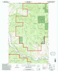
 1992 Boyds1996 Print · USGSFerry County's river valley and timberlands are captured here in the early 1990s, centered on the Burlington Northern rail corridor. Researchers can trace the rugged topography from Hoodoo Mountain down to the settlement at Boyds and the Kettle River shoreline.
 - 1992 Map of Bald Knob, 1996 Print
 1992 Bald Knob1996 Print · USGSThe Colville Indian Reservation and surrounding national forest land are shown here in the early 1990s. Trace old mining operations like the Bungalow Mine and remote Prospects near the summit of Bald Knob.
 - 1992 Map of Independent Mtn, 1996 Print
 1992 Independent Mtn1996 Print · USGSThe high peaks of Ferry County sit just south of the international border in the early nineties. Genealogists and hikers can trace the winding Republic Kettle Falls Rd past Noonday Spring and up the slopes of Independent Mtn.
 - 1992 Map of Rice, 1996 Print
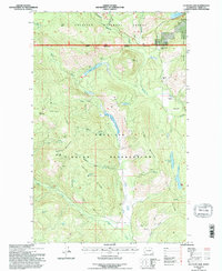
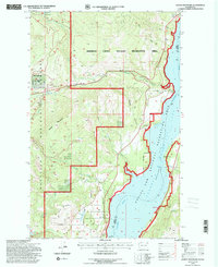
 1992 Rice1996 Print · USGSThe Columbia River valley in the early nineties reveals a landscape of high-country ranching and tribal lands shaped by the Grand Coulee Dam. Researchers can trace family sites like Staehly Ranch, find the Cem near Rice, or locate the Staehly Mine.
 - 1992 Map of Malo, 1996 Print
 1992 Malo1996 Print · USGSThe mountain valley around Malo is documented here during the early nineties as it appeared before major modern developments. Genealogists and historians can trace local landmarks like the Cem and Grave Pit, or explore old mining sites like the Mineshaft and Prospect.
 - 1992 Map of Bangs Mountain, 1996 Print
 1992 Bangs Mountain1996 Print · USGSIn the early 1990s, the Columbia River basin here was defined by timbered forest and the massive impoundment of Lake Roosevelt. Researchers can trace early geography through family-named features like Donaldson Draw, remote water bodies like Lake Ellen, and a lone Cem in the forest.
 - 1992 Map of Laurier, 1996 Print
 1992 Laurier1996 Print · USGSIn the Kettle River valley during the 1990s, this borderland region shows a landscape defined by mountain peaks and international transit. Genealogists and researchers can trace the rail corridor of the Burlington Northern past the settlement at Laurier and the remote Cem near the river.
 - 1992 Map of Boundary Mtn, 1996 Print
 1992 Boundary Mtn1996 Print · USGSThe international border meets the high country of Ferry County in the early nineties, where the national forest dominates the landscape. Local historians can trace the early Indian Allotment Bdy parcels and find the site of a Prospect near Boundary Mtn.
 - 1992 Map of Karamin, 1996 Print
 1992 Karamin1996 Print · USGSFerry County’s high-country terrain is captured here in the early nineties, showing a landscape defined by the timber and water of the Colville National Forest. Researchers can trace old property lines at Indian Allotment sites and locate landmarks like the Lookout on Franson Peak or the settlement of Karamin.
 - 1992 Map of Toroda, 1996 Print
 1992 Toroda1996 Print · USGSNorthern Washington's international borderlands and river valleys come into focus in the early nineties. Genealogists and historians can trace the small settlements of Toroda and Ferry, and locate the Ranald MacDonald Historical Site along the Kettle River.
Showing maps 1-25 of 29
Top cities of Ferry County
Frequently asked questions
- What are the different types of historical maps available for Ferry County?
- What is the oldest map of Ferry County?
- Where can I purchase historical maps of Ferry County for my home or office?
- Where can I download high-res historical maps of Ferry County?
- Are there historical topographic maps available for Ferry County?
- Is there historical aerial imagery available for Ferry County?
- Where are historical maps of Ferry County sourced from?