Old Maps of Ferry County, Washington for Hiking & Exploration
Hike through history with 198 historic maps of Ferry County. Explore old trails, ghost towns, and forgotten backroads — perfect for outdoor adventurers and local explorers.
- Rediscover forgotten places: Map out old mining camps, roads, and footpaths that no longer exist on modern maps.
- Layer with modern tools: Combine with LiDAR or satellite views to plan hikes through historical terrain.
- Made for exploration: Popular among hikers, overlanders, and local history lovers.
Use these maps to find adventure and explore the hidden past of Ferry County.
Ferry County, WA maps
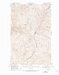
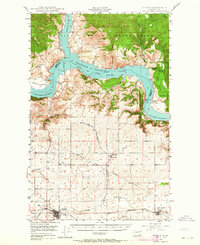
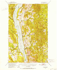
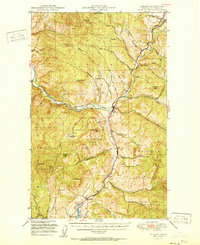
(198)- 1904 Map of Republic
 1904 Republic1904 Print · USGSFerry County was at the height of its gold boom in the early nineteen-hundreds, anchored by the rapid growth of Republic. Genealogists and historians can trace the early rail stops and mine sites of the era, from the Lone Star Mine to the depot at Seward Station.4 unique versions available
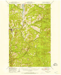
 - 1936 Map of Marcus
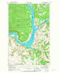
 1936 Marcus1936 Print · USGSUpper Stevens County was a hub of mining and rail transport in the mid-1930s, where the Kettle River meets the Columbia River. Genealogists can trace family roots through numerous rural landmarks like Napoleon Sch and the Old Catholic Mission.
 - 1942 Map of Marcus
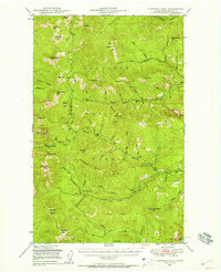
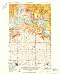
 1942 Marcus1942 Print · USGSUpper Stevens County in the late thirties shows a rugged landscape of rail-connected river towns and mountain mines. Trace family roots at the Old Catholic Mission or locate early industrial sites like the Kettle River Mine and Meyers Falls.3 unique versions available
 - 1948 Map of Curlew
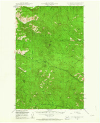
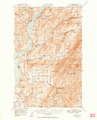
 1948 Curlew1948 Print · USGSFerry County’s river-and-rail corridor is captured here in the late 1940s, showing the vital connection between the Canadian border and the interior. Researchers can trace the Great Northern line through Curlew and Danville, or locate family-named features like Lundimo Meadows and St Peter Cr.3 unique versions available
 - 1948 Map of Grand Coulee Dam, 1955 Print
 1948 Grand Coulee Dam1955 Print · USGSThe Grand Coulee region underwent a massive transformation by the late 1940s as the dam transformed the river valley into a sprawling reservoir. Trace the growth of Coulee Dam and Grand Coulee, and locate rural landmarks like the Grand Coulee Grange and Bagdad Junction.6 unique versions available
 - 1948 Map of Republic, 1957 Print
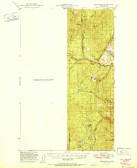
 1948 Republic1957 Print · USGSRepublic and the surrounding Ferry County high country are shown here in the late 1940s as a hub of mining and rail. You can trace the Great Northern tracks past Curlew Lake, locate the California Mine, and find the Fairweather Airport near town.2 unique versions available
 - 1948 Map of Sherman Peak, 1957 Print
 1948 Sherman Peak1957 Print · USGSThe high country of Ferry County is captured here in the late 1940s, showing a landscape of lookouts and forest outposts. You can trace early mountain routes through Sherman Creek Pass and locate isolated stations like Growden Guard Sta and Snowshoe Camp.2 unique versions available
 - 1948 Map of Kettle Falls, 1960 Print
 1948 Kettle Falls1960 Print · USGSThe Kettle Falls region of Stevens County is captured here shortly after the creation of Lake Roosevelt. Genealogists and local historians can locate the community of Boyds, the Sherwood Sch (Aban'd), and family-named landmarks like Bisbee Mtn.
 - 1948 Map of Hunters, 1960 Print
 1948 Hunters1960 Print · USGSIn the late 1940s, this portion of Stevens County shows the impact of the newly created Lake Roosevelt on the Columbia River valley. Researchers can trace remote mining operations like the Cleveland Mine and Germania Mine or locate family roots near the Enterprise Cem and Cedonia Sch.2 unique versions available
 - 1948 Map of Orient, 1960 Print
 1948 Orient1960 Print · USGSIn the late 1940s, the remote valley of the Kettle River was a lifeline for border communities along the Great Northern rail line. Genealogists and historians can trace the foundations of local life through labels for the Barstow Sch, the Orient Ranger Station, and the Kettle River Mine.
 - 1948 Map of Togo Mountain, 1963 Print
 1948 Togo Mountain1963 Print · USGSFerry County’s high country is captured in the late 1940s, showing a landscape of rugged peaks and essential forest service outposts. Researchers can locate remote sites like the Summit Guard Sta or trace family history through landmarks like Ryan Cabin and Ryan Hill.2 unique versions available
 - 1948 Map of Wilbur, 1964 Print
 1948 Wilbur1964 Print · USGSLincoln County is captured here in the years following the creation of the Grand Coulee reservoir. Genealogists and historians can trace the rail-side growth of Wilbur and Creston or locate rural landmarks like the Potlatch Grange and Sherman.2 unique versions available
 - 1948 Map of Wilmont Creek, 1964 Print
 1948 Wilmont Creek1964 Print · USGSThe northern reaches of the Columbia River are captured here in the late 1940s, showing the early years of the massive reservoir. Genealogists and local historians can trace small communities like Kewa and Rogers Bar, noting the exact locations of the Kewa Cem and rural schools.
 - 1948 Map of Lincoln, 1968 Print
 1948 Lincoln1968 Print · USGSThe mid-century transformation of the upper Columbia River is captured here as the new reservoir rises. Researchers can trace the legacy of Fort Spokane, old schoolhouses like Enterprise Sch, and the layout of Bachelor Prairie.2 unique versions available
 - 1950 Map of Lincoln
 1950 Lincoln1950 Print · USGSThe Columbia and Spokane Rivers converge here just after the filling of Lake Roosevelt, shaping the borders of two tribal nations. Genealogists and local historians can locate early schools like Rothlisburg Sch, the landmark Fort Spokane, and the community of Lincoln.2 unique versions available
 - 1950 Map of Wilmont Creek
 1950 Wilmont Creek1950 Print · USGSThe Colville and Spokane Indian Reservations meet here at the newly formed Lake Roosevelt in the years following the Grand Coulee Dam project. Genealogists and historians can locate old landmarks like Kewa, the Kewa Cem, and the Rogers Bar Sch.2 unique versions available
 - 1950 Map of Wilbur
 1950 Wilbur1950 Print · USGSThe Washington plateau and the newly formed Franklin D Roosevelt Lake appear here in the late 1940s as the regional landscape adjusted to massive hydrological change. Genealogists can locate family landmarks in Wilbur and Creston, or trace rural life through the Potlatch Grange and Keller Ferry.
 - 1950 Map of Hunters
 1950 Hunters1950 Print · USGSStevens County is shown in the early postwar years as a rugged mining and ranching corridor between the Columbia River and the high peaks. Genealogists and researchers can locate family-named landmarks and rural centers like the Greenwood Grange, Enterprise Cemetery, and several remote operations including the Cleveland Mine.2 unique versions available
 - 1950 Map of Grand Coulee Dam
 1950 Grand Coulee Dam1950 Print · USGSThe Grand Coulee region during the late 1940s reveals a landscape transformed by the new reservoir and the massive engineering of the dam. Researchers can trace local history through the Lafollette Cem, the community at Elmer City, and rural sites like the Grand Coulee Grange.2 unique versions available
 - 1950 Map of Nespelem, 1952 Print
 1950 Nespelem1952 Print · USGSWithin the Colville Indian Reservation at mid-century, this area shows the transition from mountain lakes to the Columbia River shore. You can trace early settlements and agency sites like Nespelem, Koontzville, and the Colville Indian Agency during a period of significant regional change.4 unique versions available
 - 1950 Map of Inchelium, 1952 Print
 1950 Inchelium1952 Print · USGSThe Huckleberry Range and the newly formed Franklin D Roosevelt Lake define this mid-century look at the Columbia River valley. Genealogists and historians can trace riverside settlements like Rice and Inchelium, as well as industrial remnants like the Columbia Tungsten Mine.4 unique versions available
 - 1951 Map of Wauconda
 1951 Wauconda1951 Print · USGSOkanogan and Ferry counties were centers of high-country mining and forestry during the early fifties. Genealogists and historians can locate the Knob Hill Mine, Tom Thumb Mine, and the Lookout at Sheep Mtn alongside the remote Sheridan Road.2 unique versions available
 - 1951 Map of Togo Mountain
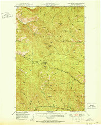 1951 Togo Mountain1951 Print · USGSFerry County’s high timber country is shown here in the early fifties, just after post-war aerial surveys updated the record of this remote terrain. You can locate isolated landmarks and forest service outposts like Ryan Cabin, the Summit Guard Sta, and Sentinel Butte.
 - 1951 Map of Sherman Peak
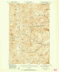 1951 Sherman Peak1951 Print · USGSFerry County's high forest country is captured here during the early fifties, focusing on the fire lookouts and passes of the Kettle River Range. Trace old backcountry routes through Sherman Pass and find forest service outposts like Growden Guard Sta or Snowshoe Camp.2 unique versions available
 - 1951 Map of Curlew
 1951 Curlew1951 Print · USGSThe upper Kettle River valley near the Canadian border is shown in the early fifties, where the Great Northern railroad connects mountain outposts. Trace old routes through Curlew and Malo, or locate high-country features like the Vulcan Lookout and Lundimo Meadows.2 unique versions available
Showing maps 1-25 of 198
Top cities of Ferry County
Frequently asked questions
- What are the different types of historical maps available for Ferry County?
- What is the oldest map of Ferry County?
- Where can I purchase historical maps of Ferry County for my home or office?
- Where can I download high-res historical maps of Ferry County?
- Are there historical topographic maps available for Ferry County?
- Is there historical aerial imagery available for Ferry County?
- Where are historical maps of Ferry County sourced from?