1950s Maps of Ferry County, Washington
Explore 26 historic maps of Ferry County from the 1950s. These maps offer a rare glimpse into what life looked like during the 1950s — showing old roads, neighborhoods, homes, and landmarks that have changed or disappeared over time.
Whether you're researching your family's past, planning a metal detecting trip, or studying how Ferry County's landscape evolved across the 1950s, these high-resolution maps are a powerful tool for exploring the history of this region.
- Focus on a specific era: All maps on this page are from the 1950s, giving you a focused view of this time period.
- See what’s changed: Compare century-old streets, trails, and buildings to today's modern landscape using overlays and satellite layers.
- Research with precision: Use these maps for genealogy, historical research, land use analysis, or educational projects.
- View, download, or print: Maps are fully viewable online in high resolution, and can be downloaded or printed for your own records.
Start exploring Ferry County's history through authentic maps from the 1950s. This is your window into the past.
Ferry County, WA maps
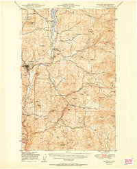
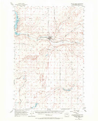
(26)- 1950 Map of Lincoln
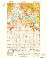
 1950 Lincoln1950 Print · USGSThe Columbia and Spokane Rivers converge here just after the filling of Lake Roosevelt, shaping the borders of two tribal nations. Genealogists and local historians can locate early schools like Rothlisburg Sch, the landmark Fort Spokane, and the community of Lincoln.2 unique versions available
 - 1950 Map of Wilmont Creek
 1950 Wilmont Creek1950 Print · USGSThe Colville and Spokane Indian Reservations meet here at the newly formed Lake Roosevelt in the years following the Grand Coulee Dam project. Genealogists and historians can locate old landmarks like Kewa, the Kewa Cem, and the Rogers Bar Sch.2 unique versions available
 - 1950 Map of Wilbur
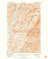
 1950 Wilbur1950 Print · USGSThe Washington plateau and the newly formed Franklin D Roosevelt Lake appear here in the late 1940s as the regional landscape adjusted to massive hydrological change. Genealogists can locate family landmarks in Wilbur and Creston, or trace rural life through the Potlatch Grange and Keller Ferry.
 - 1950 Map of Hunters
 1950 Hunters1950 Print · USGSStevens County is shown in the early postwar years as a rugged mining and ranching corridor between the Columbia River and the high peaks. Genealogists and researchers can locate family-named landmarks and rural centers like the Greenwood Grange, Enterprise Cemetery, and several remote operations including the Cleveland Mine.2 unique versions available
 - 1950 Map of Grand Coulee Dam
 1950 Grand Coulee Dam1950 Print · USGSThe Grand Coulee region during the late 1940s reveals a landscape transformed by the new reservoir and the massive engineering of the dam. Researchers can trace local history through the Lafollette Cem, the community at Elmer City, and rural sites like the Grand Coulee Grange.2 unique versions available
 - 1950 Map of Nespelem, 1952 Print
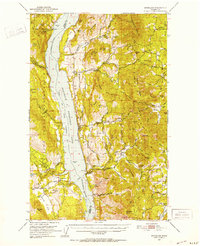
 1950 Nespelem1952 Print · USGSWithin the Colville Indian Reservation at mid-century, this area shows the transition from mountain lakes to the Columbia River shore. You can trace early settlements and agency sites like Nespelem, Koontzville, and the Colville Indian Agency during a period of significant regional change.4 unique versions available
 - 1950 Map of Inchelium, 1952 Print
 1950 Inchelium1952 Print · USGSThe Huckleberry Range and the newly formed Franklin D Roosevelt Lake define this mid-century look at the Columbia River valley. Genealogists and historians can trace riverside settlements like Rice and Inchelium, as well as industrial remnants like the Columbia Tungsten Mine.4 unique versions available
 - 1951 Map of Wauconda
 1951 Wauconda1951 Print · USGSOkanogan and Ferry counties were centers of high-country mining and forestry during the early fifties. Genealogists and historians can locate the Knob Hill Mine, Tom Thumb Mine, and the Lookout at Sheep Mtn alongside the remote Sheridan Road.2 unique versions available
 - 1951 Map of Togo Mountain
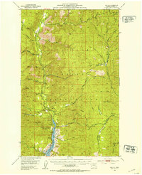
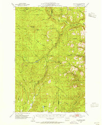
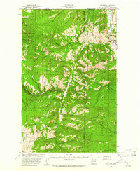
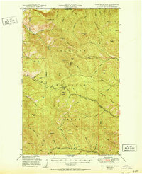 1951 Togo Mountain1951 Print · USGSFerry County’s high timber country is shown here in the early fifties, just after post-war aerial surveys updated the record of this remote terrain. You can locate isolated landmarks and forest service outposts like Ryan Cabin, the Summit Guard Sta, and Sentinel Butte.
 - 1951 Map of Sherman Peak
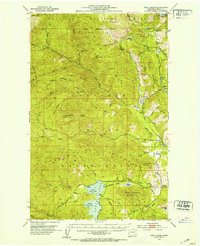
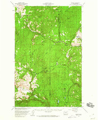
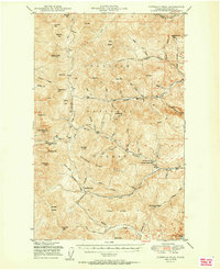 1951 Sherman Peak1951 Print · USGSFerry County's high forest country is captured here during the early fifties, focusing on the fire lookouts and passes of the Kettle River Range. Trace old backcountry routes through Sherman Pass and find forest service outposts like Growden Guard Sta or Snowshoe Camp.2 unique versions available
 - 1951 Map of Curlew
 1951 Curlew1951 Print · USGSThe upper Kettle River valley near the Canadian border is shown in the early fifties, where the Great Northern railroad connects mountain outposts. Trace old routes through Curlew and Malo, or locate high-country features like the Vulcan Lookout and Lundimo Meadows.2 unique versions available
 - 1951 Map of Orient
 1951 Orient1951 Print · USGSThe Kettle River valley at the onset of the fifties serves as a vital corridor for the Great Northern railroad. Genealogists and historians can trace riverside settlements from Laurier to Barstow, alongside the Talisman Mine and Barstow Sch.2 unique versions available
 - 1951 Map of Kettle Falls
 1951 Kettle Falls1951 Print · USGSThe Columbia River shoreline appears as the recently formed Franklin D Roosevelt Lake in this early 1950s study of the Colville National Forest. Genealogists and historians can trace the settlement at Boyds and identify rural landmarks like Sch No 10 and the Sherwood Sch (Aban'd).
 - 1951 Map of Bodie Mountain
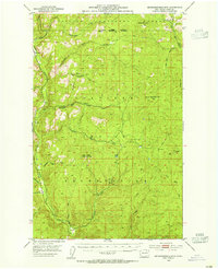
 1951 Bodie Mountain1951 Print · USGSNorthern Washington mountain life and mining are documented here at mid-century as the forest services mapped the high ridges. Trace local sites like the Sheridan Mine, the settlement of Toroda, and peaks from Harvard Mtn to Hardscrabble Mtn.
 - 1951 Map of Republic
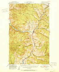
 1951 Republic1951 Print · USGSFerry County’s mining and timber country is captured here just after the war, centered on the historic town of Republic. Researchers can trace the Great Northern rail line past Curlew Lake to find the California Mine and local Cem sites.2 unique versions available
 - 1952 Map of Keller, 1953 Print
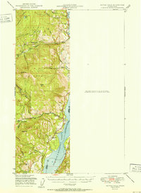
 1952 Keller1953 Print · USGSThe mid-century landscape of the Colville Indian Reservation is captured here during a period of transition as the Sanpoil River valley met the rising waters of the new reservoir. Researchers can trace historical mining sites like Shamrock Mine and Pacific Mutual Mine, or locate early landmarks including the local Cem and French Johns Lake.3 unique versions available
 - 1952 Map of Twin Lakes, 1953 Print
 1952 Twin Lakes1953 Print · USGSFerry County ranchlands and timbered ridges are captured here in the early fifties, showing the high-country landscape of the Colville Reservation. Researchers can trace remote sites like Meteor, Cornstalk, and the Hall Ranch (Site) near the Twin Lakes shoreline.2 unique versions available
 - 1953 Map of Seventeenmile Mtn., 1955 Print
 1953 Seventeenmile Mtn.1955 Print · USGSFerry County’s timbered ridges and the Colville Indian Reservation border are captured here in the mid-1950s. Researchers can trace the drainage of the Sanpoil River and locate remote sites like Cody Butte Lookout and Devils Elbow.2 unique versions available
 - 1953 Map of Bald Knob, 1955 Print
 1953 Bald Knob1955 Print · USGSThe Okanogan highlands in the early 1950s show a landscape of tribal lands and national forests at the peak of the fire lookout era. Genealogists and historians can trace the Colville Indian Reservation boundaries and find remote sites like Bungalow Mine or Owhi Lake.3 unique versions available
 - 1953 Map of Ritzville, 1966 Print
 1953 Ritzville1966 Print · USGSEastern Washington was undergoing a massive agricultural and industrial transformation in the mid-fifties as irrigation from the Grand Coulee Dam reached the plateau. Researchers can trace the mid-century rail network of the Great Northern and locate vital local sites like Larson Air Force Base and Odessa.3 unique versions available
 - 1954 Map of Okanogan, 1964 Print
 1954 Okanogan1964 Print · USGSNorth Central Washington’s interior comes into focus during the mid-fifties, showing the rise of the Columbia River reservoir system. Genealogists and historians can trace the Great Northern rail line and locate historical mining operations at the Mountain Lion Mine or Gold Hill Mine.2 unique versions available
 - 1956 Map of Wilmont Creek, 1972 Print
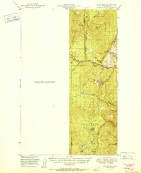
 1956 Wilmont Creek1972 Print · USGSThe settlement at Wilson Creek and its surrounding Grant County Coulee country are shown here in the mid-1950s. Trace the rail-and-water economy through the Great Northern line, local cemeteries, and the irrigation network around Soda Lake.
 - 1958 Map of Okanogan
 1958 Okanogan1958 Print · USGSThe Okanogan River valley and the Colville Indian Reservation are shown here in the late fifties, during a period of established river and rail commerce. Researchers can trace the Great Northern line through Oroville or locate landmarks like the Knowlton School and Orient Ranger Station.
 - 1958 Map of Aeneas, 1960 Print
 1958 Aeneas1960 Print · USGSNortheast Washington’s high-altitude timber and mining country is captured here during the late fifties. Genealogists and researchers can locate old mining operations like Knob Hill Mine and trace early routes through Old Wauconda or across Wauconda Summit.3 unique versions available
 - 1958 Map of Bodie Mtn, 1961 Print
 1958 Bodie Mtn1961 Print · USGSThe northern reaches of Okanogan and Ferry Counties are captured here in the late fifties, as mining and forestry defined life along the Canadian border. Genealogists and historians can trace old settlements like Toroda and Bodie, or locate industrial sites such as the Sheridan Mine and the Magnetic Mine.
Showing maps 1-25 of 26
Top cities of Ferry County
Frequently asked questions
- What are the different types of historical maps available for Ferry County?
- What is the oldest map of Ferry County?
- Where can I purchase historical maps of Ferry County for my home or office?
- Where can I download high-res historical maps of Ferry County?
- Are there historical topographic maps available for Ferry County?
- Is there historical aerial imagery available for Ferry County?
- Where are historical maps of Ferry County sourced from?