Old Maps of Windust, Washington for Hiking & Exploration
Hike through history with 11 historic maps of Windust. Explore old trails, ghost towns, and forgotten backroads — perfect for outdoor adventurers and local explorers.
- Rediscover forgotten places: Map out old mining camps, roads, and footpaths that no longer exist on modern maps.
- Layer with modern tools: Combine with LiDAR or satellite views to plan hikes through historical terrain.
- Made for exploration: Popular among hikers, overlanders, and local history lovers.
Use these maps to find adventure and explore the hidden past of Windust.
Windust, WA maps
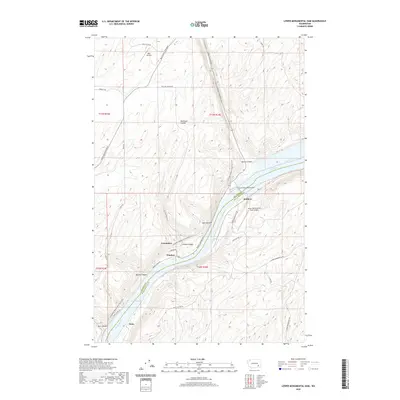
(11)- 1916 Map of Connell
 1916 Connell1916 Print · USGSIn the decade before the region's landscape was further transformed by modern irrigation, this area shows a dense network of early schoolhouses and railroad stops. Genealogists can trace family footprints through sites like Roxboro School, Hatton, and Kahlotus along the Washtucna Lake shoreline.
 - 1918 Map of Connell
 1918 Connell1918 Print · USGSEastern Washington at the end of the Great War era shows a landscape shaped by emerging railroads and a dense network of rural school districts. Genealogists and historians can trace family-named sites across Paradise Flats and locate early community hubs like Kahlotus, Connell, and Stephenson School.
 - 1953 Map of Walla Walla, 1964 Print
 1953 Walla Walla1964 Print · USGSSoutheast Washington enters the atomic and hydroelectric age in the mid-twentieth century as new dams reshape the desert landscape. You can trace the development of the Hanford Works, identify remote rail stops like Novara Siding, and locate the historic Dry Creek Cem.3 unique versions available
 - 1958 Map of Walla Walla
 1958 Walla Walla1958 Print · USGSThe Tri-Cities and Walla Walla region are captured here during the mid-century expansion of atomic energy and river infrastructure. Genealogists and historians can trace the early layout of Richland (AEC), the rural Hatton and Washtucna settlements, and landmarks like Palouse Falls State Park.
 - 1970 Map of Lower Monumental Dam, 1973 Print
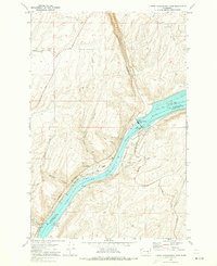 1970 Lower Monumental Dam1973 Print · USGSThe Snake River at the start of the 1970s reveals a landscape transformed by the Lower Monumental Dam and Lake Sacajawea. Researchers can trace the Burlington Northern rail line past the settlements of Farrington and Windust.
 - 1983 Map of Connell
 1983 Connell1983 Print · USGSEastern Washington's coulee country is captured here in the early eighties as a landscape of remote rail junctions and massive river engineering. Trace family roots in Connell or Kahlotus, and follow old transport lines like the Old Lind Road Grade and Burlington Northern tracks.
 - 2011 Map of Lower Monumental Dam, 2011 Print
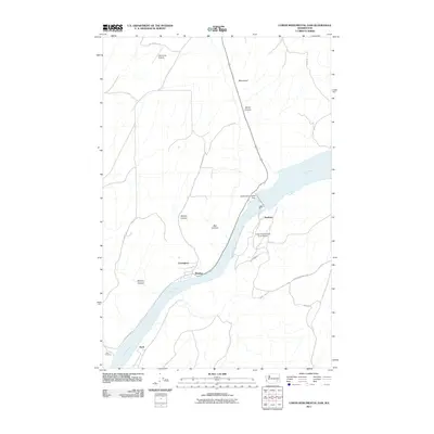 2011 Lower Monumental Dam2011 Print · USGSCovers Windust, including Scott, Farrington, and other nearby areas
 - 2014 Map of Lower Monumental Dam, 2014 Print
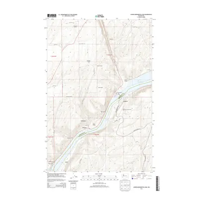 2014 Lower Monumental Dam2014 Print · USGSCovers Windust, including Scott, Farrington, and other nearby areas
 - 2017 Map of Lower Monumental Dam, 2017 Print
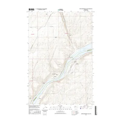 2017 Lower Monumental Dam2017 Print · USGSCovers Windust, including Scott, Farrington, and other nearby areas
 - 2020 Map of Lower Monumental Dam, 2020 Print
 2020 Lower Monumental Dam2020 Print · USGSCovers Windust, including Scott, Farrington, and other nearby areas
 - 2023 Map of Lower Monumental Dam, 2023 Print
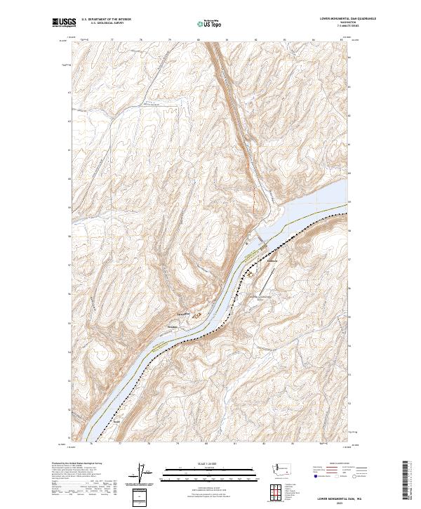 2023 Lower Monumental Dam2023 Print · USGSThe Snake River corridor in southeastern Washington remains a landscape of dramatic canyons and rural outposts. Researchers can trace the historic rail route along the Columbia Plateau State Park Trl and locate riverside settlements like Windust and Farrington.
End of results
Showing maps 1-11 of 11
Top cities near Windust
Frequently asked questions
- What are the different types of historical maps available for Windust?
- What is the oldest map of Windust?
- Where can I purchase historical maps of Windust for my home or office?
- Where can I download high-res historical maps of Windust?
- Are there historical topographic maps available for Windust?
- Is there historical aerial imagery available for Windust?
- Where are historical maps of Windust sourced from?