1990s Maps of Grays Harbor County, Washington
Explore 32 historic maps of Grays Harbor County from the 1990s. These maps offer a rare glimpse into what life looked like during the 1990s — showing old roads, neighborhoods, homes, and landmarks that have changed or disappeared over time.
Whether you're researching your family's past, planning a metal detecting trip, or studying how Grays Harbor County's landscape evolved across the 1990s, these high-resolution maps are a powerful tool for exploring the history of this region.
- Focus on a specific era: All maps on this page are from the 1990s, giving you a focused view of this time period.
- See what’s changed: Compare century-old streets, trails, and buildings to today's modern landscape using overlays and satellite layers.
- Research with precision: Use these maps for genealogy, historical research, land use analysis, or educational projects.
- View, download, or print: Maps are fully viewable online in high resolution, and can be downloaded or printed for your own records.
Start exploring Grays Harbor County's history through authentic maps from the 1990s. This is your window into the past.
Grays Harbor County, WA maps
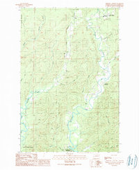
(32)- 1990 Map of Finley Creek
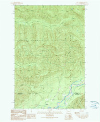 1990 Finley Creek1990 Print · USGSThe Olympic Peninsula wilderness comes into focus in the 1990s as it spans the county line from Jefferson to Grays Harbor. Researchers can trace the boundaries of the Colonel Bob Wilderness and locate landmarks like the Quinault River Ranger Sta and Lilly Lake.
 - 1990 Map of Matheny Ridge
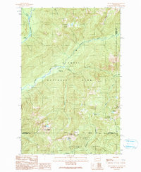
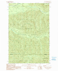 1990 Matheny Ridge1990 Print · USGSThe Olympic Peninsula backcountry is mapped here in the late twentieth century, showing where tribal, forest, and park lands converge. Trace the high points of Matheny Ridge and Higley Peak, or locate the historic Salmon River Lookout and Radio Tower.
 - 1990 Map of Grisdale
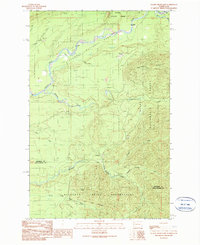
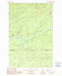
 1990 Grisdale1990 Print · USGSThe timberlands of the Olympic Peninsula are captured here in the 1990s as the logging community of Grisdale transitions. Genealogists and local historians can trace the drainages of the West Fork Satsop River and find landmarks like the Satsop FS Station and Weatherwax Ridge.
 - 1990 Map of Salmon River East
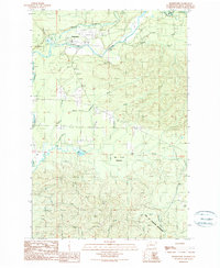
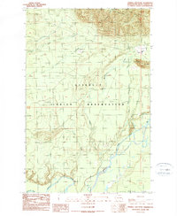
 1990 Salmon River East1990 Print · USGSCoastal Washington wilderness is mapped in detail during the late twentieth century, showing where tribal lands meet the national forest. Researchers can trace the administrative limits of the Quinault Indian Reservation and locate the Queets Ranger Sta along the Queets River.
 - 1990 Map of Wynoochee Valley SW
 1990 Wynoochee Valley SW1990 Print · USGSThe Wynoochee and Wishkah river valleys in Grays Harbor County are shown here during the 1990s as a landscape of rural community and water management. Researchers can locate the Wynoochee Valley Grange Hall, the Diversion Dam, and the small settlement of Anderson.
 - 1990 Map of Prices Peak
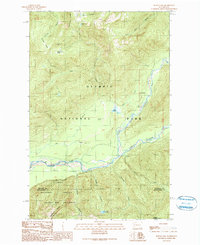
 1990 Prices Peak1990 Print · USGSThe Satsop River valley and the northern edge of Montesano are captured here in the late twentieth century, showing a landscape defined by water and woods. Genealogists and hikers can trace the paths to Lake Sylvia State Park or locate the historic Swinging Bridge and Prices Peak.
 - 1990 Map of Humptulips
 1990 Humptulips1990 Print · USGSThe Grays Harbor backcountry in the early nineties shows a landscape of active timber management and protected watersheds. Researchers can trace the Old Railroad Grade, locate the Cem near the river, or explore the reaches of Axford Prairie and Camp Klahanee.
 - 1990 Map of Wynoochee Lake
 1990 Wynoochee Lake1990 Print · USGSGrays Harbor County at the close of the twentieth century shows the rugged timberlands and waterways of the Olympic Peninsula. Hikers and researchers can trace the East Fork Humptulips River Trail and locate recreation sites like Coho Campground Boat Ramp and Wynoochee Falls Campground.
 - 1990 Map of Aberdeen Gardens
 1990 Aberdeen Gardens1990 Print · USGSThe river valleys north of Aberdeen are captured here in the early nineties, showing a landscape defined by timber and watershed management. Researchers can trace the Old Railroad Grade, locate the Cem at Wishkah, and explore the Olympic State Wildlife Area.
 - 1990 Map of Dry Bed Lakes
 1990 Dry Bed Lakes1990 Print · USGSThe Mason and Grays Harbor county line in the early nineties shows a timber-rich landscape within the Olympic National Forest. You can trace the complex Satsop watershed through Dry Bed Lakes, Vance Creek, and several remote forest work sites like the Gravel Pit.
 - 1990 Map of O'Took Prairie
 1990 O'Took Prairie1990 Print · USGSManaged forest and tribal lands within the Quinault Indian Reservation are captured here during the 1990s. Trace the remote waterways of O'Took Creek and Lunch Creek or the open grounds of O'Took Prairie.
 - 1990 Map of Mount Hoquiam
 1990 Mount Hoquiam1990 Print · USGSThe Olympic wilderness comes into focus in the 1990s at the high-country junction of Jefferson, Mason, and Grays Harbor counties. Researchers can trace remote trails and landmarks like Mount Hoquiam, Graves Creek Ranger Station, and the high waters of Lake Sundown.
 - 1990 Map of Larsen Creek
 1990 Larsen Creek1990 Print · USGSGrays Harbor County’s vital watershed and timberlands are documented in this late-century survey of the Olympic Peninsula. Researchers can trace the source of local water systems through the Aberdeen Reservoir, Wishkah River, and the winding Wynoochee River.
 - 1990 Map of Lake Quinault West
 1990 Lake Quinault West1990 Print · USGSThe Quinault River valley and Olympic foothills are captured here in the 1990s, showing the intersection of tribal and federal lands. Researchers can trace the Old Railroad Grade or locate family roots in Amanda Park and Neilton.
 - 1990 Map of Lake Quinault East
 1990 Lake Quinault East1990 Print · USGSGrays Harbor County in the early nineties reveals a landscape divided between tribal lands, national forest, and wilderness. Researchers can trace the layout of the Quinault community, locate the local Cem, and explore the backcountry reaches of the Colonel Bob Wilderness.
 - 1990 Map of Wynoochee Valley NE
 1990 Wynoochee Valley NE1990 Print · USGSGrays Harbor County’s timber and river country is captured here during the late eighties and early nineties. Researchers can trace the winding paths of the West Fork Satsop River and Wynoochee River, while locating landmarks like Simpson and several riverside Gravel Pit sites.
 - 1990 Map of Colonel Bob
 1990 Colonel Bob1990 Print · USGSThe Olympic Peninsula wilderness in the 1990s is captured here, showing the protected peaks and forests before modern changes. Hikers and historians can trace routes to the Campbell Shelter or the summit of Colonel Bob near Elk Lake.
 - 1990 Map of Salmon River West
 1990 Salmon River West1990 Print · USGSIn the early 1990s, this area of the Olympic Peninsula was a junction of protected wilderness and tribal lands. Researchers can trace the Old Indian Treaty Boundary and find industrial markers like the Gravel Pit and various Borrow Pits.
 - 1990 Map of Thimble Mountain
 1990 Thimble Mountain1990 Print · USGSCoastal Washington forests and tribal lands are documented here in the early nineties, centered on the Quinault Indian Reservation. Researchers can trace the path of an Old RR Grade and locate features like Chow Chow Prairie and the Indian Treaty Boundary.2 unique versions available
 - 1990 Map of Railroad Camp
 1990 Railroad Camp1990 Print · USGSThe Grays Harbor backcountry in the early nineties reveals a landscape shaped by timber and water. You can trace the remnants of the logging era along the Old Railroad Grade and the former location of Railroad Camp (Site) near the Hoquiam River.
 - 1990 Map of Wynoochee Valley NW
 1990 Wynoochee Valley NW1990 Print · USGSGrays Harbor County at the close of the twentieth century shows a landscape where wildlife management and resource extraction meet. Researchers can trace the winding Wynoochee River and identify localized features like the Fish Hatchery and the Olympic State Wildlife Area.
 - 1990 Map of Bunch Lake
 1990 Bunch Lake1990 Print · USGSIn the early 1990s, the upper reaches of the Quinault watershed remained a focal point for wilderness management and conservation. Researchers can trace the path of the North Fork Quinault River Trail and locate landmarks like the North Fork Ranger Station and Irely Lake.
 - 1990 Map of Stevens Creek
 1990 Stevens Creek1990 Print · USGSCoastal Washington timberlands and river valleys are documented here during the late twentieth century. Researchers can trace the legacy of logging via the extensive Old Railroad Grade or locate local landmarks like the Quinault Nat Fish Hatchery and Chow Chow Prairie.
 - 1990 Map of New London
 1990 New London1990 Print · USGSGrays Harbor County at the start of the nineties reveals a landscape of industrial watersheds and timber-country transit. Historians can trace the Old Railroad Grade and locate local landmarks like the Hoquiam Water Works and New London.
 - 1990 Map of Burnt Hill
 1990 Burnt Hill1990 Print · USGSThe Grays Harbor timberlands are captured here in the late twentieth century as the forest service managed these remote reaches. Researchers can trace historical logging infrastructure like the Railroad Grade and locate the Humptulips FS Station near the Humptulips River.
Showing maps 1-25 of 32
Top cities of Grays Harbor County
- Aberdeen historical maps
- Hoquiam historical maps
- Ocean Shores historical maps
- Montesano historical maps
- Elma historical maps
- Westport historical maps
See more
Frequently asked questions
- What are the different types of historical maps available for Grays Harbor County?
- What is the oldest map of Grays Harbor County?
- Where can I purchase historical maps of Grays Harbor County for my home or office?
- Where can I download high-res historical maps of Grays Harbor County?
- Are there historical topographic maps available for Grays Harbor County?
- Is there historical aerial imagery available for Grays Harbor County?
- Where are historical maps of Grays Harbor County sourced from?