Old Maps of Liberty, Washington for Genealogy
Trace your family roots with 12 historic maps of Liberty. These high-res maps reveal old neighborhoods, homesites, landmarks, and streets — helping you uncover where your ancestors lived and how the area evolved over time.
- Explore historic neighborhoods: Identify where your relatives may have lived in the 1800s or 1900s.
- Compare maps over time: Trace the changes in streets, buildings, and landmarks for multi-generational research.
- Perfect for genealogy & ancestry research: Used by family historians and researchers to map out lineage and migration.
These maps are an incredible resource for exploring your personal connection to Liberty's past.
Liberty, WA maps
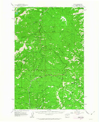
(12)- 1897 Map of Mount Stuart
 1897 Mount Stuart1897 Print · USGSThe Kittitas Valley and Wenatchee Mountains are captured here at the end of the nineteenth century as coal and gold mining began to transform the frontier. Researchers can trace the early rail networks of the Northern Pacific and locate historic mining camps like Liberty, Meaghersville, and the remote Blewett station.2 unique versions available
 - 1902 Map of Mount Stuart, 1908 Print
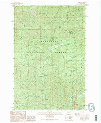
 1902 Mount Stuart1908 Print · USGSThe Kittitas Valley and Wenatchee Mountains are shown here during the height of the early twentieth-century rail and mining era. Researchers can trace the industrial landscape through the Roslyn Branch and mountain camps like Liberty and Blewett.5 unique versions available
 - 1957 Map of Wenatchee, 1973 Print
 1957 Wenatchee1973 Print · USGSThe northern Cascades and Columbia River valley appear here in the mid-fifties, showing the region's critical rail and transit corridors. Researchers can trace the routes of the Great Northern RR and Milwaukee Road through settlements like Skykomish, Baring, and Dryden.2 unique versions available
 - 1961 Map of Liberty, 1963 Print
 1961 Liberty1963 Print · USGSThe high Cascades of Chelan and Kittitas counties are captured here in the early sixties, showing the transition from mining era to modern recreation. Trace the former Blewett townsite, the historic mining camp of Liberty, and the Mineral Springs Resort.2 unique versions available
 - 1975 Map of Wenatchee, 1977 Print
 1975 Wenatchee1977 Print · USGSCentral Washington in the mid-seventies shows a landscape of deep mountain valleys and bustling river towns. Trace the industrial and agricultural backbone of the region along the Yakima River and Columbia River, from the mining history of Roslyn to the rail hubs at Cle Elum and Appleyard.
 - 1989 Map of Liberty
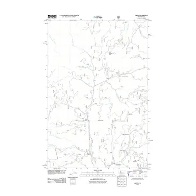
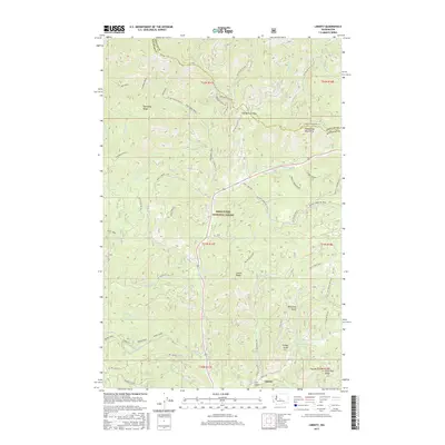
 1989 Liberty1989 Print · USGSThe high country of Kittitas County is seen here in the late eighties, just as recreational and mining interests converged in the Wenatchee Mountains. Researchers can locate specific prospect sites and strip mines near the settlement of Liberty or trace routes through Blewett Pass.2 unique versions available
 - 2003 Map of Liberty, 2006 Print
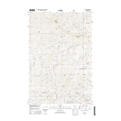
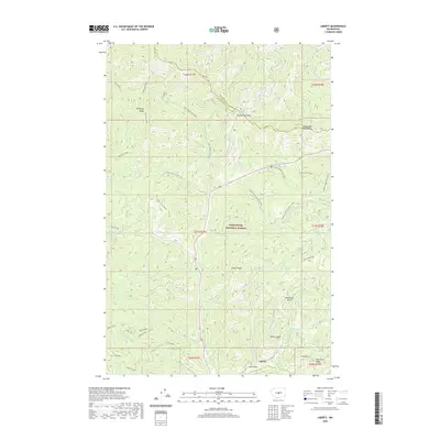
 2003 Liberty2006 Print · USGSThe mining community of Liberty is shown in detail at the dawn of the 21st century, surrounded by the peaks of the Wenatchee Mountains. Genealogists and historians can trace numerous Mine Shafts and Strip Mines along Williams Creek and Swauk Creek.
 - 2011 Map of Liberty, 2011 Print
 2011 Liberty2011 Print · USGSCovers Liberty, including Chelan County, Kittitas County, and other nearby areas
 - 2014 Map of Liberty, 2014 Print
 2014 Liberty2014 Print · USGSCovers Liberty, including Chelan County, Kittitas County, and other nearby areas
 - 2017 Map of Liberty, 2017 Print
 2017 Liberty2017 Print · USGSCovers Liberty, including Chelan County, Kittitas County, and other nearby areas
 - 2020 Map of Liberty, 2020 Print
 2020 Liberty2020 Print · USGSCovers Liberty, including Chelan County, Kittitas County, and other nearby areas
 - 2023 Map of Liberty, 2023 Print
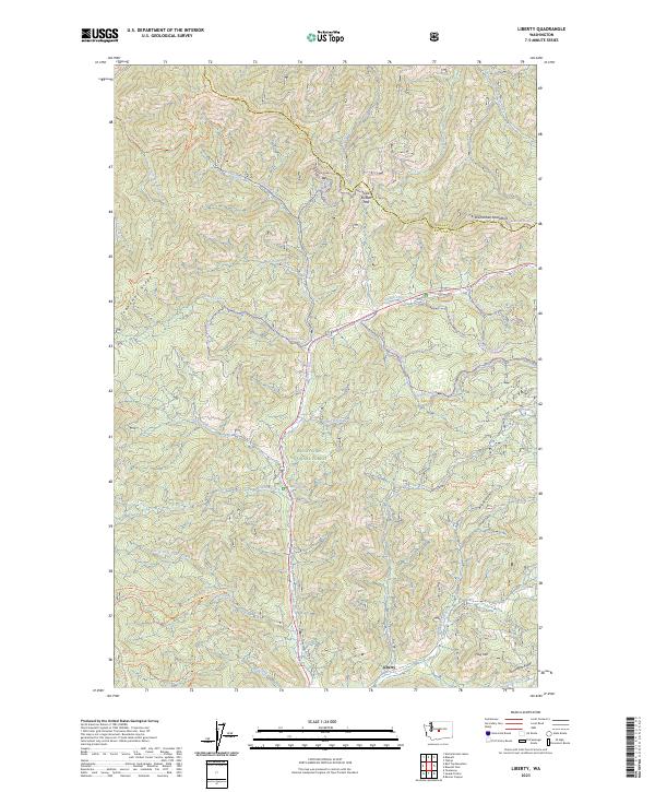 2023 Liberty2023 Print · USGSUpper Kittitas County is seen here in modern detail, focusing on the historic mining district surrounding Liberty. Genealogists and hikers can trace old routes like Old Blewett Pass and the Guard Station Trl, or locate landmarks such as the Mineral Springs Resort.
End of results
Showing maps 1-12 of 12
Top cities near Liberty
Frequently asked questions
- What are the different types of historical maps available for Liberty?
- What is the oldest map of Liberty?
- Where can I purchase historical maps of Liberty for my home or office?
- Where can I download high-res historical maps of Liberty?
- Are there historical topographic maps available for Liberty?
- Is there historical aerial imagery available for Liberty?
- Where are historical maps of Liberty sourced from?