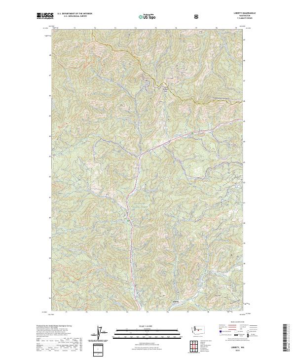
2023 Map of Liberty
USGS Topo · Published 2023About this map
Liberty sits at the heart of this mountain landscape, a historic gold-mining settlement tucked along the southern slopes of the Wenatchee Mountains. The terrain is defined by a series of prominent rises including Teanaway Ridge, Swauk Ridge, and Snowshoe Ridge, which channel numerous waterways like Swauk Creek and Peshastin Creek. The geography here shows a classic pattern of resource-based settlement, where trails like the Teanaway Ridge Trl and Iron Bear Trl follow the high ground once used by prospectors and foresters.
Find a feature on this map
53 named features on this map. Tap any name to fly to it.
Don’t see what you’re looking for? This feature index may not catch every label — zoom into the map to look around manually.
Map Details
Editions of this 2023 Liberty Map
This is the sole edition of this map. No revisions or reprints were ever made.
Other maps of this area

1897 · Mount Stuart
USGS Topo · 1:125,000

1902 · Mount Stuart
USGS Topo · 1:125,000

1957 · Wenatchee
USGS Topo · 1:250,000

1958 · Thorp
USGS Topo · 1:62,500

1958 · Cle Elum
USGS Topo · 1:62,500

1961 · Liberty
USGS Topo · 1:62,500

1961 · Mount Stuart
USGS Topo · 1:62,500

1975 · Wenatchee
USGS Topo · 1:100,000
1985 · Swauk Prairie
USGS Topo · 1:24,000
1985 · Reecer Canyon
USGS Topo · 1:24,000