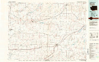
1980s Maps of Lincoln County, Washington
Explore 23 historic maps of Lincoln County from the 1980s. These maps offer a rare glimpse into what life looked like during the 1980s — showing old roads, neighborhoods, homes, and landmarks that have changed or disappeared over time.
Whether you're researching your family's past, planning a metal detecting trip, or studying how Lincoln County's landscape evolved across the 1980s, these high-resolution maps are a powerful tool for exploring the history of this region.
- Focus on a specific era: All maps on this page are from the 1980s, giving you a focused view of this time period.
- See what’s changed: Compare century-old streets, trails, and buildings to today's modern landscape using overlays and satellite layers.
- Research with precision: Use these maps for genealogy, historical research, land use analysis, or educational projects.
- View, download, or print: Maps are fully viewable online in high resolution, and can be downloaded or printed for your own records.
Start exploring Lincoln County's history through authentic maps from the 1980s. This is your window into the past.
Lincoln County, WA maps
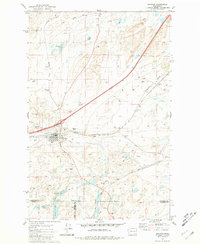
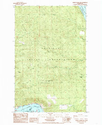
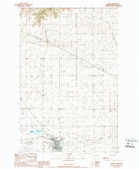
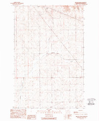
(23)- 1980 Map of Sassin, 1981 Print
 1980 Sassin1981 Print · USGSLincoln County agriculture and rail transit are captured here in the early eighties. Researchers can locate the settlement of Sassin, the Rocklyn Cem, and trace water sources like Browns Lake and Hampton Spring.
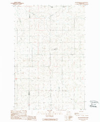
 - 1980 Map of Tyler, 1981 Print
 1980 Tyler1981 Print · USGSSpokane and Lincoln Counties are captured here in the early 1980s as modern highway interchanges began to reshape the old prairie settlements. Genealogists can locate Rockdale Cem and trace the rail-side growth of Tyler and Fishtrap.
 - 1981 Map of Sprague
 1981 Sprague1981 Print · USGSThe rail-centered town of Sprague is shown here in the early eighties at a significant junction of two major lines. Genealogists and researchers can trace local landmarks like Lake View Cem, Maccabee Cem, and the waters of Fourth of July Lake.
 - 1981 Map of Fishtrap Lake
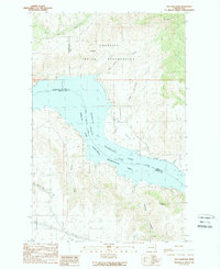
 1981 Fishtrap Lake1981 Print · USGSThe scablands and lakes of eastern Washington are captured here in the early eighties, showcasing the rail lines and rural outposts of the Lincoln and Spokane county borders. Trace the routes of the Burlington Northern railroad past the storage bins at Rodna and the shores of Fishtrap Lake.
 - 1982 Map of Ritzville, 1983 Print
 1982 Ritzville1983 Print · USGSEastern Washington's scabland landscape is captured here in the early eighties as a network of rail-towns and coulees. Researchers can trace the BURLINGTON NORTHERN route through Odessa, Lamona, and Ritzville or locate landmarks like Sprague Lake and Karakul Hills.
 - 1983 Map of Coulee Dam
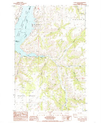
 1983 Coulee Dam1983 Print · USGSThe high plateau and deep coulees of central Washington are captured here in the early eighties, centered on the massive Franklin D Roosevelt Lake and the towns of Coulee Dam and Grand Coulee. Researchers can trace the Burlington Northern rail corridor through old stops at Govan and Mondovi or locate the historic Fort Spokane.2 unique versions available
 - 1984 Map of Rosalia
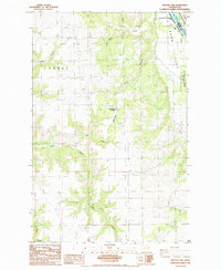
 1984 Rosalia1984 Print · USGSThe Palouse region of Eastern Washington and the Idaho borderlands are shown here in the mid-1980s, a landscape of rolling wheat fields and vital rail corridors. Genealogists and historians can trace the early layout of Cheney, the rail junctions at Rosalia, and the distinct topography of Steptoe Butte.
 - 1985 Map of Olsen Canyon
 1985 Olsen Canyon1985 Print · USGSLincoln County’s riverfront and agricultural uplands are captured here in the mid-eighties as the region balanced recreation and ranching. Trace the developments at Seven Bays or locate the scattered homesteads across Bachelor Prairie and the community of Egypt.
 - 1985 Map of Inkster Lake
 1985 Inkster Lake1985 Print · USGSLincoln County, Washington, at the edge of the Spokane Indian Reservation in the mid-1980s shows a landscape of high plateaus and deep river canyons. Researchers can locate the Cemetery near Egypt, the North Star Grange, and the small settlement of Larene.
 - 1985 Map of Mc Coy Lake
 1985 Mc Coy Lake1985 Print · USGSThe confluence of the Spokane River and Roosevelt Lake is captured in the mid-eighties, showing a mix of tribal lands and industrial activity. Trace local mining history at the Spokane Molybdenum Mine or locate old homesteads near Pitney and the local Cem.
 - 1985 Map of Johnny George Mtn
 1985 Johnny George Mtn1985 Print · USGSFerry County, Washington, is captured in the mid-eighties as a landscape of high ridges and vast reservoir waters. Researchers can trace the rugged boundaries of the Colville Indian Reservation and locate landmarks like Johnny George Mtn and Bear Spring.
 - 1985 Map of Lincoln
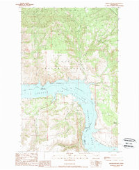
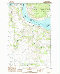 1985 Lincoln1985 Print · USGSThe Columbia River shoreline near Lincoln is captured here in the mid-1980s, documenting the intersection of recreation and reservation lands. Researchers can trace the drainage patterns of Moonshine Canyon, locate the settlement of Lincoln, and study the boundaries of the Colville Indian Reservation.
 - 1985 Map of Benjamin Lake
 1985 Benjamin Lake1985 Print · USGSThe Spokane River and the northern reaches of the Columbia River drainage are captured here in the mid-1980s. Researchers can trace the industrial activity at the Sherwood Mine, the boundaries of the Spokane Indian Reservation, and remote landmarks like Cayuse Mountain.
 - 1985 Map of Fort Spokane
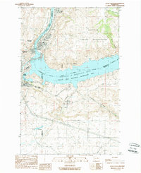
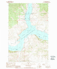
 1985 Fort Spokane1985 Print · USGSThe confluence of the Columbia and Spokane Rivers is captured here in the mid-1980s, documenting the intersection of tribal lands and federal recreation areas. Researchers can locate the historic Fort Spokane site, the settlement of Miles, and landmarks like Castle Rock.
 - 1987 Map of Spokane
 1987 Spokane1987 Print · USGSGreater Spokane and its surrounding prairies are captured in the late 1980s as the region solidified its role as a regional hub. Researchers can trace family sites near Medical Lake, military life at Fairchild Air Force Base, and rural settlements like Peone and Chattaroy.
 - 1989 Map of Creston
 1989 Creston1989 Print · USGSThe high plateau of Lincoln County is captured here in the late twentieth century, showing a landscape of farming and canyon country. Researchers can trace the layout of Creston, locate the Cem at Sherman, and see where the Colville Indian Reservation meets the Columbia River.
 - 1989 Map of Grand Coulee Dam
 1989 Grand Coulee Dam1989 Print · USGSIn the late 1980s, the Columbia River landscape was defined by the massive scale of the Grand Coulee Dam and its surrounding government settlements. Researchers can trace the layout of Elmer City and Grand Coulee alongside infrastructure like the Pumping Station and Colville Indian Reservation.
 - 1989 Map of Wilbur
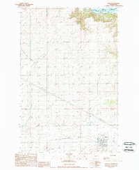
 1989 Wilbur1989 Print · USGSThe town of Wilbur and its surrounding Lincoln County ranch lands are documented here in the late eighties. Genealogists and local historians can locate the community Cem, trace the path of Goose Creek, and identify landmarks like the Wilbur Airport.
 - 1989 Map of Jack Woods Butte
 1989 Jack Woods Butte1989 Print · USGSThe eastern Washington high country at the end of the eighties shows a landscape of cattle draws and remote junctions. Trace family history at Lafollette Cem and explore features like Jack Woods Butte and Bagdad Junction.
 - 1989 Map of Keller Ferry
 1989 Keller Ferry1989 Print · USGSThe Columbia River and Sanpoil River meet at the heart of the Colville Indian Reservation in the late 1980s. Local historians can trace the vital crossing at Keller Ferry and the remote settlement of Swawilla along the banks of Franklin D Roosevelt Lake.
 - 1989 Map of Whitestone Rock
 1989 Whitestone Rock1989 Print · USGSThe Columbia River corridor north of Grand Coulee is captured in the late eighties as a transition between reservation lands and recreation areas. Researchers can trace remote sites like Pleasant Springs, Redford, and the prominent Whitestone Rock.
 - 1989 Map of Broadax Draw
 1989 Broadax Draw1989 Print · USGSThe high plateau of Lincoln County is documented here in the late eighties as a land of utility corridors and small outposts. Researchers can locate remote features like Hesseltine, Broadax Spring, and the private Landing Strip near Corbett.
 - 1989 Map of Mica Mountain
 1989 Mica Mountain1989 Print · USGSThe northern reaches of the Columbia River are captured here in the late eighties, showing the expansive Franklin D Roosevelt Lake shoreline. Researchers can trace the Colville Indian Reservation boundary and identify remote features like Mica Mtn and Swawilla Basin.
End of results
Showing maps 1-23 of 23
Top cities of Lincoln County
- Davenport historical maps
- Odessa historical maps
- Wilbur historical maps
- Reardan historical maps
- Sprague historical maps
- Harrington historical maps
See more
Frequently asked questions
- What are the different types of historical maps available for Lincoln County?
- What is the oldest map of Lincoln County?
- Where can I purchase historical maps of Lincoln County for my home or office?
- Where can I download high-res historical maps of Lincoln County?
- Are there historical topographic maps available for Lincoln County?
- Is there historical aerial imagery available for Lincoln County?
- Where are historical maps of Lincoln County sourced from?