1960s Maps of Snohomish County, Washington
Explore 21 historic maps of Snohomish County from the 1960s. These maps offer a rare glimpse into what life looked like during the 1960s — showing old roads, neighborhoods, homes, and landmarks that have changed or disappeared over time.
Whether you're researching your family's past, planning a metal detecting trip, or studying how Snohomish County's landscape evolved across the 1960s, these high-resolution maps are a powerful tool for exploring the history of this region.
- Focus on a specific era: All maps on this page are from the 1960s, giving you a focused view of this time period.
- See what’s changed: Compare century-old streets, trails, and buildings to today's modern landscape using overlays and satellite layers.
- Research with precision: Use these maps for genealogy, historical research, land use analysis, or educational projects.
- View, download, or print: Maps are fully viewable online in high resolution, and can be downloaded or printed for your own records.
Start exploring Snohomish County's history through authentic maps from the 1960s. This is your window into the past.
Snohomish County, WA maps
(21)- 1962 Map of Seattle
 1962 Seattle1962 Print · USGSThe Puget Sound region and Olympic Peninsula are shown at a peak of mid-century growth. Genealogists and historians can trace rail lines like the Pacific Coast RR or locate landmarks such as Fort Lawton and the Bothell Power Station.
 - 1962 Map of Concrete
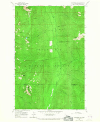
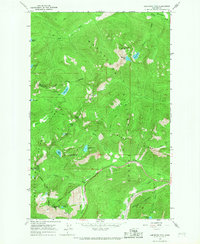
 1962 Concrete1962 Print · USGSThe Northern Cascades in the early sixties reveal a landscape of high alpine peaks and deep river valleys before the modern park era. Genealogists and historians can trace rail-and-river towns like Concrete, Darrington, and Stehekin, alongside industry at the Holden Mine.
 - 1963 Map of Agnes Mtn, 1964 Print
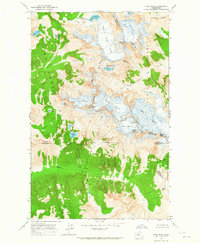
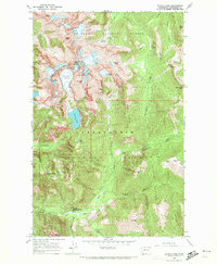
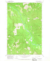
 1963 Agnes Mtn1964 Print · USGSThe high peaks of Chelan and Snohomish counties are documented here in the early 1960s, showing the intersection of wilderness and recreation. You can trace the Cascade Crest Trail past Fivemile Camp and locate glaciers such as Blue Glacier and Chickamin Glacier.4 unique versions available
 - 1963 Map of Downey Mtn, 1965 Print
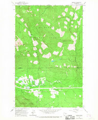
 1963 Downey Mtn1965 Print · USGSThe high Cascades at the Skagit and Snohomish county line come into focus in the early sixties. Hikers and historians can trace the remote network of Sulphur Hot Springs, the Lookout on Green Mountain, and primitive shelters like Sixmile Shelter.3 unique versions available
 - 1963 Map of Dome Peak, 1965 Print
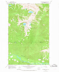
 1963 Dome Peak1965 Print · USGSThe high Cascades of the early sixties are captured here at the junction of three counties, where massive glaciers dominate the divide. Outdoor historians and geologists can trace the mid-century extent of the South Cascade Glacier and Dana Glacier near prominent summits like Dome Peak.3 unique versions available
 - 1965 Map of Captain Point, 1967 Print
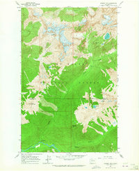
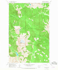
 1965 Captain Point1967 Print · USGSThe Cascades back-country at the meeting of Snohomish, Chelan, and King counties is shown here in the mid-sixties. Trace high-altitude routes like the Cascade Crest Trail and find remote waters including Grizzly Lake and Saucer Lake.2 unique versions available
 - 1965 Map of Evergreen Mtn, 1967 Print
 1965 Evergreen Mtn1967 Print · USGSThe Snoqualmie National Forest wilderness in the mid-1960s was a high-country network of fire lookouts and river drainages. You can trace early backcountry access routes including the Pack Trail along Johnson Ridge and the remote Lookout on Evergreen Mtn.2 unique versions available
 - 1965 Map of Monte Cristo, 1967 Print
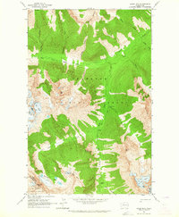
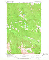
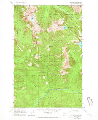 1965 Monte Cristo1967 Print · USGSSnohomish County mining history is preserved here in the mid-1960s, showing the high-altitude landscape where prospectors once sought fortune. Researchers can trace the remnants of old camps at Mineral City (Site) and Galena (Site) or locate landmarks like Monte Cristo.5 unique versions available
 - 1965 Map of Poe Mountain, 1967 Print
 1965 Poe Mountain1967 Print · USGSChelan County is shown at a peak of backcountry wilderness management in the mid-sixties, dominated by high summits and the headwaters of the Wenatchee. Hikers and historians can trace old pack routes like the Cady Ridge Trail to landmarks such as Poe Mountain and Meander Meadow.3 unique versions available
 - 1965 Map of Bench Mark Mtn, 1967 Print
 1965 Bench Mark Mtn1967 Print · USGSHigh in the Cascades during the mid-sixties, this area is defined by the intersection of three national forests and remote alpine terrain. Trace historic pack trails through Dishpan Gap, Cady Pass, and past the shores of Lake Sally Ann.
 - 1965 Map of Baring, 1967 Print
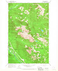 1965 Baring1967 Print · USGSThe mountain settlement of Baring and the surrounding Cascades are documented here in the mid-sixties. Researchers can trace the Great Northern rail corridor and find historic sites like the Sunset Mine and the local Quarry.4 unique versions available
 - 1965 Map of Labyrinth Mtn, 1967 Print
 1965 Labyrinth Mtn1967 Print · USGSThe Cascades crest at Stevens Pass is captured here in the mid-1960s, showing the intersection of three counties and major mountain transit. Trace the routes of the Great Northern Tunnel, the Stevens Pass Hwy, and the Pacific Crest National Scenic Trail.5 unique versions available
 - 1965 Map of Blanca Lake, 1972 Print
 1965 Blanca Lake1972 Print · USGSThe high Cascades of Snohomish County are documented in the mid-1960s, showing a landscape defined by glacial ice and early mountain recreation. Researchers can trace historic access routes like Jack Pass and find specific landmarks including Garland Mineral Springs and the Curry Gap Ruins.3 unique versions available
 - 1966 Map of Huckleberry Mtn, 1968 Print
 1966 Huckleberry Mtn1968 Print · USGSThe high Cascades at the Skagit and Snohomish county line come into focus in the mid-1960s, showing a landscape defined by forest management and alpine lakes. Hikers and historians can trace the Huckleberry Trail and locate the Suiattle Guard Station and Buck Creek Campground.3 unique versions available
 - 1966 Map of Sloan Peak, 1968 Print
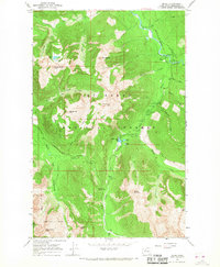
 1966 Sloan Peak1968 Print · USGSThe Cascades high country in the mid-1960s is preserved here, showing the intersection of the Mount Baker National Forest and wilderness lands. Trace old backcountry routes to the Sloan Creek Campground, the high Lookout, and remote Rainy Camp.4 unique versions available
 - 1966 Map of Pugh Mountain, 1968 Print
 1966 Pugh Mountain1968 Print · USGSThe White Chuck River valley in the mid-1960s was a landscape of high-altitude lookouts and remote wilderness. Trace the early Pack Trail routes connecting Owl Creek Campground to summits like Pugh Mountain and Circle Peak.3 unique versions available
 - 1966 Map of Darrington, 1968 Print
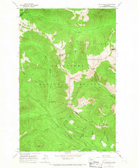
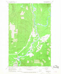 1966 Darrington1968 Print · USGSThe Sauk and Suiattle river valleys appear in the mid-sixties as vital hubs for the timber and rail industries. Researchers can trace the Northern Pacific rail line to its terminus at Darrington or locate the Indian Cem and Three Rivers Mill Pond.4 unique versions available
 - 1966 Map of Bedal, 1968 Print
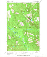
 1966 Bedal1968 Print · USGSThe Snohomish County backcountry is captured here in the mid-1960s as a hub for timber management and alpine recreation. Trace the routes of early explorers and miners along the Sunrise Mine Trail, and locate historic forest sites like the North Fork Guard Sta and Bedal.4 unique versions available
 - 1966 Map of White Chuck Mtn., 1968 Print
 1966 White Chuck Mtn.1968 Print · USGSThe Snohomish County backcountry comes into focus in the mid-1960s, showing the intersection of the Sauk and White Chuck rivers. Researchers can locate remote high-altitude landmarks like White Chuck Mtn, the White Chuck Campgrounds, and a secluded Prospect near Dutch Creek.3 unique versions available
 - 1966 Map of Prairie Mtn., 1968 Print
 1966 Prairie Mtn.1968 Print · USGSThe Skagit and Snohomish county line area comes into focus in the mid-sixties, showing a landscape shaped by glacial waters and mountain timber. Genealogists and historians can locate the Suiattle Cemetery and trace the paths of Big Creek and the Suiattle River.2 unique versions available
 - 1966 Map of Fortson, 1968 Print
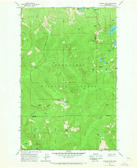
 1966 Fortson1968 Print · USGSThe Stillaguamish River valley in the mid-1960s shows a landscape of mountain rail towns and National Forest timberland. Genealogists and hikers can locate Fortson, Swede Heaven, and the old Northern Pacific rail line.3 unique versions available
End of results
Showing maps 1-21 of 21
Top cities of Snohomish County
- Everett historical maps
- Marysville historical maps
- Edmonds historical maps
- Lynnwood historical maps
- Lake Stevens historical maps
- Silver Firs historical maps
See more
Frequently asked questions
- What are the different types of historical maps available for Snohomish County?
- What is the oldest map of Snohomish County?
- Where can I purchase historical maps of Snohomish County for my home or office?
- Where can I download high-res historical maps of Snohomish County?
- Are there historical topographic maps available for Snohomish County?
- Is there historical aerial imagery available for Snohomish County?
- Where are historical maps of Snohomish County sourced from?