1980s Maps of Snohomish County, Washington
Explore 24 historic maps of Snohomish County from the 1980s. These maps offer a rare glimpse into what life looked like during the 1980s — showing old roads, neighborhoods, homes, and landmarks that have changed or disappeared over time.
Whether you're researching your family's past, planning a metal detecting trip, or studying how Snohomish County's landscape evolved across the 1980s, these high-resolution maps are a powerful tool for exploring the history of this region.
- Focus on a specific era: All maps on this page are from the 1980s, giving you a focused view of this time period.
- See what’s changed: Compare century-old streets, trails, and buildings to today's modern landscape using overlays and satellite layers.
- Research with precision: Use these maps for genealogy, historical research, land use analysis, or educational projects.
- View, download, or print: Maps are fully viewable online in high resolution, and can be downloaded or printed for your own records.
Start exploring Snohomish County's history through authentic maps from the 1980s. This is your window into the past.
Snohomish County, WA maps
(24)- 1985 Map of Mc Murray
 1985 Mc Murray1985 Print · USGSSkagit and Snohomish counties are captured here in the mid-1980s, showcasing a landscape of timber-country heritage and active water systems. Researchers can trace the Old Railroad Grade through the valley or locate local landmarks like Mc Murray and the Walker Valley Quarry.
 - 1985 Map of Stimson Hill
 1985 Stimson Hill1985 Print · USGSThe foothills of the North Cascades come into focus during the mid-eighties as industry meets the high country. Trace the river geography near Cicero and identify landmarks like Lake Cavanaugh, Stimson Hill, and the local Quarry.
 - 1988 Map of Glacier Peak West
 1988 Glacier Peak West1988 Print · USGSThe high Cascades of Snohomish County are captured here in the late eighties, showing the convergence of three major wilderness areas. Trace the Pacific Crest National Scenic Trail past Kennedy Hot Spring or locate the Mackinaw Shelter and White Chuck Glacier.
 - 1988 Map of Suiattle Pass
 1988 Suiattle Pass1988 Print · USGSThe high Cascades at the Snohomish and Chelan border are captured here in the late eighties, showing a landscape of ice and alpine passes. Hikers and historians can trace the Pacific Crest National Scenic Trail past Glacier Peak Mines and over the stony heights of Suiattle Pass.2 unique versions available
 - 1988 Map of Lime Mountain
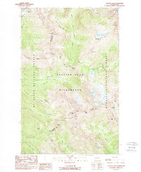
 1988 Lime Mountain1988 Print · USGSThe high Cascades within the Glacier Peak Wilderness are documented here in the late eighties, featuring a landscape of active ice and alpine water. Researchers can trace the extent of the Milk Lake Glacier, Kennedy Glacier, and Scimitar Glacier alongside remote landmarks like Mica Lake and Fire Creek Pass.2 unique versions available
 - 1988 Map of Glacier Peak East
 1988 Glacier Peak East1988 Print · USGSThe high Cascades at the Snohomish and Chelan county line appear in this late 1980s survey of glacial systems and alpine peaks. Researchers can trace the extent of the Suiattle Glacier and Kennedy Glacier or locate isolated features like Airplane Lake and Tenpeak Mountain.
 - 1988 Map of Gamma Peak
 1988 Gamma Peak1988 Print · USGSThe high Cascades within Snohomish County are captured here in the late eighties, showing a landscape shaped by ice and elevation. Hikers and researchers can trace the Pacific Crest National Scenic Trail past Gamma Hot Springs and the Ptarmigan Glacier.2 unique versions available
 - 1988 Map of Clark Mountain
 1988 Clark Mountain1988 Print · USGSThe high Cascades of Chelan County are mapped in detail during the 1980s, showcasing the massive ice fields of the Glacier Peak Wilderness. Researchers can trace remote alpine routes through Little Giant Pass and Boulder Pass or locate the headwaters of the Chiwawa River.
 - 1989 Map of Meadow Mountain
 1989 Meadow Mountain1989 Print · USGSThe Snohomish County backcountry is shown here in the late eighties, just as new wilderness protections were being formalized. Researchers can trace the high-country drainage basins of Boulder River and locate remote landmarks like Saddle Lake and Boulder Falls.
 - 1989 Map of Whitehorse Mtn.
 1989 Whitehorse Mtn.1989 Print · USGSSnohomish County's high Cascades are documented in the late eighties, showing the preserved reaches of the Boulder River Wilderness. Researchers can trace the alpine topography around Three Fingers and glaciers like So-Bahli-Ahli Glacier.
 - 1989 Map of Lake Chaplain
 1989 Lake Chaplain1989 Print · USGSSnohomish County water systems and forests are captured here in the late eighties, featuring the critical Lake Chaplain reservoir. Trace local industrial footprints through the Powerhouse, the Quarry, and an extensive Aqueduct network.
 - 1989 Map of Wallace Lake
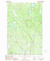
 1989 Wallace Lake1989 Print · USGSSnohomish County during the late eighties shows a landscape of deep forests, hydroelectric power, and mountain recreation. Researchers can trace the path of an Old Railroad Grade, locate the Lockwood Mine, or study the impact of Culmback Dam on Spada Lake.
 - 1989 Map of Index
 1989 Index1989 Print · USGSThe mountain town of Index is shown in the late eighties as a junction of river forks and timbered ridges. Researchers can trace historic access points and water features like Bridal Veil Falls, Sunset Falls, and high peaks such as Mt Index.3 unique versions available
 - 1989 Map of Riley Lake
 1989 Riley Lake1989 Print · USGSSnohomish County in the late eighties shows a landscape of military utility and timber activity within the foothills. Trace the specialized layout of the Naval Radio Station Jim Creek and local water systems like Riley Lake and the Jordan Ponds.
 - 1989 Map of Lake Roesiger
 1989 Lake Roesiger1989 Print · USGSSnohomish County’s lake country is captured here in the late eighties, showing a landscape of timbered hills and burgeoning rural settlements. Genealogists and hikers can trace old property lines near Forest Glade, explore the shores of Lake Roesiger, or locate the Sub Station near Wagner.
 - 1989 Map of Gold Bar
 1989 Gold Bar1989 Print · USGSThe Skykomish River valley in the late eighties shows the timber and transport routes that shaped Snohomish County. Trace the paths of an OLD RR GRADE and find local landmarks like the FISH HATCHERY or the high waters of Duffey Lakes.2 unique versions available
 - 1989 Map of Mount Stickney
 1989 Mount Stickney1989 Print · USGSSnohomish County at the end of the 1980s was a landscape of high-altitude mining and deep reservoirs. Researchers can locate the Kromona Mine or trace the drainage from Big Greider Lake into the vast Spada Lake.
 - 1989 Map of Silverton
 1989 Silverton1989 Print · USGSThe Silverton area in the late eighties remains a landscape of high-country mining and alpine watersheds. Genealogists and historians can trace the sites of the Bonanza Queen Mine and Sperry-Iverson Mine or locate the remote Deer Creek Pass and Independence Lake.2 unique versions available
 - 1989 Map of Verlot
 1989 Verlot1989 Print · USGSSnohomish County is shown at a time when mountain corridors and forest management shaped the local landscape. You can trace early infrastructure like the Lookout Tower and Fire Station, or locate old resource sites like the Gravel Pit and Robe.2 unique versions available
 - 1989 Map of Granite Falls
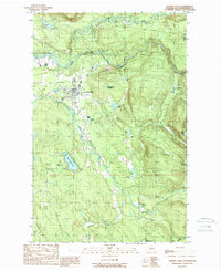 1989 Granite Falls1989 Print · USGSGranite Falls and the surrounding Snohomish County river valleys are captured here in the late eighties as timber lands met growing rural development. Genealogists and hikers can locate family landmarks like Bosworth Lake, the local Cem, and the winding Pilchuck River.2 unique versions available
 - 1989 Map of Mallardy Ridge
 1989 Mallardy Ridge1989 Print · USGSThe mountain interior of Snohomish County is captured here in the late 1980s, centered on the high terrain between the Boulder River and Snoqualmie forests. Researchers can trace the rugged drainage patterns of the South Fork Stillaguamish River and locate alpine landmarks like Ashland Lakes and Mallardy Ridge.
 - 1989 Map of Oso
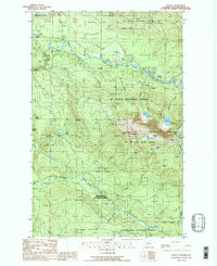
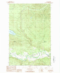 1989 Oso1989 Print · USGSThe Stillaguamish valley and its surrounding peaks are captured here in the late eighties, showing the rural landscape of Snohomish County. Researchers can trace the riverfront settlements of Oso and Halterman or locate landmarks like the Fish Hatchery and the public Boat Ramp at Lake Cavanaugh.
 - 1989 Map of Mt Higgins
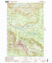
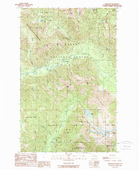
 1989 Mt Higgins1989 Print · USGSThe North Fork Stillaguamish River valley in the late 1980s shows a landscape defined by timber, small settlements, and high-altitude wilderness. Trace the river road through Hazel and Rowan or explore the high peaks of Mt Higgins and Skadulgwas Peak.
 - 1989 Map of Helena Ridge
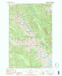
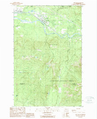
 1989 Helena Ridge1989 Print · USGSDarrington sits at the edge of the Mt Baker National Forest in the late 1980s, where the river and mountain landscape define the region. Trace early forest access and mineral sites like Asbestos Cr or high alpine landmarks including Helena Ridge and Jumbo Mountain.
End of results
Showing maps 1-24 of 24
Top cities of Snohomish County
- Everett historical maps
- Marysville historical maps
- Edmonds historical maps
- Lynnwood historical maps
- Lake Stevens historical maps
- Silver Firs historical maps
See more
Frequently asked questions
- What are the different types of historical maps available for Snohomish County?
- What is the oldest map of Snohomish County?
- Where can I purchase historical maps of Snohomish County for my home or office?
- Where can I download high-res historical maps of Snohomish County?
- Are there historical topographic maps available for Snohomish County?
- Is there historical aerial imagery available for Snohomish County?
- Where are historical maps of Snohomish County sourced from?