Old Maps of Snohomish County, Washington for Metal Detecting
Plan your next treasure hunt with 441 historic maps of Snohomish County. Find old homesites, ghost towns, trails, and gathering spots that may be lost to time — perfect for identifying promising metal detecting locations.
- Locate forgotten sites: Uncover places like long-lost settlements, abandoned rail lines, or gathering spots.
- Plan better hunts: Use map overlays combined with LiDAR or satellite views to narrow in on historically rich areas.
- Made for detectorists: Thousands of hobbyists use these maps to discover relics, coins, and hidden history.
Use these historic maps to boost your research and find new opportunities beneath the surface of Snohomish County.
Snohomish County, WA maps
(441)- 1895 Map of Snohomish, 1954 Print
 1895 Snohomish1954 Print · USGSThe Puget Sound region in the late nineteenth century is documented here as Seattle and Everett rapidly expand via a growing rail network. Genealogists and historians can trace early waterfront settlements and inland junctions such as Mukilteo, Woodinville, and the grounds of Ft. Lawton.
 - 1897 Map of Seattle
 1897 Seattle1897 Print · USGSThe Puget Sound region is seen here in the late nineteenth century as the rail-and-water economy flourished. Genealogists and historians can trace early landings and rail stops like Curtis Landing, Moorland, and Kirkland Junction.10 unique versions available
 - 1899 Map of Glacier Peak, 1955 Print
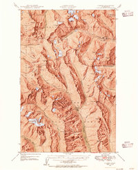
 1899 Glacier Peak1955 Print · USGSThe high North Cascades appear here just before the turn of the century, detailing the early outposts and massive ice fields of the region. Researchers can trace the original trails between Mineral Park and Gilbert or locate high-altitude landmarks like Suiattle Glacier and Monte Cristo Lake.2 unique versions available
 - 1899 Map of Stillaguamish, 1955 Print
 1899 Stillaguamish1955 Print · USGSThe North Cascades foothills at the turn of the century are defined by the rapid expansion of rail lines and mining camps. Trace the early routes of the Everett & Monte Cristo Ry and locate early settlements like Silverton, Darrington, and Granite Falls.
 - 1901 Map of Glacier Peak
 1901 Glacier Peak1901 Print · USGSThe North Cascades wilderness is captured here at the end of the 19th century, during the early years of the Washington Forest Reserve. Local historians can trace the high-country outposts of Gilbert and Stehekin, as well as the original boundaries of the Horseshoe Basin and Cascade Pass.6 unique versions available
 - 1901 Map of Stilaguamish
 1901 Stilaguamish1901 Print · USGSThe North Cascades at the close of the nineteenth century reveal a landscape of mining camps and pioneer river settlements. Genealogists and historians can trace early families in Silverton, Darrington, and the remote Mansford Prairie.6 unique versions available
 - 1902 Map of Skykomish
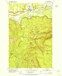
 1902 Skykomish1902 Print · USGSThe central Cascades were defined by the rail corridor at the turn of the century as the high passes were first conquered. Genealogists and historians can trace early mountain settlements like Monte Cristo, Mineral City, and Skykomish along the Great Northern Railway.
 - 1902 Map of Stehekin, 1955 Print
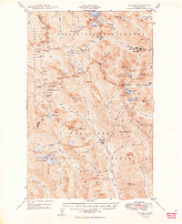
 1902 Stehekin1955 Print · USGSLake Chelan and the North Cascades are captured here at the dawn of the twentieth century, during a period of remote mountain development. Genealogists and historians can trace early settlements at Stehekin, Lucerne, and Gilbert, along with the route of the Holden Railroad.2 unique versions available
 - 1904 Map of Stehekin
 1904 Stehekin1904 Print · USGSThe northern reaches of Lake Chelan are captured here at the turn of the century, showing a wilderness being shaped by early mountain outposts and mining. Genealogists and researchers can trace remote sites like Gilbert and Holden, or the unique path of the Holden Railroad.5 unique versions available
 - 1905 Map of Skykomish
 1905 Skykomish1905 Print · USGSThe central Cascades at the start of the century reveal a landscape of high-altitude mining and the engineering of the Great Northern railroad. Trace early mountain settlements like Monte Cristo, the rail siding at Tonga, and the original Cascade Tunnel.7 unique versions available
 - 1911 Map of Mount Vernon
 1911 Mount Vernon1911 Print · USGSSkagit and Snohomish counties are shown here just after the turn of the century as the railroad and river networks fueled rapid growth. Researchers can trace historic transportation routes like the Anderson Ferry and the Monte Cristo RR through Mount Vernon and the Tulalip Indian Reservation.4 unique versions available
 - 1921 Map of Sultan
 1921 Sultan1921 Print · USGSThe Snoqualmie and Skykomish river valleys are defined by timber and rail in the 1920s. Researchers can trace early industry through the Apex Mines, Coke Ovens, and rural schools like Mountain View School.4 unique versions available
 - 1923 Map of Sultan
 1923 Sultan1923 Print · USGSThe Skykomish and Snoqualmie river valleys thrive in the early twenties as centers of timber and rail. Genealogists can trace family roots through rural sites like Forest Glade School or follow the Lumber RR lines to the Apex Mines.4 unique versions available
 - 1940 Map of Mt Vernon, 1957 Print
 1940 Mt Vernon1957 Print · USGSThe Skagit River delta and its thriving rail-and-river towns are captured here just before the mid-century. Genealogists can trace family roots through numerous country schools like Harmony Sch and landmarks like the Milltown Ch or the timber-hauling Logging Railroad.2 unique versions available
 - 1941 Map of Marysville, 1959 Print
 1941 Marysville1959 Print · USGSSnohomish County is captured here just before the mid-century, showing the vital rail-and-river networks connecting the Puget Sound to the Cascades. Trace family roots and vanished landmarks through early rural sites like Shoultes Sch, the Tulalip Indian Reservation, and Sisco Heights.
 - 1942 Map of Edmonds, 1944 Print
 1942 Edmonds1944 Print · USGSCoastal Snohomish County and Whidbey Island are captured in the early 1940s during a period of maritime and rail expansion. Researchers can trace historic ferry lines, the Great Northern railroad, and local landmarks like Alderwood Manor and Firlands Sanitarium.
 - 1943 Map of Marysville
 1943 Marysville1943 Print · USGSSnohomish County thrived as a railroad and river hub during the early 1940s. Genealogists and local historians can trace rural schoolhouse locations like Shoultes Sch and early transit nodes such as Lakewood English Sta and Stimson Crossing.2 unique versions available
 - 1943 Map of Mt Vernon
 1943 Mt Vernon1943 Print · USGSSkagit County during the early years of the war reveals a complex network of river deltas and rail-dependent settlements. Researchers can trace the heritage of rural communities through labels for Skagit City, the Ridgeway Sch, and the Great Northern railroad.2 unique versions available
 - 1943 Map of Stanwood
 1943 Stanwood1943 Print · USGSThe Puget Sound shoreline comes alive in the early 1940s, showing the intricate waterways and settlements surrounding the Stillaguamish River delta. Genealogists and local historians can trace schoolhouse locations like School No 203 or coastal communities such as Langley and Mabana.2 unique versions available
 - 1944 Map of Clear Lake
 1944 Clear Lake1944 Print · USGSSkagit County in the early 1940s was a hub of timber production and rail transport. Genealogists and historians can trace the Northern Pacific RR through settlements like Montborne and find rural landmarks such as Electron Sch and the high Lake Cavanaugh.
 - 1944 Map of Everett
 1944 Everett1944 Print · USGSMid-century Snohomish County shows a landscape of industrial riverfronts and rural schoolhouses during the Second World War. Genealogists can trace family names at Cypress Lawn Cem, locate the CCC Camp, or find old school sites like Forbes Sch.
 - 1944 Map of Holden, 1955 Print
 1944 Holden1955 Print · USGSThe northern Cascades of the 1940s come into focus through this survey of the high alpine region between Chelan and Snohomish counties. Researchers can trace the legacy of remote mining at the Holden Mine and find the site of the old Trinity settlement.7 unique versions available
 - 1949 Map of Holden
 1949 Holden1949 Print · USGSThe high Cascades of Chelan County are documented here during the post-war era of active mountain mining and alpine exploration. Researchers can trace the industrial footprint of the Holden Mine and Glacier Peak Mines alongside high-country camps like McKenzie Camp.3 unique versions available
 - 1950 Map of Glacier Peak, 1954 Print
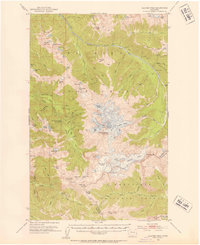 1950 Glacier Peak1954 Print · USGSThe high cascades of Snohomish and Chelan counties are captured here in the mid-twentieth century, centered on the ice-clad summit of Glacier Peak. Trace the paths of early mountaineers and rangers through Lyman Camp, Mackinaw Shelter, and along the Pacific Crest Trail.4 unique versions available
 - 1953 Map of Sultan, 1955 Print
 1953 Sultan1955 Print · USGSThe river-and-rail corridor of the Skykomish Valley is captured here in the early fifties, centering on the town of Sultan. Researchers can trace the Great Northern line and discover upland features like Drunken Charlie Lake and the Old Railroad Grade.4 unique versions available
Showing maps 1-25 of 441
Top cities of Snohomish County
- Everett historical maps
- Marysville historical maps
- Edmonds historical maps
- Lynnwood historical maps
- Lake Stevens historical maps
- Silver Firs historical maps
See more
Frequently asked questions
- What are the different types of historical maps available for Snohomish County?
- What is the oldest map of Snohomish County?
- Where can I purchase historical maps of Snohomish County for my home or office?
- Where can I download high-res historical maps of Snohomish County?
- Are there historical topographic maps available for Snohomish County?
- Is there historical aerial imagery available for Snohomish County?
- Where are historical maps of Snohomish County sourced from?