Old Maps of Stevens County, Washington for Metal Detecting
Plan your next treasure hunt with 225 historic maps of Stevens County. Find old homesites, ghost towns, trails, and gathering spots that may be lost to time — perfect for identifying promising metal detecting locations.
- Locate forgotten sites: Uncover places like long-lost settlements, abandoned rail lines, or gathering spots.
- Plan better hunts: Use map overlays combined with LiDAR or satellite views to narrow in on historically rich areas.
- Made for detectorists: Thousands of hobbyists use these maps to discover relics, coins, and hidden history.
Use these historic maps to boost your research and find new opportunities beneath the surface of Stevens County.
Stevens County, WA maps
(225)- 1927 Map of Chewelah, 1957 Print
 1927 Chewelah1957 Print · USGSStevens County was a hub of mining and rail during the late twenties, centered on the Colville River valley. Genealogists can trace family footprints through dozens of rural landmarks like Halfway House, Camas Sch, and the United Copper Mine.
 - 1929 Map of Colville, 1958 Print
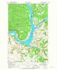
 1929 Colville1958 Print · USGSNorthern Washington's mining and timber country is captured here in the late 1920s. Researchers can trace dozens of mountain workings like Electric Point Mine and local landmarks including Old Fort Colville and Evergreen Cem.2 unique versions available
 - 1930 Map of Chewelah
 1930 Chewelah1930 Print · USGSStevens County's mining and timber landscape comes alive in the late 1920s, showing the vital rail-to-river corridor. Trace family roots and vanished industrial sites from Springdale to Chewelah, including the United Copper Mine and Bear Creek Sch.2 unique versions available
 - 1933 Map of Colville
 1933 Colville1933 Print · USGSIn the early thirties, this corner of Washington was a powerhouse of mining and timber activity along the Columbia River. Local historians can trace the foundations of Colville and Northport, and locate historic landmarks like Old Fort Colville or the Electric Point Mine.2 unique versions available
 - 1934 Map of Metaline, 1959 Print
 1934 Metaline1959 Print · USGSThe Pend Oreille River valley was a hub of mining and rail activity in the 1930s as the railroad pushed north toward the Canadian border. Genealogists and historians can trace the foundations of Metaline Falls and Tiger or locate the Bunker Hill Mine and Lincoln Sch.
 - 1936 Map of Marcus
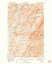
 1936 Marcus1936 Print · USGSUpper Stevens County was a hub of mining and rail transport in the mid-1930s, where the Kettle River meets the Columbia River. Genealogists can trace family roots through numerous rural landmarks like Napoleon Sch and the Old Catholic Mission.
 - 1936 Map of Newport
 1936 Newport1936 Print · USGSThe Pend Oreille River valley in the 1930s reveals a landscape of railroad towns and timber outposts along the Idaho border. Genealogists can locate family-named school districts like Locke Sch and Otter Creek Sch, alongside settlements at Dalkena, Cusick, and Scotia.2 unique versions available
 - 1942 Map of Marcus
 1942 Marcus1942 Print · USGSUpper Stevens County in the late thirties shows a rugged landscape of rail-connected river towns and mountain mines. Trace family roots at the Old Catholic Mission or locate early industrial sites like the Kettle River Mine and Meyers Falls.3 unique versions available
 - 1942 Map of Metaline
 1942 Metaline1942 Print · USGSThe Pend Oreille River valley and the surrounding Selkirk Mountains are shown here in the early 1940s, during a period of intense mining and timber activity. Genealogists and historians can trace rail-side settlements like Ione and Tiger or locate mining sites such as Josephine Mine and Bunker Hill Mines.3 unique versions available
 - 1942 Map of Newport
 1942 Newport1942 Print · USGSPend Oreille River country is captured here during the early 1940s, showing the vital rail and river links between Newport and the mountain frontier. Researchers can trace family homesteads near old schools like Fertile Valley Sch or locate the Indian Mission and Dalkena mill site.3 unique versions available
 - 1944 Map of Clayton
 1944 Clayton1944 Print · USGSThe rural landscape north of Spokane is captured here just before the mid-forties, showing the vital river junctions and rail-connected settlements. Genealogists and researchers can trace local school districts and landmarks like Clayton, Haines Ranch, and the Spokane Indian Reservation.2 unique versions available
 - 1944 Map of Wellpinit
 1944 Wellpinit1944 Print · USGSThe Spokane Indian Reservation and the winding Spokane River define this 1940s landscape during an era of logging and early hydroelectric power. Genealogists and historians can trace the foundations of local life at Wellpinit, the Deer Park Logging Camp, and the State Fish Hatchery.2 unique versions available
 - 1948 Map of Kettle Falls, 1960 Print
 1948 Kettle Falls1960 Print · USGSThe Kettle Falls region of Stevens County is captured here shortly after the creation of Lake Roosevelt. Genealogists and local historians can locate the community of Boyds, the Sherwood Sch (Aban'd), and family-named landmarks like Bisbee Mtn.
 - 1948 Map of Hunters, 1960 Print
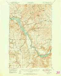
 1948 Hunters1960 Print · USGSIn the late 1940s, this portion of Stevens County shows the impact of the newly created Lake Roosevelt on the Columbia River valley. Researchers can trace remote mining operations like the Cleveland Mine and Germania Mine or locate family roots near the Enterprise Cem and Cedonia Sch.2 unique versions available
 - 1948 Map of Orient, 1960 Print
 1948 Orient1960 Print · USGSIn the late 1940s, the remote valley of the Kettle River was a lifeline for border communities along the Great Northern rail line. Genealogists and historians can trace the foundations of local life through labels for the Barstow Sch, the Orient Ranger Station, and the Kettle River Mine.
 - 1948 Map of Wilmont Creek, 1964 Print
 1948 Wilmont Creek1964 Print · USGSThe northern reaches of the Columbia River are captured here in the late 1940s, showing the early years of the massive reservoir. Genealogists and local historians can trace small communities like Kewa and Rogers Bar, noting the exact locations of the Kewa Cem and rural schools.
 - 1948 Map of Lincoln, 1968 Print
 1948 Lincoln1968 Print · USGSThe mid-century transformation of the upper Columbia River is captured here as the new reservoir rises. Researchers can trace the legacy of Fort Spokane, old schoolhouses like Enterprise Sch, and the layout of Bachelor Prairie.2 unique versions available
 - 1948 Map of Turtle Lake, 1969 Print
 1948 Turtle Lake1969 Print · USGSThe Spokane River and the newly formed Franklin D. Roosevelt Lake define the landscape of Stevens County in the late 1940s. Genealogists can trace family connections at Egypt Ch, the St Augustine Sch, or the Germania Consolidated Mine.
 - 1950 Map of Lincoln
 1950 Lincoln1950 Print · USGSThe Columbia and Spokane Rivers converge here just after the filling of Lake Roosevelt, shaping the borders of two tribal nations. Genealogists and local historians can locate early schools like Rothlisburg Sch, the landmark Fort Spokane, and the community of Lincoln.2 unique versions available
 - 1950 Map of Turtle Lake
 1950 Turtle Lake1950 Print · USGSThe Spokane Indian Reservation and the newly formed reservoir at Franklin D Roosevelt Lake dominate this mid-century survey. Genealogists and historians can locate the Germania Mine, the Church of Our Lady of Lourdes, and rural landmarks like Egypt Ch.2 unique versions available
 - 1950 Map of Wilmont Creek
 1950 Wilmont Creek1950 Print · USGSThe Colville and Spokane Indian Reservations meet here at the newly formed Lake Roosevelt in the years following the Grand Coulee Dam project. Genealogists and historians can locate old landmarks like Kewa, the Kewa Cem, and the Rogers Bar Sch.2 unique versions available
 - 1950 Map of Hunters
 1950 Hunters1950 Print · USGSStevens County is shown in the early postwar years as a rugged mining and ranching corridor between the Columbia River and the high peaks. Genealogists and researchers can locate family-named landmarks and rural centers like the Greenwood Grange, Enterprise Cemetery, and several remote operations including the Cleveland Mine.2 unique versions available
 - 1950 Map of Inchelium, 1952 Print
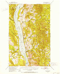 1950 Inchelium1952 Print · USGSThe Huckleberry Range and the newly formed Franklin D Roosevelt Lake define this mid-century look at the Columbia River valley. Genealogists and historians can trace riverside settlements like Rice and Inchelium, as well as industrial remnants like the Columbia Tungsten Mine.4 unique versions available
 - 1950 Map of Clayton, 1970 Print
 1950 Clayton1970 Print · USGSThe Stevens and Spokane county line in the mid-twentieth century shows a landscape of river-fed prairies and mountain peaks. Genealogists can locate family landmarks like Haines Ranch, Williams Valley Cem, and the Fort Spokane Historic Site.
 - 1951 Map of Orient
 1951 Orient1951 Print · USGSThe Kettle River valley at the onset of the fifties serves as a vital corridor for the Great Northern railroad. Genealogists and historians can trace riverside settlements from Laurier to Barstow, alongside the Talisman Mine and Barstow Sch.2 unique versions available
Showing maps 1-25 of 225
Top cities of Stevens County
- Colville historical maps
- Chewelah historical maps
- Kettle Falls historical maps
- Northport historical maps
- Springdale historical maps
- Marcus historical maps
Frequently asked questions
- What are the different types of historical maps available for Stevens County?
- What is the oldest map of Stevens County?
- Where can I purchase historical maps of Stevens County for my home or office?
- Where can I download high-res historical maps of Stevens County?
- Are there historical topographic maps available for Stevens County?
- Is there historical aerial imagery available for Stevens County?
- Where are historical maps of Stevens County sourced from?