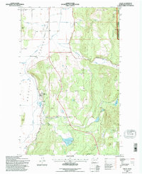
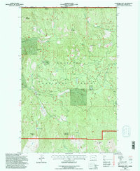
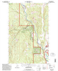
1990s Maps of Stevens County, Washington
Explore 31 historic maps of Stevens County from the 1990s. These maps offer a rare glimpse into what life looked like during the 1990s — showing old roads, neighborhoods, homes, and landmarks that have changed or disappeared over time.
Whether you're researching your family's past, planning a metal detecting trip, or studying how Stevens County's landscape evolved across the 1990s, these high-resolution maps are a powerful tool for exploring the history of this region.
- Focus on a specific era: All maps on this page are from the 1990s, giving you a focused view of this time period.
- See what’s changed: Compare century-old streets, trails, and buildings to today's modern landscape using overlays and satellite layers.
- Research with precision: Use these maps for genealogy, historical research, land use analysis, or educational projects.
- View, download, or print: Maps are fully viewable online in high resolution, and can be downloaded or printed for your own records.
Start exploring Stevens County's history through authentic maps from the 1990s. This is your window into the past.
Stevens County, WA maps
(31)- 1992 Map of Aladdin Mtn, 1996 Print
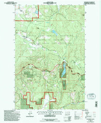
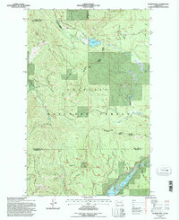 1992 Aladdin Mtn1996 Print · USGSThe northern reaches of the Colville National Forest are documented here in the early nineties, revealing a landscape defined by mountain ridges and mining claims. Researchers can locate remote industrial sites like Aladdin Mine and Middleport Mine or trace the shorelines of Lake Thomas and Big Meadow Lake.
 - 1992 Map of Ione, 1996 Print
 1992 Ione1996 Print · USGSPend Oreille County in the early 1990s was a landscape of deep timber and riverside industry. Trace the tracks of the Pend Oreille Valley Railroad through Ione and find several mountain waters like Lake Leo and Sullivan Lake.
 - 1992 Map of Boundary, 1996 Print
 1992 Boundary1996 Print · USGSThe international border at the Columbia River is captured here in the early nineties, showing a landscape defined by timber, mining, and rail. Genealogists and researchers can locate the Forest Home Cemetery, the Scandia Mine, and the remote Lind Ranch among the peaks.
 - 1992 Map of Park Rapids, 1996 Print
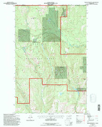
 1992 Park Rapids1996 Print · USGSStevens County in the early 1990s was a rugged territory of protected wildlife areas and high-country mining. Genealogists and local historians can trace the geography around Park Rapids, the Longshot Mine, and the waters of Little Twin Lakes.
 - 1992 Map of Chewelah, 1996 Print
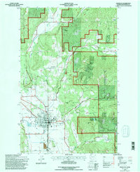 1992 Chewelah1996 Print · USGSIn the early 1990s, the Chewelah Valley was a hub of mining activity and rail transport beneath the Colville National Forest. Trace the deep history of local industry through landmarks like the United Copper No 1 Mine and the Burlington Northern rail line.
 - 1992 Map of Valley, 1996 Print
 1992 Valley1996 Print · USGSIn the early 1990s, the Stevens County town of Valley remained a key point along the Burlington Northern railroad. Researchers can trace the local industrial landscape through its Quarry and Gravel Pit, or locate family sites near the local Cem.
 - 1992 Map of Churchill Mtn, 1996 Print
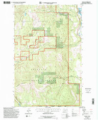
 1992 Churchill Mtn1996 Print · USGSThe northern wilderness of Stevens County is captured here in the early nineties, showing where the forest meets the international border. Researchers can trace historic mining operations like the Churchill Mine, White Horse Mine, and the high-elevation waters of Lamar Lake.
 - 1992 Map of Orient, 1996 Print
 1992 Orient1996 Print · USGSNortheastern Washington’s river-and-rail corridor is captured here in the 1990s as the Kettle River snakes through the canyonlands. Genealogists and historians can locate the Kelly Hill Cemetery and trace the mining sites of Globe Mine and Hidden Treasure Mine.
 - 1992 Map of Calispell Peak, 1996 Print
 1992 Calispell Peak1996 Print · USGSHigh Selkirk ridges and protected wildlife corridors define this area of Northeast Washington in the early nineties. Researchers can trace land use through alpine clearings like Hartill Meadows and family-named landmarks near Calispell Peak and Phillips Lake.
 - 1992 Map of Goddards Peak, 1996 Print
 1992 Goddards Peak1996 Print · USGSThe Stevens County high country is shown here in the early nineties, centered on the heights of the Selkirk Mountains. Trace the development of the 49° North Ski Area or locate family-named landmarks like Johnson Mtn and Bell Meadow Springs.
 - 1992 Map of Nelson Peak, 1996 Print
 1992 Nelson Peak1996 Print · USGSThe Stevens County mountains in the early nineties show a landscape of timber management and recreation at the edge of the national forest. Researchers can trace forest access roads to sites like Camp Hafer, Kenwood Ranch, and the waters of Deer Lake.
 - 1992 Map of Deep Lake, 1996 Print
 1992 Deep Lake1996 Print · USGSThe Stevens and Pend Oreille county line comes alive in the 1990s, showing a landscape defined by mountain mines and forest meadows. Trace historical mining operations at Thompson Wolf Mine or locate high-altitude clearings like Peterson Clearing and Smackout Valley.
 - 1992 Map of Cliff Ridge, 1996 Print
 1992 Cliff Ridge1996 Print · USGSStevens County’s rugged interior is captured here in the early nineties as the landscape shifted from early twentieth-century industry to wildlife conservation. Researchers can locate the Bingville site, the Narcisse Sch, and mining remnants like the Perry Mine.
 - 1992 Map of Aladdin, 1996 Print
 1992 Aladdin1996 Print · USGSDeep in the mountains of Stevens County in the 1990s, this area reflects a landscape of remote mining and forest service history. Researchers can trace the location of the Morning Mine, the Bon Ayre School, and the small settlement of Aladdin.
 - 1992 Map of Belshazzar Mtn, 1996 Print
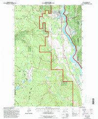
 1992 Belshazzar Mtn1996 Print · USGSThe international borderlands of Stevens County appear in the 1990s as a landscape of deep canyons and mining history. Researchers can trace historical mineral claims like the Chief Joseph Mine and Bullion Mine or locate the remote Rose Ranch near Big Sheep Creek.2 unique versions available
 - 1992 Map of Boyds, 1996 Print
 1992 Boyds1996 Print · USGSFerry County's river valley and timberlands are captured here in the early 1990s, centered on the Burlington Northern rail corridor. Researchers can trace the rugged topography from Hoodoo Mountain down to the settlement at Boyds and the Kettle River shoreline.
 - 1992 Map of Rice, 1996 Print
 1992 Rice1996 Print · USGSThe Columbia River valley in the early nineties reveals a landscape of high-country ranching and tribal lands shaped by the Grand Coulee Dam. Researchers can trace family sites like Staehly Ranch, find the Cem near Rice, or locate the Staehly Mine.
 - 1992 Map of Bangs Mountain, 1996 Print
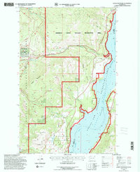 1992 Bangs Mountain1996 Print · USGSIn the early 1990s, the Columbia River basin here was defined by timbered forest and the massive impoundment of Lake Roosevelt. Researchers can trace early geography through family-named features like Donaldson Draw, remote water bodies like Lake Ellen, and a lone Cem in the forest.
 - 1992 Map of Laurier, 1996 Print
 1992 Laurier1996 Print · USGSIn the Kettle River valley during the 1990s, this borderland region shows a landscape defined by mountain peaks and international transit. Genealogists and researchers can trace the rail corridor of the Burlington Northern past the settlement at Laurier and the remote Cem near the river.
 - 1992 Map of Colville, 1996 Print
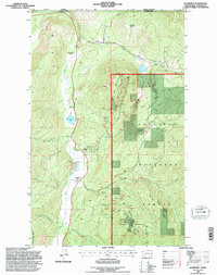
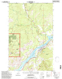
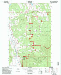
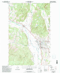 1992 Colville1996 Print · USGSColville and the surrounding river valley are captured here in the early nineties, showing a landscape defined by mountain ranges and agricultural tradition. Researchers can locate the Pinkney City (Site), trace the Burlington Northern line, and find the Phipps Homestead.
 - 1992 Map of Leadpoint, 1996 Print
 1992 Leadpoint1996 Print · USGSThe Stevens County highlands near the international border are mapped here in the early nineties, showing a landscape defined by mining. Trace local history through the Leadpoint settlement, the Cedar Creek Sch (Aban'd), and the Electric Point Mine.
 - 1992 Map of Gillette Mtn, 1996 Print
 1992 Gillette Mtn1996 Print · USGSStevens County highlands come into focus in the early nineties, showing a landscape defined by forest service roads and historic mineral claims. Researchers can trace the proximity of the Marble Quarry and Lucky Boy Mine to early ranching sites like Reed Ranch.
 - 1992 Map of Lake Gillette, 1996 Print
 1992 Lake Gillette1996 Print · USGSIn the early nineties, Stevens County served as a major wildlife corridor between the Colville and Kaniksu National Forests. Researchers can trace water levels and timber access roads near Lake Gillette, Scrabblers Flat, and the Little Pend Oreille River.
 - 1992 Map of Northport, 1997 Print
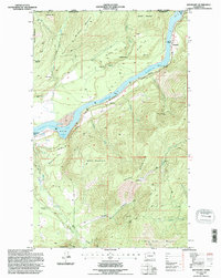
 1992 Northport1997 Print · USGSNorthport and the upper reaches of the Columbia River are documented here in the early nineties as the region balanced mining heritage with forest management. Genealogists and historians can locate the Old Northport Cemetery and trace the legacy of local extraction at the St Crispen Mine and Coyote Mine.2 unique versions available
 - 1992 Map of Addy Mountain, 1997 Print
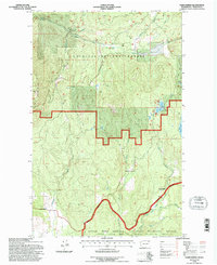
 1992 Addy Mountain1997 Print · USGSThe Colville Valley corridor comes into focus in the early nineties, showing a landscape defined by the Burlington Northern railroad and the timbered slopes of the Selkirks. Genealogists and local historians can locate the Twelvemile Sch and the community of Arden, alongside the waters of Hatch Lake.
Showing maps 1-25 of 31
Top cities of Stevens County
- Colville historical maps
- Chewelah historical maps
- Kettle Falls historical maps
- Northport historical maps
- Springdale historical maps
- Marcus historical maps
Frequently asked questions
- What are the different types of historical maps available for Stevens County?
- What is the oldest map of Stevens County?
- Where can I purchase historical maps of Stevens County for my home or office?
- Where can I download high-res historical maps of Stevens County?
- Are there historical topographic maps available for Stevens County?
- Is there historical aerial imagery available for Stevens County?
- Where are historical maps of Stevens County sourced from?