1960s Maps of Whatcom County, Washington
Explore 14 historic maps of Whatcom County from the 1960s. These maps offer a rare glimpse into what life looked like during the 1960s — showing old roads, neighborhoods, homes, and landmarks that have changed or disappeared over time.
Whether you're researching your family's past, planning a metal detecting trip, or studying how Whatcom County's landscape evolved across the 1960s, these high-resolution maps are a powerful tool for exploring the history of this region.
- Focus on a specific era: All maps on this page are from the 1960s, giving you a focused view of this time period.
- See what’s changed: Compare century-old streets, trails, and buildings to today's modern landscape using overlays and satellite layers.
- Research with precision: Use these maps for genealogy, historical research, land use analysis, or educational projects.
- View, download, or print: Maps are fully viewable online in high resolution, and can be downloaded or printed for your own records.
Start exploring Whatcom County's history through authentic maps from the 1960s. This is your window into the past.
Whatcom County, WA maps
(14)- 1962 Map of Concrete
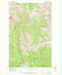
 1962 Concrete1962 Print · USGSThe Northern Cascades in the early sixties reveal a landscape of high alpine peaks and deep river valleys before the modern park era. Genealogists and historians can trace rail-and-river towns like Concrete, Darrington, and Stehekin, alongside industry at the Holden Mine.
 - 1963 Map of Azurite Peak, 1964 Print
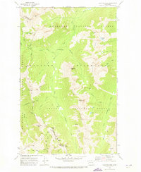
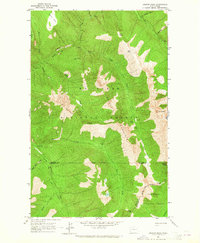 1963 Azurite Peak1964 Print · USGSThe North Cascades high country appears in the early sixties at a peak of alpine mining and forest management. Geologists and historians can trace the foundations of the Azurite Mine, the Gold Hill Mine, and the route of the Cascade Crest Trail.2 unique versions available
 - 1963 Map of Slate Peak, 1964 Print
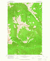 1963 Slate Peak1964 Print · USGSThe high Cascades of Okanogan County are captured here during the early 1960s, showcasing a landscape of remote mines and forest service outposts. Genealogists and researchers can locate historic mining sites like Goat Mine and base camps such as Deer Park Camp or Harts Pass Guard Station.4 unique versions available
 - 1963 Map of Crater Mountain, 1965 Print
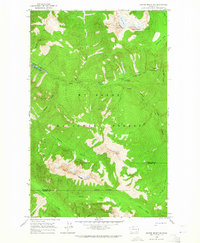 1963 Crater Mountain1965 Print · USGSThe North Cascades in the early sixties are documented here through high-altitude topography and vital forest infrastructure. You can trace the Cascade Crest Trail past the Granite Creek Guard Station or locate remote lookouts atop Crater Mountain.2 unique versions available
 - 1963 Map of Diablo Dam, 1965 Print
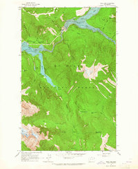
 1963 Diablo Dam1965 Print · USGSHydro-electric development in the North Cascades reached a peak in the early sixties as industrial outposts like Diablo and Newhalem hummed with activity. Trace the infrastructure of the Skagit River project from the Diablo Dam to the ice of the Neve Glacier.3 unique versions available
 - 1963 Map of Ross Dam, 1965 Print
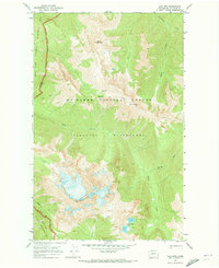
 1963 Ross Dam1965 Print · USGSThe Skagit River canyon was undergoing significant transformation in the 1960s as these massive hydroelectric projects matured within the North Cascades. Researchers can trace the early infrastructure of Ross Dam and locate seasonal landmarks like Diablo Lake Resort, Buster Brown Flats, and the Ross Lake Guard Station.4 unique versions available
 - 1969 Map of Skagit Peak, 1972 Print
 1969 Skagit Peak1972 Print · USGSThe North Cascades along the Canadian border are captured in the late sixties, showing the rugged backcountry just as new wilderness protections were established. Hikers and historians can trace the network of Pack Trail routes connecting remote outposts like Nightmare Camp, Deer Lick Cabin, and Little Fish Shelter.2 unique versions available
 - 1969 Map of Mt Prophet, 1973 Print
 1969 Mt Prophet1973 Print · USGSThe North Cascades wilderness is captured here in the late sixties as the newly established national park took shape. Explorers and researchers can trace the high-country Pack Trail system to remote camps like Beaver Pass Shelter and Tenmile Shelter.
 - 1969 Map of Pasayten Peak, 1973 Print
 1969 Pasayten Peak1973 Print · USGSThe Okanogan wilderness in the late sixties remained a primitive landscape of high-mountain passes and remote mining claims. Hikers and historians can trace early routes along the Pacific Crest National Scenic Trail or locate the mines near Indiana Basin.2 unique versions available
 - 1969 Map of Jack Mtn, 1973 Print
 1969 Jack Mtn1973 Print · USGSThe North Cascades high country appears in detail during the late sixties as new wilderness boundaries were established. Hikers and historians can trace the old Pack Trail through Dry Creek Pass and locate the remote Bear Skull Shelter.2 unique versions available
 - 1969 Map of Shull Mtn., 1973 Print
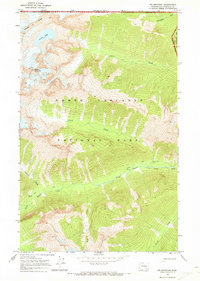
 1969 Shull Mtn.1973 Print · USGSThe high mountain passes of Whatcom County are captured here in the late sixties, just as the wilderness was being formally preserved. Trace the path of the Pacific Crest Scenic Trail and locate remote landmarks like the Devils Park Shelter and Shull Lake.
 - 1969 Map of Pumpkin Mtn., 1973 Print
 1969 Pumpkin Mtn.1973 Print · USGSThe North Cascades wilderness is captured here in the late sixties, showcasing the vast Ross Lake reservoir and its surrounding parklands. Hikers and historians can trace old routes like the Pierce Mountain (Pack) Way or locate remote sites like Little Jerusalem Island and Spencer Camp.2 unique versions available
 - 1969 Map of Hozomeen Mtn, 1973 Print
 1969 Hozomeen Mtn1973 Print · USGSThe high Cascades and the international border meet in the late sixties at the headwaters of the Skagit. Trace backcountry routes like the Desolation Lookout Trail, find the isolated Stromberg Cabin, or locate camp sites at Cat Island.
 - 1969 Map of Mt Spickard, 1973 Print
 1969 Mt Spickard1973 Print · USGSHigh in the North Cascades during the late sixties, this survey documents the alpine environment along the Canadian border. Explorers and researchers can trace the Pack Trail to the Perry Creek Shelter or study the glacial terrain around Mount Spickard.3 unique versions available
End of results
Showing maps 1-14 of 14
Top cities of Whatcom County
- Bellingham historical maps
- Lynden historical maps
- Ferndale historical maps
- Point Roberts historical maps
- Maple Falls historical maps
- Glacier historical maps
Frequently asked questions
- What are the different types of historical maps available for Whatcom County?
- What is the oldest map of Whatcom County?
- Where can I purchase historical maps of Whatcom County for my home or office?
- Where can I download high-res historical maps of Whatcom County?
- Are there historical topographic maps available for Whatcom County?
- Is there historical aerial imagery available for Whatcom County?
- Where are historical maps of Whatcom County sourced from?