1900s (20th Century) Maps of Whatcom County, Washington
Explore 93 historic maps of Whatcom County from the 1900s (20th Century). These maps offer a rare glimpse into what life looked like during the 1900s — showing old roads, neighborhoods, homes, and landmarks that have changed or disappeared over time.
Whether you're researching your family's past, planning a metal detecting trip, or studying how Whatcom County's landscape evolved across the 1900s, these high-resolution maps are a powerful tool for exploring the history of this region.
- Focus on a specific era: All maps on this page are from the 1900s, giving you a focused view of this time period.
- See what’s changed: Compare century-old streets, trails, and buildings to today's modern landscape using overlays and satellite layers.
- Research with precision: Use these maps for genealogy, historical research, land use analysis, or educational projects.
- View, download, or print: Maps are fully viewable online in high resolution, and can be downloaded or printed for your own records.
Start exploring Whatcom County's history through authentic maps from the 1900s. This is your window into the past.
Whatcom County, WA maps
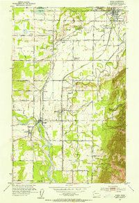
(93)- 1906 Map of Sumas, 1958 Print
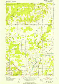
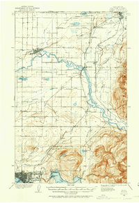 1906 Sumas1958 Print · USGSWhatcom County's northern borderlands are shown in great detail during the early twentieth century, from the international line down to the growing city of Bellingham. Genealogists and historians can trace early school sites like Gerry School, local industry at Larsens Mill, and the path of the Chicago Milwaukee St Paul and Pacific RR.
 - 1907 Map of Blaine
 1907 Blaine1907 Print · USGSNorthwest Washington at the dawn of the twentieth century is defined here by the international border and the arrival of the rails. Genealogists and historians can trace the early layouts of Blaine, Ferndale, and Semiahmoo, alongside the Great Northern RR and the Lummi Indian Reservation.3 unique versions available
 - 1908 Map of Sumas
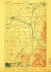 1908 Sumas1908 Print · USGSNorthern Whatcom County comes into focus in the early twentieth century as a bustling network of river towns and timber rails. Genealogists and local historians can trace family roots through sites like Larsens Mill, Geary School, and old stops along the B B and B C R R.3 unique versions available
 - 1909 Map of Mt Baker
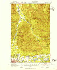
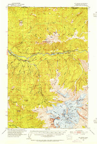
 1909 Mt Baker1909 Print · USGSThe North Cascades were undergoing a transformation into an industrial frontier during the first decade of the twentieth century. Researchers can trace early railroad lines like the Great Northern and identify vanished logging or mining sites such as Morovits Ranch and the Excelsior Power Plant.3 unique versions available
 - 1915 Map of Mt. Baker, 1925 Print
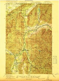
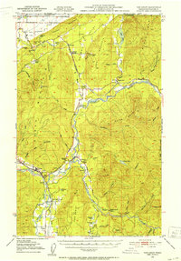
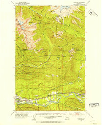
 1915 Mt. Baker1925 Print · USGSUpper Whatcom and Skagit counties are seen here in the early twentieth century as railroads and mines began to pierce the wilderness. Genealogists and historians can locate early homesteads like Morovits Ranch, the Lone Jack Mine, and the route of the Great Northern railroad.3 unique versions available
 - 1918 Map of Samish Lake
 1918 Samish Lake1918 Print · USGSCoastal Skagit and Whatcom counties appear here during the height of the early twentieth-century timber and rail era. Researchers can pinpoint long-standing landmarks like the Alger Shingle Mill, Blue Canyon, and the State Fish Hatchery.3 unique versions available
 - 1919 Map of Van Zandt
 1919 Van Zandt1919 Print · USGSWhatcom County's timber and mining frontier is captured here at the end of the Great War, as railroads pushed deep into the river valleys. Genealogists can locate family landmarks like Heislers Ranch, the Peoples Store, and the Old Nooksack Mine along the Nooksack River.2 unique versions available
 - 1920 Map of Slate Pass
 1920 Slate Pass1920 Print · USGSThe North Cascades high country at the start of the 1920s reveals a wilderness of newly surveyed peaks and vital mountain passes. Trace early forest and mining routes through Slate Pass and Harts Pass or locate the remote Chancellor Power Plant.
 - 1921 Map of Wickersham
 1921 Wickersham1921 Print · USGSThe Skagit and Samish river valleys come alive in this map from the early twenties, showcasing a landscape of timber, mines, and rail. Genealogists and historians can trace the foundations of local life at Northern State Hospital, the Lyman Ferry, and the Cokedale Mine.2 unique versions available
 - 1943 Map of Orcas Island
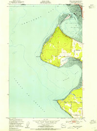
 1943 Orcas Island1943 Print · USGSThe San Juan Islands are captured in the early 1940s, showing a maritime landscape of ferry routes and isolated coastal hamlets. Genealogists and historians can trace local landmarks like Buckhorn Lodge, the Port Stanley Sch, and the CCC Camp in Moran State Park.2 unique versions available
 - 1943 Map of Anacortes
 1943 Anacortes1943 Print · USGSThe San Juan Islands and Skagit coastline appear here in the early 1940s, during an era of remote island schoolhouses and ferry reliance. Genealogists can locate family landmarks like Eden Cem and Guemes Sch, or trace the waterfront of Anacortes and South Bellingham.
 - 1951 Map of Wickersham, 1953 Print
 1951 Wickersham1953 Print · USGSSkagit County in the early fifties shows a landscape of river-valley industry and timber outposts along the Skagit River. Genealogists and historians can locate the Northern State Hospital, trace the Cokedale Mine, and find rural centers like Samish School.3 unique versions available
 - 1951 Map of Anacortes, 1953 Print
 1951 Anacortes1953 Print · USGSThe northern Puget Sound islands and the city of Anacortes are captured here in the early fifties during a period of steady coastal growth. Researchers can locate vanished landmarks and family roots at Eden Cem, Sinclair Sch, and the Lummi Indian Reservation.2 unique versions available
 - 1951 Map of Van Zandt, 1953 Print
 1951 Van Zandt1953 Print · USGSThe Nooksack River valley in the early fifties shows a bustling network of rail lines and timber-town outposts. Genealogists and local historians can trace family-named sites like Heislers Ranch or locate the Welcome Grange and the Limestone Quarry near Kendall.2 unique versions available
 - 1952 Map of Lake Whatcom, 1953 Print
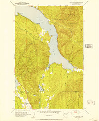 1952 Lake Whatcom1953 Print · USGSWhatcom County in the early fifties showcases a landscape of timbered peaks and vital lakeside rail lines. Genealogists and historians can trace the Northern Pacific corridor through Blue Canyon and Park, or locate the State Trout Hatchery near the shores of Lake Whatcom.4 unique versions available
 - 1952 Map of Lake Shannon, 1953 Print
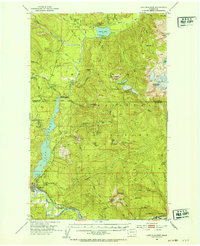 1952 Lake Shannon1953 Print · USGSSkagit County in the early fifties shows a rugged mountain landscape being transformed by hydroelectric power and the timber industry. You can trace the Great Northern rail line through Concrete or locate remote landmarks like the Morovitz Ranch and Faber Ferry.3 unique versions available
 - 1952 Map of Bertrand Creek, 1954 Print
 1952 Bertrand Creek1954 Print · USGSNorthern Whatcom County comes alive in the early fifties, showing a landscape of river-bottom farms and rural parishes near the Canadian border. Researchers can locate the Enterprise Cem, Evergreen Community Church, and the winding banks of Bertrand Creek.3 unique versions available
 - 1952 Map of Lynden, 1954 Print
 1952 Lynden1954 Print · USGSThe northern Whatcom County borderlands come to life in the early fifties, showing the agricultural heart of the Lynden area and the North Prairie. Researchers can trace old family holdings near the Nooksack River and locate historic sites like the Indian Cemetery and Tenmile Grange.3 unique versions available
 - 1952 Map of Lawrence, 1954 Print
 1952 Lawrence1954 Print · USGSWhatcom County in the early fifties is captured here during its transition from a rail-dependent rural valley to a modern highway network. Genealogists and researchers can trace local landmarks like Agate Bay, the Grange Hall in Goshen, and the small settlement of Wahl.4 unique versions available
 - 1952 Map of Point Roberts, 1954 Print
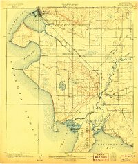
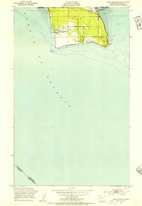 1952 Point Roberts1954 Print · USGSPoint Roberts is captured here as a mid-century coastal exclave defined by its international border and maritime surroundings. Researchers can locate the Pt Roberts Lighthouse, the Northwest Grange, and seasonal settlements at Maple Beach and South Beach.5 unique versions available
 - 1952 Map of Sumas, 1954 Print
 1952 Sumas1954 Print · USGSThe northern border of Whatcom County comes into focus in the early fifties, showing the busy rail junction and international crossing at Sumas. Genealogists and local historians can trace family-named roads like Halverstick Road and Zwashka Rd across a landscape dotted with rural landmarks like the Nooksack Valley High School.5 unique versions available
 - 1952 Map of Mt. Baker, 1954 Print
 1952 Mt. Baker1954 Print · USGSMount Baker and the surrounding North Cascades are captured here in the early fifties, detailing a landscape defined by massive glaciers and deep river valleys. Researchers can locate remote sites like the Excelsior Mine, the Kulshan Cabin, and the old rail terminus at Warnick.4 unique versions available
 - 1952 Map of Hamilton, 1954 Print
 1952 Hamilton1954 Print · USGSThe Skagit River valley was a bustling corridor of rail and river industry in the early fifties, anchored by the towns of Hamilton and Concrete. Genealogists and historians can trace the GREAT NORTHERN line through Birdsview, find the local High School, or locate the Cem and Dalles Bridge.3 unique versions available
 - 1952 Map of Birch Point, 1954 Print
 1952 Birch Point1954 Print · USGSThe northwestern tip of Washington state appears here in the early fifties, showing the coastal interface of the Strait of Georgia and Drayton Harbor. Researchers can trace the development of Semiahmoo, explore the rural roads leading to Cottonwood Beach, and locate family landmarks along Birch Point Rd.5 unique versions available
 - 1952 Map of Ferndale, 1957 Print
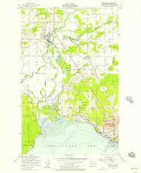 1952 Ferndale1957 Print · USGSCoastal Whatcom County is captured here in the early fifties as the delta landscape of the Nooksack River meets the growing outskirts of Bellingham. Researchers can trace old property lines near Ferndale, locate the Lummi Sch on the reservation, or find the Drive-in Theater along the highway.4 unique versions available
Showing maps 1-25 of 93
Top cities of Whatcom County
- Bellingham historical maps
- Lynden historical maps
- Ferndale historical maps
- Point Roberts historical maps
- Maple Falls historical maps
- Glacier historical maps
Frequently asked questions
- What are the different types of historical maps available for Whatcom County?
- What is the oldest map of Whatcom County?
- Where can I purchase historical maps of Whatcom County for my home or office?
- Where can I download high-res historical maps of Whatcom County?
- Are there historical topographic maps available for Whatcom County?
- Is there historical aerial imagery available for Whatcom County?
- Where are historical maps of Whatcom County sourced from?