Old Maps of Hampshire County, West Virginia
Explore 63 old maps of Hampshire County, spanning from 1891 to today. These high-resolution historic maps reveal how streets, neighborhoods, landmarks, and natural features evolved over time — perfect for genealogy, metal detecting, research, and local history exploration.
What you can do with these maps:
- See how Hampshire County changed over time: Compare historical maps to modern-day views to trace roads, homesites, rail lines & more.
- View detailed metadata: Each map includes creators, publishers, year, scale, and archive source.
- Overlay maps with satellite & LiDAR: Visualize the past alongside modern tools to explore terrain & human change.
- Trusted historical sources: Maps sourced from the USGS, Library of Congress, and other archives.
- Access maps your way: View online, download high-res files, or order prints for personal or research use.
Start exploring old maps of Hampshire County to uncover forgotten places, hidden landmarks, and the deep history beneath your feet.
Hampshire County, WV maps
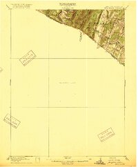
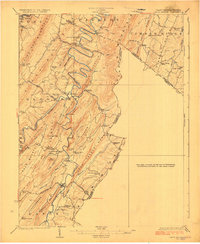
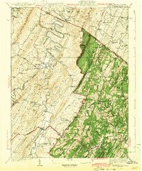
(63)- 1891 Map of Romney, 1897 Print
 1891 Romney1897 Print · USGSCovers Hampshire County, including Keyser, Moorefield, and other nearby areas5 unique versions available
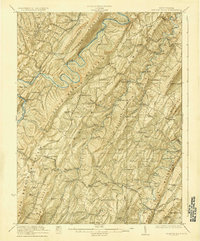
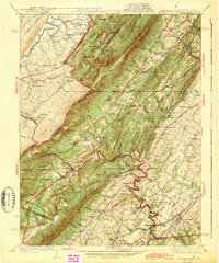
 - 1894 Map of Winchester, 1899 Print
 1894 Winchester1899 Print · USGSCovers Hampshire County, including Winchester, Martinsburg, and other nearby areas6 unique versions available
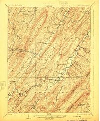
 - 1898 Map of Paw Paw, 1982 Print
 1898 Paw Paw1982 Print · USGSCovers Hampshire County, including Paw Paw, Little Orleans, and other nearby areas
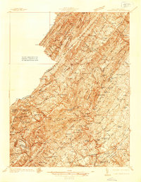
 - 1899 Map of Flintstone
 1899 Flintstone1899 Print · USGSCovers Hampshire County, including Cumberland, Bowmans Addition, and other nearby areas
 - 1900 Map of Pawpaw
 1900 Pawpaw1900 Print · USGSCovers Hampshire County, including Paw Paw, Little Orleans, and other nearby areas8 unique versions available
 - 1900 Map of Flintstone
 1900 Flintstone1900 Print · USGSCovers Hampshire County, including Cumberland, Bowmans Addition, and other nearby areas6 unique versions available
 - 1910 Map of Paw Paw, 1959 Print
 1910 Paw Paw1959 Print · USGSCovers Hampshire County, including Paw Paw, Little Orleans, and other nearby areas
 - 1916 Map of Capon Bridge
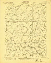
 1916 Capon Bridge1916 Print · USGSCovers Hampshire County, including Lake Holiday, Gore, and other nearby areas2 unique versions available
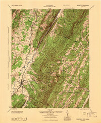
 - 1920 Map of Moorefield, 1958 Print
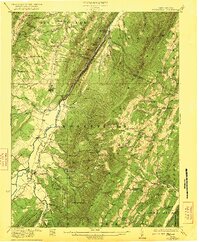
 1920 Moorefield1958 Print · USGSCovers Hampshire County, including Moorefield, Sector, and other nearby areas2 unique versions available
 - 1920 Map of Keyser, 1964 Print
 1920 Keyser1964 Print · USGSCovers Hampshire County, including Keyser, Romney, and other nearby areas
 - 1921 Map of Keyser
 1921 Keyser1921 Print · USGSCovers Hampshire County, including Keyser, Romney, and other nearby areas2 unique versions available
 - 1921 Map of Hanging Rock
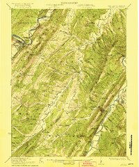
 1921 Hanging Rock1921 Print · USGSCovers Hampshire County, including Romney, Blues Beach, and other nearby areas3 unique versions available
 - 1921 Map of Moorefield
 1921 Moorefield1921 Print · USGSCovers Hampshire County, including Moorefield, Sector, and other nearby areas2 unique versions available
 - 1922 Map of Moorefield
 1922 Moorefield1922 Print · USGSCovers Hampshire County, including Moorefield, Sector, and other nearby areas2 unique versions available
 - 1922 Map of Wardensville
 1922 Wardensville1922 Print · USGSCovers Hampshire County, including Wardensville, Ruckman, and other nearby areas
 - 1922 Map of Keyser
 1922 Keyser1922 Print · USGSCovers Hampshire County, including Keyser, Romney, and other nearby areas3 unique versions available
 - 1923 Map of Middletown
 1923 Middletown1923 Print · USGSCovers Hampshire County, including Strasburg, Shawneeland, and other nearby areas
 - 1923 Map of Capon Bridge
 1923 Capon Bridge1923 Print · USGSCovers Hampshire County, including Lake Holiday, Gore, and other nearby areas2 unique versions available
 - 1923 Map of Hanging Rock
 1923 Hanging Rock1923 Print · USGSCovers Hampshire County, including Romney, Blues Beach, and other nearby areas4 unique versions available
 - 1924 Map of Wardensville
 1924 Wardensville1924 Print · USGSCovers Hampshire County, including Wardensville, Ruckman, and other nearby areas2 unique versions available
 - 1937 Map of Capon Bridge
 1937 Capon Bridge1937 Print · USGSCovers Hampshire County, including Lake Holiday, Gore, and other nearby areas4 unique versions available
 - 1937 Map of Middletown
 1937 Middletown1937 Print · USGSCovers Hampshire County, including Strasburg, Shawneeland, and other nearby areas2 unique versions available
 - 1943 Map of Capon Bridge
 1943 Capon Bridge1943 Print · USGSCovers Hampshire County, including Lake Holiday, Gore, and other nearby areas2 unique versions available
 - 1943 Map of Middletown
 1943 Middletown1943 Print · USGSCovers Hampshire County, including Strasburg, Shawneeland, and other nearby areas2 unique versions available
 - 1945 Map of Moorefield
 1945 Moorefield1945 Print · USGSCovers Hampshire County, including Moorefield, Sector, and other nearby areas
Showing maps 1-25 of 63
Top cities of Hampshire County
Frequently asked questions
- What are the different types of historical maps available for Hampshire County?
- What is the oldest map of Hampshire County?
- Where can I purchase historical maps of Hampshire County for my home or office?
- Where can I download high-res historical maps of Hampshire County?
- Are there historical topographic maps available for Hampshire County?
- Is there historical aerial imagery available for Hampshire County?
- Where are historical maps of Hampshire County sourced from?