1960s Maps of Monroe County, West Virginia
Explore 12 historic maps of Monroe County from the 1960s. These maps offer a rare glimpse into what life looked like during the 1960s — showing old roads, neighborhoods, homes, and landmarks that have changed or disappeared over time.
Whether you're researching your family's past, planning a metal detecting trip, or studying how Monroe County's landscape evolved across the 1960s, these high-resolution maps are a powerful tool for exploring the history of this region.
- Focus on a specific era: All maps on this page are from the 1960s, giving you a focused view of this time period.
- See what’s changed: Compare century-old streets, trails, and buildings to today's modern landscape using overlays and satellite layers.
- Research with precision: Use these maps for genealogy, historical research, land use analysis, or educational projects.
- View, download, or print: Maps are fully viewable online in high resolution, and can be downloaded or printed for your own records.
Start exploring Monroe County's history through authentic maps from the 1960s. This is your window into the past.
Monroe County, WV maps
(12)- 1961 Map of Bluefield
 1961 Bluefield1961 Print · USGSThe coalfields and mountain ridges of southern West Virginia and southwest Virginia are captured in the early sixties. Genealogists can trace family ties through rail-linked towns like Princeton and Richlands or along the shores of Bluestone Reservoir.
 - 1965 Map of Interior, 1966 Print
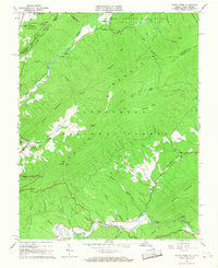
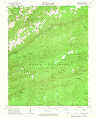 1965 Interior1966 Print · USGSThe high ridges of the Virginia and West Virginia border are captured here in the mid-sixties, dominated by the Jefferson National Forest. Researchers can locate family sites such as Fortner Cem or trace the path of the Appalachian Trail through Lybrook Gap.5 unique versions available
 - 1965 Map of Peterstown, 1966 Print
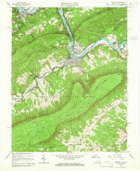
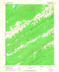
 1965 Peterstown1966 Print · USGSMonroe County and the Virginia borderlands are shown in the mid-sixties just as the waters of Bluestone Reservoir reshaped the valley. Trace the old pathways of the New River and find family landmarks like Mt Carmel Cem or Thompson Chapel.3 unique versions available
 - 1965 Map of Narrows, 1966 Print
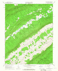
 1965 Narrows1966 Print · USGSThe Virginia and West Virginia borderlands in the mid-1960s show a rugged mountain economy defined by the New River and its rail lines. Local researchers can locate family sites like Blankenship Cem or trace the early Appalachian Trail over Pearis Mountain.4 unique versions available
 - 1965 Map of Waiteville, 1967 Print
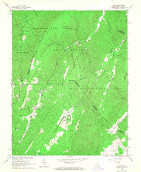
 1965 Waiteville1967 Print · USGSThe mountain valleys of the Virginia and West Virginia border come alive in the mid-1960s as timber and rail history meet. Trace the Old Railroad Grade past Waiteville or locate family roots at New Zion Union Ch and Taylor Cem.2 unique versions available
 - 1965 Map of Craig Springs, 1967 Print
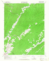
 1965 Craig Springs1967 Print · USGSThe Virginia and West Virginia borderlands in the mid-1960s reveal a landscape of ridge-top forests and narrow valley settlements. Genealogists can trace family names at the Ross Cem or locate community hubs like Simmonsville, Valley Mill, and the Maywood Sch.2 unique versions available
 - 1965 Map of Lindside, 1967 Print
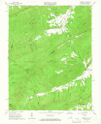
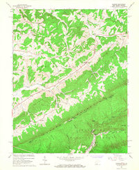 1965 Lindside1967 Print · USGSMonroe County and the Virginia borderlands are captured here in the mid-sixties, showing a landscape of high ridges and narrow valleys. Genealogists can locate family-named sites like Broyles Cem and Mountain View Cem or trace the rural routes connecting Lindside to Orchard.3 unique versions available
 - 1966 Map of Potts Creek, 1967 Print
 1966 Potts Creek1967 Print · USGSThe Virginia and West Virginia borderlands in the 1960s are defined here by the steep ridges of Peters Mountain and the winding course of Potts Creek. Genealogists and local historians can trace family locations at Rowan Memorial Home Cem, Paxton Chapel, and the Paint Bank National Fish Hatchery.2 unique versions available
 - 1966 Map of Paint Bank, 1968 Print
 1966 Paint Bank1968 Print · USGSThe West Virginia and Virginia borderlands around Monroe County are captured here in the mid-sixties, showing a landscape defined by high ridges and narrow valley settlements. Researchers can trace the Old RR Grade near Paint Bank or locate rural landmarks like Pine Grove Ch and Mountain View Cem.2 unique versions available
 - 1966 Map of Glace, 1968 Print
 1966 Glace1968 Print · USGSThe West Virginia and Virginia borderlands come to life in the mid-sixties, showing the rugged topography of the Greenbrier State Forest. Genealogists and hikers can trace old landmarks like Hylton Ch, the Catholic Cem, and Moncove Lake.2 unique versions available
 - 1966 Map of Alleghany, 1968 Print
 1966 Alleghany1968 Print · USGSThe Virginia and West Virginia state line runs through these high ridges in the mid-sixties, tracing a landscape of mountain rail passes and mineral springs. Researchers can locate remote sites like the Lewis Tunnel, Sweet Chalybeate, and old rural landmarks such as Palestine Ch.3 unique versions available
 - 1968 Map of Forest Hill, 1971 Print
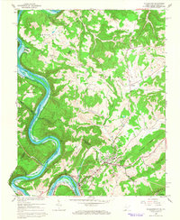
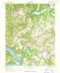 1968 Forest Hill1971 Print · USGSThe river-carved landscape of Summers and Monroe counties is captured here in the late sixties as Bluestone Lake reshaped the valley. Genealogists can trace old family sites around Bargers Springs, Indian Mills, and the Fairview Ch cemetery.2 unique versions available
End of results
Showing maps 1-12 of 12
Top cities of Monroe County
Frequently asked questions
- What are the different types of historical maps available for Monroe County?
- What is the oldest map of Monroe County?
- Where can I purchase historical maps of Monroe County for my home or office?
- Where can I download high-res historical maps of Monroe County?
- Are there historical topographic maps available for Monroe County?
- Is there historical aerial imagery available for Monroe County?
- Where are historical maps of Monroe County sourced from?