1970s Maps of Monroe County, West Virginia
Explore 6 historic maps of Monroe County from the 1970s. These maps offer a rare glimpse into what life looked like during the 1970s — showing old roads, neighborhoods, homes, and landmarks that have changed or disappeared over time.
Whether you're researching your family's past, planning a metal detecting trip, or studying how Monroe County's landscape evolved across the 1970s, these high-resolution maps are a powerful tool for exploring the history of this region.
- Focus on a specific era: All maps on this page are from the 1970s, giving you a focused view of this time period.
- See what’s changed: Compare century-old streets, trails, and buildings to today's modern landscape using overlays and satellite layers.
- Research with precision: Use these maps for genealogy, historical research, land use analysis, or educational projects.
- View, download, or print: Maps are fully viewable online in high resolution, and can be downloaded or printed for your own records.
Start exploring Monroe County's history through authentic maps from the 1970s. This is your window into the past.
Monroe County, WV maps
(6)- 1971 Map of Alderson, 1974 Print
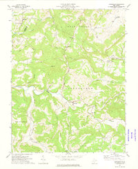
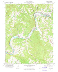 1971 Alderson1974 Print · USGSAlderson and the Greenbrier River valley are documented here in the early 1970s, showing a landscape defined by its mountains and institutional landmarks. Researchers can locate Federal Reformatory for Women, trace the Chesapeake and Ohio rail line, or find local spots like Pence Springs and Keller Ch.2 unique versions available
 - 1971 Map of Union, 1974 Print
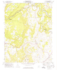
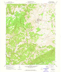 1971 Union1974 Print · USGSMonroe County was a landscape of mountain ridges and valley farms in the early 1970s. Local researchers can locate family landmarks like Rehobeth Ch, the historic Covered Bridge near Lillydale, and the rural community of Salt Sulphur Springs.2 unique versions available
 - 1971 Map of Gap Mills, 1974 Print
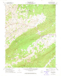 1971 Gap Mills1974 Print · USGSMonroe County mountain life is centered on the gap where the creek cuts the ridge in the early seventies. Genealogists and historians can trace family locations near Gap Mills, Crimson Springs, and several country churches like Browns Chapel.
 - 1971 Map of Ronceverte, 1975 Print
 1971 Ronceverte1975 Print · USGSGreenbrier and Monroe counties are captured here in the early seventies, showing the rail-and-river hub of Ronceverte. Genealogists can trace local roots through sites like Organ Cave, Morgan Cem, and the numerous country churches like Salem Ch and Elizabeth Chapel.
 - 1971 Map of Fort Spring, 1975 Print
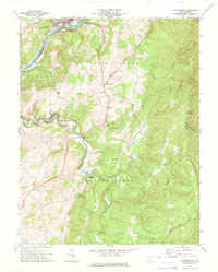
 1971 Fort Spring1975 Print · USGSMonroe County in the early seventies shows a landscape defined by the winding Greenbrier River and heavy rail industry. Local historians can trace industrial sites like Snowflake and old water-powered landmarks including Nickells Mill and the Covered Bridge.2 unique versions available
 - 1971 Map of Greenville, 1975 Print
 1971 Greenville1975 Print · USGSMonroe County's rural valleys and ridges are captured here during the early 1970s, showcasing a landscape of isolated farmsteads and creek-side hamlets. Family historians can locate several local landmarks like Indian Creek Ch, Wikel, and the Oak Grove Cem.2 unique versions available
End of results
Showing maps 1-6 of 6
Top cities of Monroe County
Frequently asked questions
- What are the different types of historical maps available for Monroe County?
- What is the oldest map of Monroe County?
- Where can I purchase historical maps of Monroe County for my home or office?
- Where can I download high-res historical maps of Monroe County?
- Are there historical topographic maps available for Monroe County?
- Is there historical aerial imagery available for Monroe County?
- Where are historical maps of Monroe County sourced from?