Old Maps of Monroe County, West Virginia for Genealogy
Trace your family roots with 139 historic maps of Monroe County. These high-res maps reveal old neighborhoods, homesites, landmarks, and streets — helping you uncover where your ancestors lived and how the area evolved over time.
- Explore historic neighborhoods: Identify where your relatives may have lived in the 1800s or 1900s.
- Compare maps over time: Trace the changes in streets, buildings, and landmarks for multi-generational research.
- Perfect for genealogy & ancestry research: Used by family historians and researchers to map out lineage and migration.
These maps are an incredible resource for exploring your personal connection to Monroe County's past.
Monroe County, WV maps
(139)- 1887 Map of Hinton
 1887 Hinton1887 Print · USGSSouthern West Virginia’s rugged river corridors and mineral spring resorts come alive in this late nineteenth-century survey. Trace the rail-and-river economy through the Big Bend Tunnel, the Greenbrier Stock Yards, and the historic springs at Red Sulphur Springs.
 - 1887 Map of Lewisburg
 1887 Lewisburg1887 Print · USGSThe Greenbrier Valley and the Virginia borderlands are captured here in the late nineteenth century during a period of significant rail expansion. Genealogists and historians can trace early mountain settlements like White Sulphur Springs and Ronceverte, or locate specific landmarks like Van Staverns Mill and the Half Way House.
 - 1890 Map of Dublin
 1890 Dublin1890 Print · USGSThe mountainous borderlands of Virginia and West Virginia are captured here in the late nineteenth century as industry and rail expanded along the New River. Genealogists and historians can trace the foundations of local commerce through sites like Pearisburg, the Belle Hampton Mine, and river crossings at Peppers Ferry.
 - 1890 Map of Christiansburg
 1890 Christiansburg1890 Print · USGSSouthwestern Virginia in the late nineteenth century centers on the emerging rail and resort economy. Trace the Norfolk and Western Railroad through Christiansburg and find historic resorts like Alleghany Springs.10 unique versions available
 - 1891 Map of Lewisburg
 1891 Lewisburg1891 Print · USGSThe Virginia and West Virginia borderlands are captured here in the late 1880s, documenting a landscape of mountain ridges and burgeoning rail infrastructure. Genealogists and historians can trace family-named landmarks like Van Staverns Mill or follow the route of the Chesapeake and Ohio Railroad through the Alleghany Tunnel.8 unique versions available
 - 1891 Map of Dublin
 1891 Dublin1891 Print · USGSAcross Southwest Virginia and West Virginia in the late nineteenth century, the river and rail lines dictated the pace of mountain life. Genealogists can trace family footprints through numerous river crossings like Ingles Ferry and historic industry sites like Altoona Mines and Mercers Salt Works.9 unique versions available
 - 1892 Map of Hinton
 1892 Hinton1892 Print · USGSSouthern West Virginia in the late nineteenth century centers on the river-and-rail hub of Hinton and the high ridges of the Alleghenies. Researchers can trace early railroad engineering at the Big Bend Tunnel or locate historic mineral spring resorts like Salt Sulphur Springs and Blue Sulphur Springs.5 unique versions available
 - 1912 Map of Big Bend, 1964 Print
 1912 Big Bend1964 Print · USGSSummers County at the height of the steam era reveals a landscape shaped by the meeting of the Greenbrier and New Rivers. You can trace the path of the Chesapeake and Ohio RR through the Big Bend Tunnel or locate long-lost rural schools like Rock Bottom School and Spicklick School.
 - 1913 Map of Peterstown
 1913 Peterstown1913 Print · USGSPeterstown and the New River valley are captured in the early twentieth century as the railroad transformed these mountain borderlands. Genealogists and historians can trace dozens of rural schoolhouses and stops like Willowton PO, Shanklins Ferry, and Oakvale.
 - 1914 Map of Big Bend
 1914 Big Bend1914 Print · USGSIn the early twentieth century, the New River valley was a bustling corridor defined by its railroads and mountain settlements. Genealogists can trace family footprints at Packs Ferry PO, the Big Bend Tunnel, and numerous rural sites like Indian Mills.4 unique versions available
 - 1916 Map of Peterstown
 1916 Peterstown1916 Print · USGSMonroe and Mercer Counties are seen here in the decade before the First World War, defined by steep ridges and the critical rail corridors of the New River valley. Genealogists can locate dozens of country schools and remote landmarks like Mauvern Saltworks, Goodwin Chapel, and Shanklins Ferry.2 unique versions available
 - 1921 Map of Alderson
 1921 Alderson1921 Print · USGSThe Greenbrier River valley and the West Virginia highlands come alive in the early 1920s, showing the region's rail-dependent economy and rural school networks. Researchers can trace family roots at Nickels Mill, Spider Den School, and the settlement of Sinks Grove.3 unique versions available
 - 1921 Map of Ronceverte
 1921 Ronceverte1921 Print · USGSThe West Virginia and Virginia borderlands come alive in this early 1920s record of the Greenbrier Valley and Allegheny ridges. Genealogists can trace family roots through numerous local landmarks like Organ Cave, Red Mill, and the Highland Green School.2 unique versions available
 - 1923 Map of Ronceverte
 1923 Ronceverte1923 Print · USGSSoutheast West Virginia in the early twenties is a landscape of mountain ridges and remote hollows. Genealogists can trace the rural communities of Gap Mills and Sweet Springs, alongside dozens of landmarks like Organ Cave and Schley School.4 unique versions available
 - 1923 Map of Pearisburg
 1923 Pearisburg1923 Print · USGSThe West Virginia and Virginia state line follows the high crest of Peters Mountain in the early 1920s. Genealogists can trace a remarkable concentration of rural education and faith at sites like Oak Hill School and Green Valley Church.3 unique versions available
 - 1923 Map of Waiteville
 1923 Waiteville1923 Print · USGSThe mountain border between West Virginia and Virginia comes to life in the early 1920s, centered on the settlement of Waiteville. Local historians can trace the Norfolk and Western Ry line as it snakes along Potts Cr beneath Peters Mountain.2 unique versions available
 - 1923 Map of Alderson
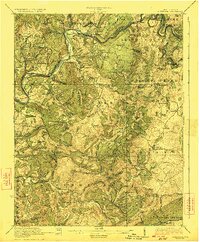 1923 Alderson1923 Print · USGSMonroe and Greenbrier Counties are shown here in the early 1920s, a landscape defined by mineral springs and a dense network of rural schoolhouses. Researchers can locate dozens of local sites like Hokes Mill, Sinks Grove P O, and the Spider Den School.3 unique versions available
 - 1925 Map of Peterstown
 1925 Peterstown1925 Print · USGSThe border of West Virginia and Virginia is captured in the mid-1920s, dominated by the winding path of the New River and the steep slopes of Peters Mtn. Genealogists can trace family locations near Mercers Saltworks, Wills Sta Willowton PO, and the Scratchgravel School.
 - 1931 Map of Waiteville
 1931 Waiteville1931 Print · USGSThe Virginia and West Virginia borderlands in the early 1930s reveal a landscape of high ridges and isolated valley settlements. Genealogists can trace family footprints around Newport, Clover Hollow Ch, and the waters of Striking Creek.
 - 1932 Map of Peterstown
 1932 Peterstown1932 Print · USGSThe borderlands of Giles and Mercer counties come alive in the early 1930s as the New River carves a path through the Appalachian ridges. Trace the rail-and-river economy of Narrows and find family-named landmarks like Blankenship Sch and Cedar Grove Ch.3 unique versions available
 - 1932 Map of Pearisburg
 1932 Pearisburg1932 Print · USGSGiles County in the early 1930s is defined by the winding New River and its mountain-bound communities. Genealogists can trace early homesteads and local institutions through Goodwins Ferry, Hoges Store, and several named schools like McGrady Sch.3 unique versions available
 - 1937 Map of Pearisburg
 1937 Pearisburg1937 Print · USGSGiles County at the onset of the late 1930s reveals a rugged mountain landscape where the New River dictates the path of commerce and travel. Genealogists can trace family roots through numerous rural landmarks like Hoges Store, Goodwins Ferry, and the remote McClardy School.3 unique versions available
 - 1937 Map of Narrows
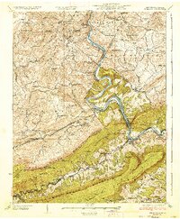 1937 Narrows1937 Print · USGSThe New River corridor comes alive in the late 1930s, showing the vital rail and river connections between Virginia and West Virginia. Genealogists and historians can locate dozens of country schools, family-named ridges, and landmarks like Shanklins Ferry and Mercers Saltworks.4 unique versions available
 - 1944 Map of Waiteville
 1944 Waiteville1944 Print · USGSThe borderlands of Giles and Craig counties are captured here in the early twentieth century, showing a transition from rail-dependent industry to rural isolation. Genealogists and historians can trace family locations near Mt Olivet Ch, the settlement at Waiteville, and the now-silent tracks of the Norfolk and Western Ry.
 - 1945 Map of New Castle, 1964 Print
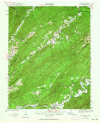 1945 New Castle1964 Print · USGSThe mountain gaps of Craig and Alleghany Counties are captured here at the end of the war, when mining and rail transport still defined the local economy. Researchers can trace the legacy of industry and faith at Jordan Mines, Lignite, and Shoafs Chapel.
Showing maps 1-25 of 139
Top cities of Monroe County
Frequently asked questions
- What are the different types of historical maps available for Monroe County?
- What is the oldest map of Monroe County?
- Where can I purchase historical maps of Monroe County for my home or office?
- Where can I download high-res historical maps of Monroe County?
- Are there historical topographic maps available for Monroe County?
- Is there historical aerial imagery available for Monroe County?
- Where are historical maps of Monroe County sourced from?