2000s (21st Century) Maps of Hubbard, Wisconsin
Explore 4 historic maps of Hubbard from the 2000s (21st Century). These maps offer a rare glimpse into what life looked like during the 2000s — showing old roads, neighborhoods, homes, and landmarks that have changed or disappeared over time.
Whether you're researching your family's past, planning a metal detecting trip, or studying how Hubbard's landscape evolved across the 2000s, these high-resolution maps are a powerful tool for exploring the history of this region.
- Focus on a specific era: All maps on this page are from the 2000s, giving you a focused view of this time period.
- See what’s changed: Compare century-old streets, trails, and buildings to today's modern landscape using overlays and satellite layers.
- Research with precision: Use these maps for genealogy, historical research, land use analysis, or educational projects.
- View, download, or print: Maps are fully viewable online in high resolution, and can be downloaded or printed for your own records.
Start exploring Hubbard's history through authentic maps from the 2000s. This is your window into the past.
Hubbard, WI maps
(4)- 2022 Map of Horicon, 2022 Print
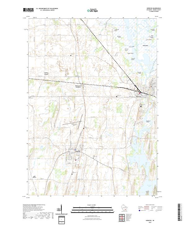 2022 Horicon2022 Print · USGSDodge County in the early 2020s shows a landscape defined by the expansive Horicon Marsh and the city of Juneau. Researchers can trace local history through numerous sites like Minnesota Junction, Oak Hill Cem, and the Wild Goose State Trl.
 - 2022 Map of Clyman, 2022 Print
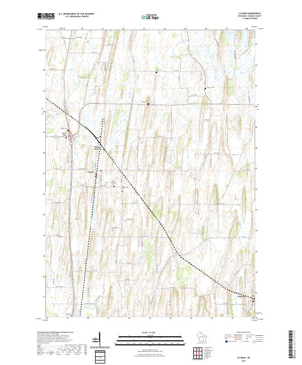 2022 Clyman2022 Print · USGSDodge County's agricultural heartland is documented here in the early twenty-first century, showing the enduring layout of rural townships and local hamlets. Genealogists and historians can locate numerous small burial sites like Mengel Cem and Clyman Center Cem or trace the Wild Goose State Trl.
 - 2022 Map of Hustisford, 2022 Print
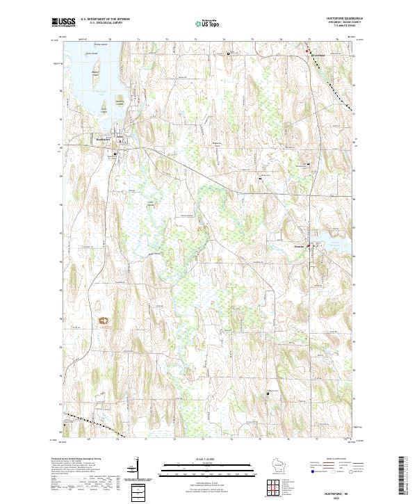 2022 Hustisford2022 Print · USGSDodge County’s river valleys and glacial wetlands appear in high detail during the early 2020s. Researchers can trace family history through local burial grounds like Saint Johns Cem and Lebanon Cem or follow the waters of Wildcat Creek.
 - 2022 Map of Mayville South, 2022 Print
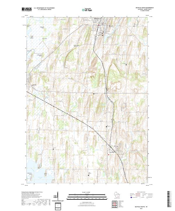 2022 Mayville South2022 Print · USGSDodge County's river valleys and glacial marshlands are documented here in the early twenty-first century. Researchers can trace family roots through numerous local burial grounds like Graceland Cem and find old homesteads near Kekoskee and Iron Ridge.
End of results
Showing maps 1-4 of 4
Top cities near Hubbard
- Beaver Dam historical maps
- Watertown historical maps
- Hartford historical maps
- Merton historical maps
- Mayville historical maps
- Horicon historical maps
See more
Top neighborhoods of Hubbard
Frequently asked questions
- What are the different types of historical maps available for Hubbard?
- What is the oldest map of Hubbard?
- Where can I purchase historical maps of Hubbard for my home or office?
- Where can I download high-res historical maps of Hubbard?
- Are there historical topographic maps available for Hubbard?
- Is there historical aerial imagery available for Hubbard?
- Where are historical maps of Hubbard sourced from?