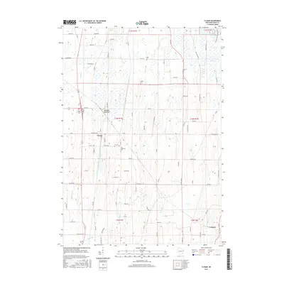
2015 Map of Clyman
USGS Topo · Published 2015About this map
Clyman and its neighboring agricultural communities are defined by a complex network of glacial hydrology and established rural cemeteries in this 2015 study of Dodge County. The landscape is characterized by the marshy lowlands surrounding Dead Cr and Clyman Cr, which feed into the northeastern reach of Sinissippi Lake. These watercourses carve through the terrain, creating a backdrop for the scattered family and church burial grounds that dot the township lines, including Tabor Cem and Fehling Cem.
Find a feature on this map
91 named features on this map. Tap any name to fly to it.
Don’t see what you’re looking for? This feature index may not catch every label — zoom into the map to look around manually.
Map Details
Editions of this 2015 Clyman Map
This is the sole edition of this map. No revisions or reprints were ever made.
Other maps of this area

1891 · Waterloo
USGS Topo · 1:62,500

1892 · Watertown
USGS Topo · 1:62,500

1894 · Waterloo
USGS Topo · 1:62,500

1894 · Watertown
USGS Topo · 1:62,500

1910 · Waterloo
USGS Topo · 1:62,500

1955 · Beaver Dam
USGS Topo · 1:62,500

1955 · Horicon
USGS Topo · 1:62,500

1957 · Madison
USGS Topo · 1:250,000
1959 · Richwood
USGS Topo · 1:24,000

1959 · Ixonia
USGS Topo · 1:24,000