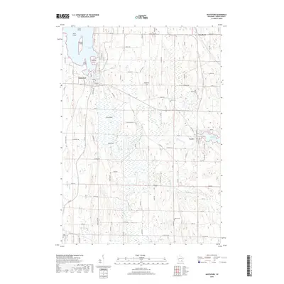
2018 Map of Hustisford
USGS Topo · Published 2018About this map
The Rock River and its various tributaries define the landscape of eastern Dodge County, flowing through the primary settlements of Hustisford and Neosho. This area is characterized by an intricate water network where the river widens into Sinissippi Lake, dotted with features like Anthony Island and Koch Island. To the east, the Rubicon River feeds the Neosho Millpond, a focal point for the village of Neosho.
Find a feature on this map
95 named features on this map. Tap any name to fly to it.
Don’t see what you’re looking for? This feature index may not catch every label — zoom into the map to look around manually.
Map Details
Editions of this 2018 Hustisford Map
This is the sole edition of this map. No revisions or reprints were ever made.
Other maps of this area

1892 · Watertown
USGS Topo · 1:62,500

1892 · Oconomowoc
USGS Topo · 1:62,500

1894 · Watertown
USGS Topo · 1:62,500

1904 · Hartford
USGS Topo · 1:62,500

1909 · Oconomowoc
USGS Topo · 1:62,500

1955 · Horicon
USGS Topo · 1:62,500

1957 · Madison
USGS Topo · 1:250,000

1959 · Ixonia
USGS Topo · 1:24,000
1959 · Stonebank
USGS Topo · 1:24,000

1959 · Hartford
USGS Topo · 1:62,500