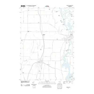
2010 Map of Horicon
USGS Topo · Published 2010About this map
Juneau and Horicon anchor this Dodge County landscape, where the Rock River and its branches create a complex network of wetlands and islands. The river system includes notable landforms like Diamond Island and Onemile Island, while the Horicon WP317 Dam regulates the local flow. The area's settlement history is preserved through several family-named and community burial grounds, including the centrally located Wrucke Cemetery and Stone Cemetery near the agricultural crossroads of Minnesota Junction.
Find a feature on this map
70 named features on this map. Tap any name to fly to it.
Don’t see what you’re looking for? This feature index may not catch every label — zoom into the map to look around manually.
Map Details
Editions of this 2010 Horicon Map
This is the sole edition of this map. No revisions or reprints were ever made.
Other maps of this area

1955 · Beaver Dam
USGS Topo · 1:62,500

1955 · Waupun
USGS Topo · 1:62,500

1955 · Fox Lake
USGS Topo · 1:62,500

1955 · Horicon
USGS Topo · 1:62,500

1957 · Madison
USGS Topo · 1:250,000

1960 · Madison
USGS Topo · 1:250,000

1975 · Horicon NW
USGS Topo · 1:24,000

1975 · Beaver Dam NE
USGS Topo · 1:24,000
1975 · Horicon NE
USGS Topo · 1:24,000
1975 · Waupun SE
USGS Topo · 1:24,000