Old Maps of Fond du Lac County, Wisconsin for Academic Research
Study the evolution of Fond du Lac County with 74 high-resolution historic maps. Whether you're teaching, researching, or modeling changes in land use, these maps provide essential visual documentation of urban, environmental, and geographic change.
- Analyze long-term change: Track patterns in development, transportation, and natural features.
- Ideal for environmental or urban studies: Support academic projects with primary historical map data.
- Use in the classroom or lab: Educators and researchers rely on these maps to bring historical context to life.
These maps are a powerful tool for teaching, research, and visualizing how Fond du Lac County has changed over the decades.
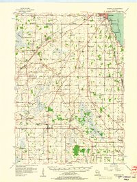
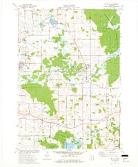
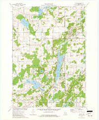
Fond du Lac County, WI maps
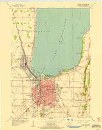
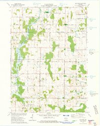
(74)- 1910 Map of Fond du Lac
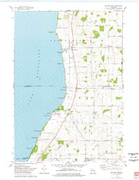
 1910 Fond du Lac1910 Print · USGSCovers Fond du Lac County, including Fond du Lac, North Fond du Lac, and other nearby areas2 unique versions available
 - 1916 Map of Ripon
 1916 Ripon1916 Print · USGSCovers Fond du Lac County, including Ripon, Berlin, and other nearby areas
 - 1918 Map of Ripon
 1918 Ripon1918 Print · USGSCovers Fond du Lac County, including Ripon, Berlin, and other nearby areas
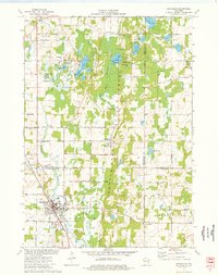
 - 1954 Map of Kiel, 1956 Print
 1954 Kiel1956 Print · USGSCovers Fond du Lac County, including Plymouth, New Holstein, and other nearby areas2 unique versions available
 - 1955 Map of Waupun, 1957 Print
 1955 Waupun1957 Print · USGSCovers Fond du Lac County, including Mayville, Waupun, and other nearby areas2 unique versions available
 - 1955 Map of Campbellsport, 1957 Print
 1955 Campbellsport1957 Print · USGSCovers Fond du Lac County, including Fond du Lac, Kewaskum, and other nearby areas2 unique versions available
 - 1955 Map of Fox Lake, 1957 Print
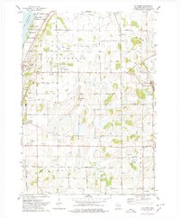
 1955 Fox Lake1957 Print · USGSCovers Fond du Lac County, including Beaver Dam, Waupun, and other nearby areas
 - 1955 Map of Kewaskum, 1957 Print
 1955 Kewaskum1957 Print · USGSCovers Fond du Lac County, including Kewaskum, Greenbush, and other nearby areas4 unique versions available
 - 1955 Map of Fond Du Lac, 1957 Print
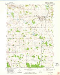
 1955 Fond Du Lac1957 Print · USGSCovers Fond du Lac County, including Fond du Lac, North Fond du Lac, and other nearby areas2 unique versions available
 - 1955 Map of Fond Du Lac, 1966 Print
 1955 Fond Du Lac1966 Print · USGSCovers Fond du Lac County, including Fond du Lac, North Fond du Lac, and other nearby areas2 unique versions available
 - 1956 Map of Ripon, 1957 Print
 1956 Ripon1957 Print · USGSCovers Fond du Lac County, including Ripon, Berlin, and other nearby areas
 - 1956 Map of Rosendale, 1957 Print
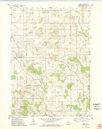
 1956 Rosendale1957 Print · USGSCovers Fond du Lac County, including Oshkosh, North Fond du Lac, and other nearby areas2 unique versions available
 - 1957 Map of Madison, 1967 Print
 1957 Madison1967 Print · USGSCovers Fond du Lac County, including Milwaukee, Madison, and other nearby areas3 unique versions available
 - 1960 Map of Madison
 1960 Madison1960 Print · USGSCovers Fond du Lac County, including Milwaukee, Madison, and other nearby areas2 unique versions available
 - 1974 Map of St. Cloud, 1977 Print
 1974 St. Cloud1977 Print · USGSCovers Fond du Lac County, including Greenbush, Mount Calvary, and other nearby areas
 - 1974 Map of Dundee, 1977 Print
 1974 Dundee1977 Print · USGSCovers Fond du Lac County, including Greenbush, Mitchell, and other nearby areas2 unique versions available
 - 1974 Map of Marytown, 1977 Print
 1974 Marytown1977 Print · USGSCovers Fond du Lac County, including Brothertown, Calumet, and other nearby areas
 - 1974 Map of Kewaskum, 1977 Print
 1974 Kewaskum1977 Print · USGSCovers Fond du Lac County, including Kewaskum, Scott, and other nearby areas
 - 1974 Map of St. Peter, 1978 Print
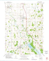
 1974 St. Peter1978 Print · USGSCovers Fond du Lac County, including Fond du Lac, Taycheedah, and other nearby areas
 - 1974 Map of Fahrney Point, 1978 Print
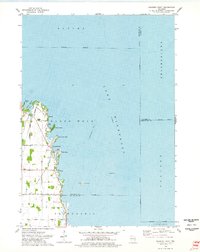 1974 Fahrney Point1978 Print · USGSCovers Fond du Lac County, including Black Wolf, Friendship, and other nearby areas
 - 1974 Map of Brothertown, 1978 Print
 1974 Brothertown1978 Print · USGSCovers Fond du Lac County, including Taycheedah, Brothertown, and other nearby areas
 - 1974 Map of Campbellsport, 1978 Print
 1974 Campbellsport1978 Print · USGSCovers Fond du Lac County, including Kewaskum, Wayne, and other nearby areas
 - 1974 Map of Eden, 1978 Print
 1974 Eden1978 Print · USGSCovers Fond du Lac County, including Ashford, Eden, and other nearby areas
 - 1974 Map of Byron, 1978 Print
 1974 Byron1978 Print · USGSCovers Fond du Lac County, including Fond du Lac, Lomira, and other nearby areas
 - 1974 Map of Lomira, 1978 Print
 1974 Lomira1978 Print · USGSCovers Fond du Lac County, including Lomira, Wayne, and other nearby areas
Showing maps 1-25 of 74
Top cities of Fond du Lac County
- Fond du Lac historical maps
- Ripon historical maps
- North Fond du Lac historical maps
- Taycheedah historical maps
- Campbellsport historical maps
- Ashford historical maps
See more
Frequently asked questions
- What are the different types of historical maps available for Fond du Lac County?
- What is the oldest map of Fond du Lac County?
- Where can I purchase historical maps of Fond du Lac County for my home or office?
- Where can I download high-res historical maps of Fond du Lac County?
- Are there historical topographic maps available for Fond du Lac County?
- Is there historical aerial imagery available for Fond du Lac County?
- Where are historical maps of Fond du Lac County sourced from?