1940s Maps of Langlade County, Wisconsin
Explore 4 historic maps of Langlade County from the 1940s. These maps offer a rare glimpse into what life looked like during the 1940s — showing old roads, neighborhoods, homes, and landmarks that have changed or disappeared over time.
Whether you're researching your family's past, planning a metal detecting trip, or studying how Langlade County's landscape evolved across the 1940s, these high-resolution maps are a powerful tool for exploring the history of this region.
- Focus on a specific era: All maps on this page are from the 1940s, giving you a focused view of this time period.
- See what’s changed: Compare century-old streets, trails, and buildings to today's modern landscape using overlays and satellite layers.
- Research with precision: Use these maps for genealogy, historical research, land use analysis, or educational projects.
- View, download, or print: Maps are fully viewable online in high resolution, and can be downloaded or printed for your own records.
Start exploring Langlade County's history through authentic maps from the 1940s. This is your window into the past.
Langlade County, WI maps
(4)- 1940 Map of Parrish
 1940 Parrish1940 Print · USGSUpper Wisconsin during the early 1940s is captured here at the edges of Three counties. Researchers can trace the Chicago and Northwestern rail line and locate the Enterprise settlement near Shingle Mill Lake before the full survey was completed.
 - 1942 Map of Elcho
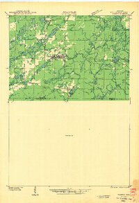
 1942 Elcho1942 Print · USGSUpper Wisconsin’s lake country appears here in the early 1940s, showing a landscape of scattered rural schools and forest townships. Genealogists and researchers can trace local roots at the Enterprise Cem, St Johns Ch, or find family landmarks near Pelican Lake.
 - 1942 Map of Wabeno
 1942 Wabeno1942 Print · USGSForest County's timberlands are captured here in the early 1940s, when rail and river still drove the local economy. Researchers can locate vanished rural schools like Rummel Sch, several local cemeteries, and the site of an Abandoned CCC Camp near Otter Lake.
 - 1942 Map of Pearson
 1942 Pearson1942 Print · USGSNorthern Wisconsin lake country and timberlands are shown in the early 1940s as rail transit still defined the local economy. Genealogists and historians can trace rail stops like Jones Spur, the Woodlawn Sch, and the settlement at Mole Lake.
End of results
Showing maps 1-4 of 4
Top cities of Langlade County
- Antigo historical maps
- Elcho historical maps
- Polar historical maps
- Neva historical maps
- Langlade historical maps
- White Lake historical maps
See more
Frequently asked questions
- What are the different types of historical maps available for Langlade County?
- What is the oldest map of Langlade County?
- Where can I purchase historical maps of Langlade County for my home or office?
- Where can I download high-res historical maps of Langlade County?
- Are there historical topographic maps available for Langlade County?
- Is there historical aerial imagery available for Langlade County?
- Where are historical maps of Langlade County sourced from?