1970s Maps of Langlade County, Wisconsin
Explore 28 historic maps of Langlade County from the 1970s. These maps offer a rare glimpse into what life looked like during the 1970s — showing old roads, neighborhoods, homes, and landmarks that have changed or disappeared over time.
Whether you're researching your family's past, planning a metal detecting trip, or studying how Langlade County's landscape evolved across the 1970s, these high-resolution maps are a powerful tool for exploring the history of this region.
- Focus on a specific era: All maps on this page are from the 1970s, giving you a focused view of this time period.
- See what’s changed: Compare century-old streets, trails, and buildings to today's modern landscape using overlays and satellite layers.
- Research with precision: Use these maps for genealogy, historical research, land use analysis, or educational projects.
- View, download, or print: Maps are fully viewable online in high resolution, and can be downloaded or printed for your own records.
Start exploring Langlade County's history through authentic maps from the 1970s. This is your window into the past.
Langlade County, WI maps
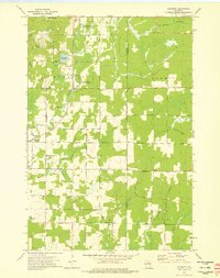
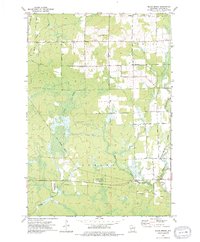
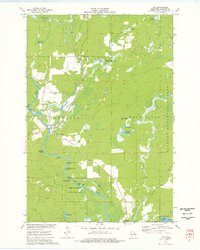
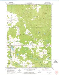
(28)- 1972 Map of Wabeno, 1975 Print
 1972 Wabeno1975 Print · USGSForest County in the early 1970s is characterized by the timber-belt communities of Wabeno and Soperton within the Nicolet National Forest. Genealogists and historians can trace rail-side developments, numerous lakefronts, and several local cemeteries like St Ambrose Cem and Roseland Cem.
 - 1972 Map of Reservoir Pond, 1975 Print
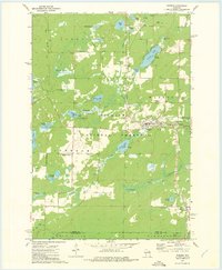
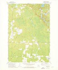
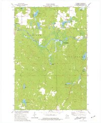
 1972 Reservoir Pond1975 Print · USGSWisconsin's north woods in the early 1970s appear as a dense network of glacial lakes and springs along the Oconto River. Outdoorsmen and historians can trace the Railroad Grade or locate the Ada Lake Lookout Tower and the Jones Spring Impoundment.2 unique versions available
 - 1973 Map of Roberts Lake, 1976 Print
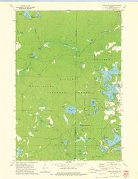
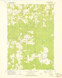
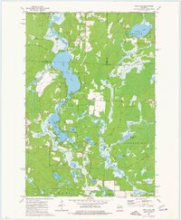
 1973 Roberts Lake1976 Print · USGSNorthern Forest County in the early seventies reveals a landscape defined by glacial lakes and the timber-hauling lines of the Soo Line. Genealogists and historians can trace small crossroads like Woodlawn and Freedom Corners tucked between Roberts Lake and the Bog Brook State Wildlife Area.2 unique versions available
 - 1973 Map of Antigo, 1976 Print
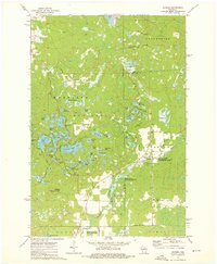
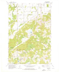
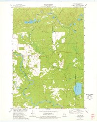
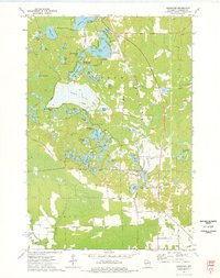
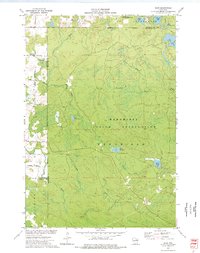
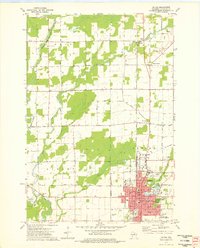 1973 Antigo1976 Print · USGSAntigo and the surrounding Langlade County countryside are captured in the early 1970s, as the city expanded around its river branches and rail corridors. Researchers can find numerous parochial schools and cemeteries, including St Hyacinths Sch and Bohemian Cem, alongside small rural hubs like Deerbrook.2 unique versions available
 - 1973 Map of Gleason, 1976 Print
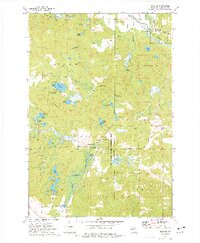
 1973 Gleason1976 Print · USGSLincoln County's rural townships are captured in the early 1970s, showing a landscape defined by the Prairie River and historic immigrant settlements. Researchers can locate the Estonian Cem, Latvian Cem, and follow the Old Railroad Grade through the Northwoods.2 unique versions available
 - 1973 Map of Kalinke, 1976 Print
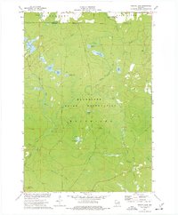
 1973 Kalinke1976 Print · USGSIn the early 1970s, the rural crossroads of Marathon County supported a quiet network of family farms and river-fed wetlands. Genealogists and local historians can locate early institutions like Zion Ch, Trinity Cem, and the Hewitt Texas Sch.
 - 1973 Map of Bavaria, 1976 Print
 1973 Bavaria1976 Print · USGSNorthern Wisconsin's timber and rail history is etched into this 1970s landscape near Bavaria and Ormsby. Researchers can trace the extensive OLD RAILROAD GRADE and find local landmarks like the Town Cem or the waters of Bullhead Lake.2 unique versions available
 - 1973 Map of Doering, 1976 Print
 1973 Doering1976 Print · USGSThe northern woods of Lincoln County come to life in this mid-seventies survey of the area around Doering. Genealogists and historians can trace the Old Railroad Grade past Wildwood Ch and find family names at Forest View Cem.
 - 1973 Map of Parrish, 1976 Print
 1973 Parrish1976 Print · USGSNorthern Wisconsin lake country in the 1970s is defined by its glacial terrain and timber history. Researchers can locate the Parrish Cem, trace the Old Railroad Grade, and explore the vast Prairie River State Public Hunting and Fishing Area.2 unique versions available
 - 1973 Map of Bryant, 1976 Print
 1973 Bryant1976 Print · USGSLanglade County's agricultural and forest lands are captured in the early seventies, showing a landscape defined by its rural townships and timber history. Genealogists and researchers can trace local landmarks like Bent Cem, Spring Valley Sch, and the Old Railroad Grade.
 - 1973 Map of Black Brook, 1976 Print
 1973 Black Brook1976 Print · USGSLanglade County's conservation lands and rural townships are captured here in the early seventies, as the modern wildlife areas were becoming established. Researchers can trace historic transportation routes along the Old RR Grade and locate local landmarks like Peck Cem and the Vilas Lookout Tower.
 - 1973 Map of Aniwa, 1976 Print
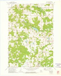
 1973 Aniwa1976 Print · USGSAniwa and the rural edges of Langlade, Shawano, and Marathon counties are captured here in the early seventies. You can trace the Chicago and North Western Railroad through Elmhurst or locate local landmarks like St Boniface Cem and Pleasant View Sch.
 - 1973 Map of Hogarty, 1976 Print
 1973 Hogarty1976 Print · USGSMarathon and Langlade counties come into focus in the early seventies, showing a landscape of timber, stone, and river water. Researchers can trace rural life through the Bethany Ch, an Old RR Grade, and the Aniwa Lookout Tower.
 - 1973 Map of Enterprise, 1976 Print
 1973 Enterprise1976 Print · USGSEnterprise and the surrounding lakelands are shown in the early 1970s, as the region's logging heritage transitioned toward conservation and recreation. Researchers can trace the path of the Old Railroad Grade and locate points of interest like the Lookout Tower and Payne Spring.
 - 1973 Map of Mole Lake, 1976 Print
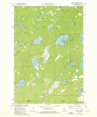
 1973 Mole Lake1976 Print · USGSThe Mole Lake region of northern Wisconsin is shown in the 1970s as a landscape of glacial lakes and reservation lands. Researchers can trace the Soo Line rail corridor or locate landmarks like the Lookout Tower and Kingdom Hall.
 - 1973 Map of Mattoon, 1976 Print
 1973 Mattoon1976 Print · USGSIn the early 1970s, the borderlands of Langlade and Shawano counties featured a landscape of conservation and small-town industry. Trace family roots in Mattoon and Phlox, or locate landmarks like the Norwood Cem and the Old Railroad Grade.2 unique versions available
 - 1973 Map of Lily, 1977 Print
 1973 Lily1977 Print · USGSLanglade County's river-driven landscape is captured here in the early seventies, showing the junction of the Wolf River and Lily River. Local researchers can trace the Soo Line rail corridor through Hollister and find landmarks like Lily Cem and Poor Farm Spring.
 - 1973 Map of Langlade, 1977 Print
 1973 Langlade1977 Print · USGSThe Wolf River and Nicolet National Forest define this Wisconsin landscape in the early 1970s. Genealogists and historians can trace the community around Langlade, including the St Stanislaus Ch and the winding Soo Line railroad.2 unique versions available
 - 1973 Map of Pearson, 1977 Print
 1973 Pearson1977 Print · USGSLanglade County in the early seventies shows a landscape defined by glacial lakes and the timber-era transition to conservation. Researchers can trace the Old Railroad Grade near Pearson or locate landmarks like the Pence Lake Lookout Tower and Crystal Spring Fish Hatchery.
 - 1973 Map of Perote Lake, 1977 Print
 1973 Perote Lake1977 Print · USGSThe Menominee Indian Reservation and surrounding northern woods are captured here in the early 1970s. Researchers can trace the Soo Line railroad, find the Dutchman Lookout Tower, and explore the waters of Perote Lake and the Evergreen River.
 - 1973 Map of Polar, 1977 Print
 1973 Polar1977 Print · USGSLanglade County in the early seventies reveals a landscape of spring-fed flowages and quiet settlements. Researchers can trace the Old Railroad Grade past Sherry Junction or locate family sites near the Sherry Cem and Elton.
 - 1973 Map of Pickerel, 1977 Print
 1973 Pickerel1977 Print · USGSLanglade County's water-rich landscape is captured here in the early seventies as the Wolf River winds through Ainsworth and Price. Researchers can trace the Old Railroad Grade, locate the Pearson Cem, or find local landmarks like New St Johns Ch.
 - 1973 Map of Post Lake, 1977 Print
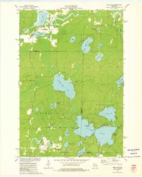
 1973 Post Lake1977 Print · USGSThe Wolf River corridor in the early 1970s reveals a landscape of interconnected lakes and protected fishery lands. Researchers can trace lakeside developments near Post Lake and locate specific features like Knoke Spring, Spider Creek Flowage, and the Wolf River State Fishery Area.2 unique versions available
 - 1973 Map of Kempster, 1977 Print
 1973 Kempster1977 Print · USGSLanglade County's lake country in the early seventies shows a transition from rail-dependent industry to Northwoods recreation. Genealogists and researchers can trace the Chicago and North Western line through Kempster and find landmarks like Bogus Swamp or the Bass Lake Country Club.
 - 1973 Map of Zoar, 1977 Print
 1973 Zoar1977 Print · USGSThe Menominee Indian Reservation and the settlement of Zoar are shown here in the early 1970s amidst a landscape of glacial lakes and northern forests. Researchers can trace the Old Railroad Grade and locate specific features like Chisel Springs and Lake Neconish.
Showing maps 1-25 of 28
Top cities of Langlade County
- Antigo historical maps
- Elcho historical maps
- Polar historical maps
- Neva historical maps
- Langlade historical maps
- White Lake historical maps
See more
Frequently asked questions
- What are the different types of historical maps available for Langlade County?
- What is the oldest map of Langlade County?
- Where can I purchase historical maps of Langlade County for my home or office?
- Where can I download high-res historical maps of Langlade County?
- Are there historical topographic maps available for Langlade County?
- Is there historical aerial imagery available for Langlade County?
- Where are historical maps of Langlade County sourced from?