Old Maps of Langlade County, Wisconsin for Hiking & Exploration
Hike through history with 188 historic maps of Langlade County. Explore old trails, ghost towns, and forgotten backroads — perfect for outdoor adventurers and local explorers.
- Rediscover forgotten places: Map out old mining camps, roads, and footpaths that no longer exist on modern maps.
- Layer with modern tools: Combine with LiDAR or satellite views to plan hikes through historical terrain.
- Made for exploration: Popular among hikers, overlanders, and local history lovers.
Use these maps to find adventure and explore the hidden past of Langlade County.
Langlade County, WI maps
(188)- 1899 Map of Wausau, 1956 Print
 1899 Wausau1956 Print · USGSMarathon County was a bustling timber and rail corridor at the turn of the century, anchored by the river power of Wausau and Merrill. Researchers can trace early logging lines like the Bull Dessert Logging R R and find vanished stops such as Dessert Junction and Nutterville.
 - 1902 Map of Wausau
 1902 Wausau1902 Print · USGSWisconsin’s timber and rail heartland is meticulously documented at the turn of the century as Wausau and Merrill expand along the river. Genealogists can trace early homesteads and rail stops like Schofield, Granite Heights, and the grounds of the State Insane Asylum.2 unique versions available
 - 1940 Map of Parrish
 1940 Parrish1940 Print · USGSUpper Wisconsin during the early 1940s is captured here at the edges of Three counties. Researchers can trace the Chicago and Northwestern rail line and locate the Enterprise settlement near Shingle Mill Lake before the full survey was completed.
 - 1942 Map of Elcho
 1942 Elcho1942 Print · USGSUpper Wisconsin’s lake country appears here in the early 1940s, showing a landscape of scattered rural schools and forest townships. Genealogists and researchers can trace local roots at the Enterprise Cem, St Johns Ch, or find family landmarks near Pelican Lake.
 - 1942 Map of Wabeno
 1942 Wabeno1942 Print · USGSForest County's timberlands are captured here in the early 1940s, when rail and river still drove the local economy. Researchers can locate vanished rural schools like Rummel Sch, several local cemeteries, and the site of an Abandoned CCC Camp near Otter Lake.
 - 1942 Map of Pearson
 1942 Pearson1942 Print · USGSNorthern Wisconsin lake country and timberlands are shown in the early 1940s as rail transit still defined the local economy. Genealogists and historians can trace rail stops like Jones Spur, the Woodlawn Sch, and the settlement at Mole Lake.
 - 1950 Map of Wabeno
 1950 Wabeno1950 Print · USGSThe Northwoods of Forest County are captured here at mid-century, where logging roots and lake country recreation meet. Genealogists and historians can locate rural schoolhouses like Rummel Sch, explore the Abandoned CCC Camp, or trace the old Logging RR routes.
 - 1950 Map of Elcho, 1952 Print
 1950 Elcho1952 Print · USGSLanglade and Oneida Counties come into focus during the early fifties, a time when the Chicago and North Western railway still connected these timber-rich lakeside communities. You can trace early township schools like Enterprise Sch, find the Pence Lake Lookout Tower, and locate vanished landmarks along the Old Railroad Grade.3 unique versions available
 - 1950 Map of Lily, 1952 Print
 1950 Lily1952 Print · USGSWisconsin’s northwoods are documented here at mid-century, showing the timber and rail landscape across Langlade and Forest Counties. Genealogists and historians can locate community sites like Pearson Cem, the Arbutus Sch, and the rail stop at Lily.3 unique versions available
 - 1950 Map of Parrish, 1956 Print
 1950 Parrish1956 Print · USGSLanglade and Lincoln Counties are shown in the early fifties as a landscape of timber-era relics and rural immigrant communities. Researchers can trace the Old Railroad Grade and locate cultural landmarks like the Estonian Ch or the Liberty Bell Sch.2 unique versions available
 - 1951 Map of Wabeno, 1953 Print
 1951 Wabeno1953 Print · USGSThe Northwoods of Forest and Oconto counties are shown in the early fifties as the timber and railway era transitioned into modern recreation. Researchers can locate the logging towns of Soperton and Wabeno, or trace rural life through the Windfall Sch and Forest Hill Cem.3 unique versions available
 - 1951 Map of Doering, 1954 Print
 1951 Doering1954 Print · USGSNorthwoods rural life is captured here in the early fifties across the intersection of Lincoln, Langlade, and Marathon counties. Genealogists can trace family footprints near Nutterville, Kalinke, and several country schools like Farrell Sch.2 unique versions available
 - 1952 Map of Parrish
 1952 Parrish1952 Print · USGSLanglade and Lincoln Counties are shown in the early fifties during a period of transition for Northwoods timber and farming communities. You can trace early ethnic heritage through the Estonian Ch, locate old logging routes like the old railroad grade, and find schools like Good Luck Sch.
 - 1952 Map of Antigo, 1954 Print
 1952 Antigo1954 Print · USGSAntigo and its surrounding townships are shown in detail during the early fifties, capturing a moment of transition for northern Wisconsin's rural school districts. Genealogists can locate family landmarks like the Bohemian Cem, St Johns Ch, and many local schools from Deerbrook to Mattoon.2 unique versions available
 - 1952 Map of White Lake, 1955 Print
 1952 White Lake1955 Print · USGSUpper Wisconsin timberlands and tribal lands meet in the early fifties, showing a region defined by forestry and the Wolf River. You can trace the Chicago and North Western rail line through rural outposts like Sherry Junction, Elton, and Hollister.2 unique versions available
 - 1952 Map of Langlade, 1955 Print
 1952 Langlade1955 Print · USGSThe Menominee Indian Reservation and Nicolet National Forest meet in this mid-century survey of northern Wisconsin. Trace local history through the Markton PO, the Gardner Dam Boy Scout Camps, and fire-watch sites like the Boulder Lake Lookout Tower.2 unique versions available
 - 1954 Map of Iron Mountain, 1964 Print
 1954 Iron Mountain1964 Print · USGSUpper Michigan and Northeastern Wisconsin are shown in detail during the mid-fifties, when the logging and mining economies still moved by rail. Trace the rail lines of the Soo Line to remote stops like Koepenick Station or explore the Iron Range near Iron Mountain.2 unique versions available
 - 1959 Map of Iron Mountain
 1959 Iron Mountain1959 Print · USGSThe northwoods of Wisconsin and the Michigan border are captured here in the mid-fifties, showing a landscape defined by timber, water, and rail. Researchers can trace historic junctions like Hiles Junction, the expansive Nicolet National Forest, and lakefront settlements from Rhinelander to Tomahawk.2 unique versions available
 - 1972 Map of Wabeno, 1975 Print
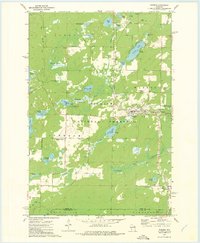 1972 Wabeno1975 Print · USGSForest County in the early 1970s is characterized by the timber-belt communities of Wabeno and Soperton within the Nicolet National Forest. Genealogists and historians can trace rail-side developments, numerous lakefronts, and several local cemeteries like St Ambrose Cem and Roseland Cem.
 - 1972 Map of Reservoir Pond, 1975 Print
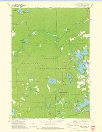 1972 Reservoir Pond1975 Print · USGSWisconsin's north woods in the early 1970s appear as a dense network of glacial lakes and springs along the Oconto River. Outdoorsmen and historians can trace the Railroad Grade or locate the Ada Lake Lookout Tower and the Jones Spring Impoundment.2 unique versions available
 - 1973 Map of Roberts Lake, 1976 Print
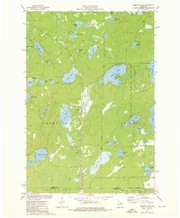 1973 Roberts Lake1976 Print · USGSNorthern Forest County in the early seventies reveals a landscape defined by glacial lakes and the timber-hauling lines of the Soo Line. Genealogists and historians can trace small crossroads like Woodlawn and Freedom Corners tucked between Roberts Lake and the Bog Brook State Wildlife Area.2 unique versions available
 - 1973 Map of Antigo, 1976 Print
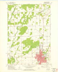 1973 Antigo1976 Print · USGSAntigo and the surrounding Langlade County countryside are captured in the early 1970s, as the city expanded around its river branches and rail corridors. Researchers can find numerous parochial schools and cemeteries, including St Hyacinths Sch and Bohemian Cem, alongside small rural hubs like Deerbrook.2 unique versions available
 - 1973 Map of Gleason, 1976 Print
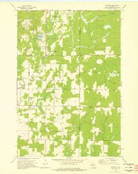 1973 Gleason1976 Print · USGSLincoln County's rural townships are captured in the early 1970s, showing a landscape defined by the Prairie River and historic immigrant settlements. Researchers can locate the Estonian Cem, Latvian Cem, and follow the Old Railroad Grade through the Northwoods.2 unique versions available
 - 1973 Map of Kalinke, 1976 Print
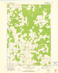 1973 Kalinke1976 Print · USGSIn the early 1970s, the rural crossroads of Marathon County supported a quiet network of family farms and river-fed wetlands. Genealogists and local historians can locate early institutions like Zion Ch, Trinity Cem, and the Hewitt Texas Sch.
 - 1973 Map of Bavaria, 1976 Print
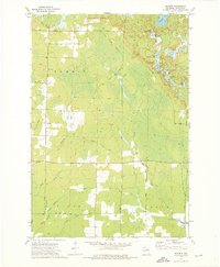 1973 Bavaria1976 Print · USGSNorthern Wisconsin's timber and rail history is etched into this 1970s landscape near Bavaria and Ormsby. Researchers can trace the extensive OLD RAILROAD GRADE and find local landmarks like the Town Cem or the waters of Bullhead Lake.2 unique versions available
Showing maps 1-25 of 188
Top cities of Langlade County
- Antigo historical maps
- Elcho historical maps
- Polar historical maps
- Neva historical maps
- Langlade historical maps
- White Lake historical maps
See more
Frequently asked questions
- What are the different types of historical maps available for Langlade County?
- What is the oldest map of Langlade County?
- Where can I purchase historical maps of Langlade County for my home or office?
- Where can I download high-res historical maps of Langlade County?
- Are there historical topographic maps available for Langlade County?
- Is there historical aerial imagery available for Langlade County?
- Where are historical maps of Langlade County sourced from?