2020s Maps of Three Lakes, Wisconsin
Explore 6 historic maps of Three Lakes from the 2020s. These maps offer a rare glimpse into what life looked like during the 2020s — showing old roads, neighborhoods, homes, and landmarks that have changed or disappeared over time.
Whether you're researching your family's past, planning a metal detecting trip, or studying how Three Lakes's landscape evolved across the 2020s, these high-resolution maps are a powerful tool for exploring the history of this region.
- Focus on a specific era: All maps on this page are from the 2020s, giving you a focused view of this time period.
- See what’s changed: Compare century-old streets, trails, and buildings to today's modern landscape using overlays and satellite layers.
- Research with precision: Use these maps for genealogy, historical research, land use analysis, or educational projects.
- View, download, or print: Maps are fully viewable online in high resolution, and can be downloaded or printed for your own records.
Start exploring Three Lakes's history through authentic maps from the 2020s. This is your window into the past.
Three Lakes, WI maps
(6)- 2022 Map of Monico NE, 2022 Print
 2022 Monico NE2022 Print · USGSNorthern Wisconsin lake country and the border of the Nicolet National Forest are documented in this recent survey. Researchers can trace the settlement of Atkins or locate family landmarks like Nelson's Landing and Atkins Lake.
 - 2022 Map of Anvil Lake, 2022 Print
 2022 Anvil Lake2022 Print · USGSVilas and Forest Counties are shown in the 2020s as a dense wilderness of protected timber and glacial waters. Trace historic routes and lake access via the Military Trl, Kentuck Lake, and the expansive Nicolet National Forest.
 - 2022 Map of Eagle River East, 2022 Print
 2022 Eagle River East2022 Print · USGSEagle River and the surrounding glacial lake chain are documented in the early twenty-first century, showcasing a landscape defined by water and woods. Researchers can trace local landmarks like the Vilas County Courthouse and Saint Peters Catholic Cem alongside Eagle Lake.
 - 2022 Map of Starks, 2022 Print
 2022 Starks2022 Print · USGSOneida County's Northwoods landscape is captured here in the early twenty-first century, showing a region defined by its glacial lakes and rural outposts. Researchers can locate small settlements like Starks and Gagen while tracing the waters of Stella Lake, Ginty Lake, and Starks Spring.
 - 2022 Map of Julia Lake, 2022 Print
 2022 Julia Lake2022 Print · USGSOneida County's lake-studded landscape is captured here in the early 2020s, showcasing the extensive water systems of the Nicolet National Forest. Trace family-named roads and remote shorelines around Big Stone Lake, Whitefish Lake, and the Three Lakes Municipal Airport.
 - 2022 Map of Three Lakes, 2022 Print
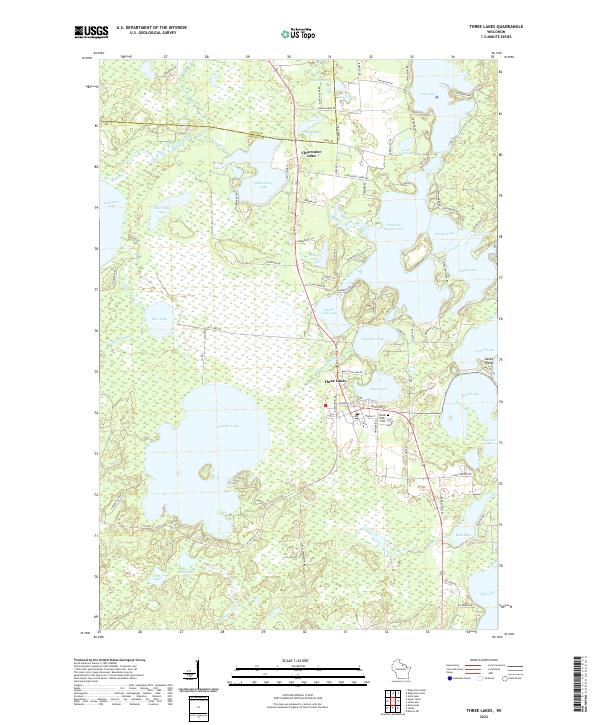 2022 Three Lakes2022 Print · USGSThe Wisconsin Northwoods around Three Lakes are captured here in high detail, showing the complex chain of lakes that defines the region. Researchers can locate family landmarks near Clearwater Lake, Three Lakes Cem, and the shores of Thunder Lake.
End of results
Showing maps 1-6 of 6
Top cities near Three Lakes
- Crandon historical maps
- Sugar Camp historical maps
- Washington historical maps
- Eagle River historical maps
- Phelps historical maps
- Conover historical maps
See more
Top neighborhoods of Three Lakes
Frequently asked questions
- What are the different types of historical maps available for Three Lakes?
- What is the oldest map of Three Lakes?
- Where can I purchase historical maps of Three Lakes for my home or office?
- Where can I download high-res historical maps of Three Lakes?
- Are there historical topographic maps available for Three Lakes?
- Is there historical aerial imagery available for Three Lakes?
- Where are historical maps of Three Lakes sourced from?