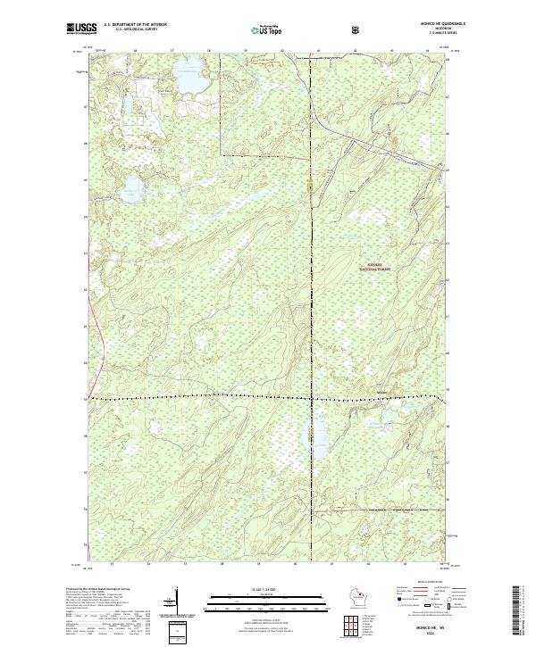
2022 Map of Monico NE
USGS Topo · Published 2022About this map
Nicolet National Forest dominates this landscape on the border of Oneida and Forest counties, where the Eagle River meanders through dense woodlands and expansive wetlands. The settlement of Atkins is situated in the southeastern corner, serving as a focal point in a territory defined by its water systems and seasonal trails. This 2022 survey captures a transition in land use, showing how the historic timberlands are now interlaced with recreational infrastructure like the Forest Co Snowmobile Trl and Snowmobile Trail Lkin Forest Trl.
Find a feature on this map
29 named features on this map. Tap any name to fly to it.
Don’t see what you’re looking for? This feature index may not catch every label — zoom into the map to look around manually.
Map Details
Editions of this 2022 Monico NE Map
This is the sole edition of this map. No revisions or reprints were ever made.
Other maps of this area

1928 · Three Lakes
USGS Topo · 1:48,000

1938 · Alvin
USGS Topo · 1:48,000

1938 · Three Lakes
USGS Topo · 1:48,000

1939 · Crandon
USGS Topo · 1:48,000

1940 · Monico
USGS Topo · 1:48,000

1941 · Crandon
USGS Topo · 1:48,000

1945 · Three Lakes
USGS Topo · 1:48,000

1946 · Alvin
USGS Topo · 1:48,000

1947 · Crandon
USGS Topo · 1:48,000

1950 · Monico
USGS Topo · 1:48,000