1960s Maps of Waupaca County, Wisconsin
Explore 22 historic maps of Waupaca County from the 1960s. These maps offer a rare glimpse into what life looked like during the 1960s — showing old roads, neighborhoods, homes, and landmarks that have changed or disappeared over time.
Whether you're researching your family's past, planning a metal detecting trip, or studying how Waupaca County's landscape evolved across the 1960s, these high-resolution maps are a powerful tool for exploring the history of this region.
- Focus on a specific era: All maps on this page are from the 1960s, giving you a focused view of this time period.
- See what’s changed: Compare century-old streets, trails, and buildings to today's modern landscape using overlays and satellite layers.
- Research with precision: Use these maps for genealogy, historical research, land use analysis, or educational projects.
- View, download, or print: Maps are fully viewable online in high resolution, and can be downloaded or printed for your own records.
Start exploring Waupaca County's history through authentic maps from the 1960s. This is your window into the past.
Waupaca County, WI maps
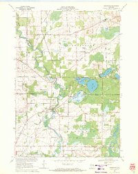
(22)- 1961 Map of Poy Sippi, 1963 Print
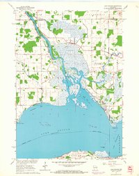
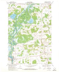
 1961 Poy Sippi1963 Print · USGSThe Lake Poygan region of Wisconsin comes alive in this early 1960s survey, showing the intricate river-and-marsh economy before modern expansion. Researchers can trace family sites at Fountain Valley Sch & Ch, the Welsh Cem, or follow the banks of the Poy Sippi River through historic lakefront settlements like Tustin.2 unique versions available
 - 1961 Map of Redgranite, 1963 Print
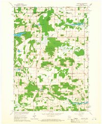
 1961 Redgranite1963 Print · USGSWaushara County’s kettle lake country is captured here in the early sixties, showing a landscape shaped by stone quarries and summer camps. Researchers can trace the Chicago and North Western rail line and find local landmarks like St Marks Cem and the Wild Rose State Fish Hatchery.2 unique versions available
 - 1961 Map of Oshkosh, 1963 Print
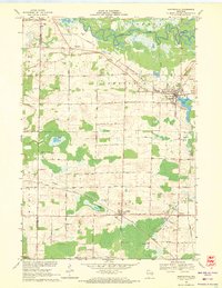
 1961 Oshkosh1963 Print · USGSThe Fox River Valley in the early sixties showcases the expansion of Oshkosh and its lakefront settlements. Genealogists and historians can trace family roots through local sites like Calvary Cem, St Peters Cem, and the Winnebago State Hospital grounds.2 unique versions available
 - 1961 Map of Saxeville, 1966 Print
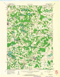
 1961 Saxeville1966 Print · USGSThe rural town of Saxeville and the surrounding Waushara County countryside are captured here in the early sixties. Genealogists and researchers can trace family roots at Cedar Cem or Hilltop Cem, and locate landmarks like the Wild Rose Sch and Emaus Ch.2 unique versions available
 - 1961 Map of Wild Rose, 1966 Print
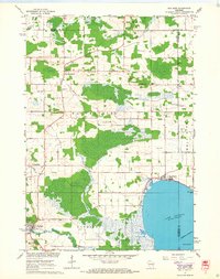
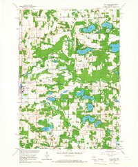 1961 Wild Rose1966 Print · USGSThe village of Wild Rose and its lake-strewn surroundings are captured here in the early sixties before modern development reshaped the landscape. Researchers can locate family landmarks such as Springwater Cem, the Wild Rose State Fish Hatchery, and numerous summer camps like Camp Windego.2 unique versions available
 - 1961 Map of Lake Poygan, 1966 Print
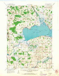
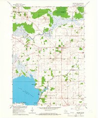
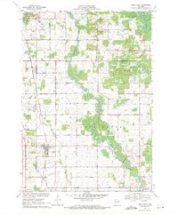
 1961 Lake Poygan1966 Print · USGSWinnebago County river life is centered on the Wolf River delta during the early sixties. Genealogists can trace family roots through numerous country landmarks including St Pauls Cem, Becker Cem, and the village of Zittau.2 unique versions available
 - 1961 Map of Oshkosh NW, 1966 Print
 1961 Oshkosh NW1966 Print · USGSWinnebago County in the early sixties shows a landscape of river marshes and small farming hamlets centered around Winchester and Larsen. Genealogists and local historians can locate early family burials at Royer Cem and Bell Cem or trace the rural school districts at Mathison Sch.2 unique versions available
 - 1961 Map of Poy Sippi, 1968 Print
 1961 Poy Sippi1968 Print · USGSThe marshlands and crossroads of Waushara County are captured here in the early 1960s as they meet the shores of Lake Poygan. Researchers can locate historic rural centers like Poy Sippi and Tustin, alongside parish sites like Emmaus Ch and St Johns Sch.2 unique versions available
 - 1969 Map of New London, 1971 Print
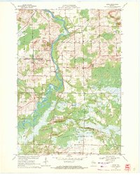
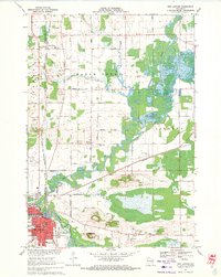 1969 New London1971 Print · USGSNew London and the surrounding river valleys are captured here in the late sixties, showcasing a landscape defined by the convergence of rail and water. Researchers can locate family landmarks such as Wayside Cem, Emanuel Ch, and the old Washington Jr High Sch.
 - 1969 Map of Readfield, 1971 Print
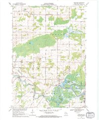
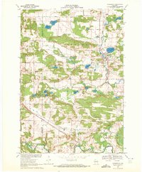
 1969 Readfield1971 Print · USGSWaupaca County in the late sixties shows a landscape shaped by the shifting currents of the Wolf River and the transit lines of the Soo Line. Genealogists and local historians can trace family locations near Readfield, Shaw Landing, and the Pioneer Cem.3 unique versions available
 - 1969 Map of Hortonville, 1971 Print
 1969 Hortonville1971 Print · USGSOutagamie County during the late sixties shows a landscape of steady agricultural life and vital rail connections. Researchers can locate family landmarks like SS Peter and Paul Cem and trace the paths of the Soo Line through Medina.2 unique versions available
 - 1969 Map of Northport, 1971 Print
 1969 Northport1971 Print · USGSWaupaca County's river valleys and rural townships are captured here in the late sixties as the river-and-rail economy persisted. Genealogists and local historians can trace family-named landmarks and essential community sites like Fitzgerald Corners, St Patrick Cem, and the Maple Hill Sch.
 - 1969 Map of Leeman, 1971 Print
 1969 Leeman1971 Print · USGSOutagamie and Shawano counties are captured here in the late sixties, where the winding Wolf River meets vast conservation lands. Researchers can locate family landmarks along Eskman Road, the St Lawrence Cem, and the old Navarino Sch.
 - 1969 Map of Embarrass, 1971 Print
 1969 Embarrass1971 Print · USGSWisconsin's river-and-lake country comes alive in the late sixties as the Embarrass River winds past small farming communities and lakeside retreats. Trace local history at St Peter Cem, the village of Embarrass, and the shoreline developments of Adams Beach.2 unique versions available
 - 1969 Map of Lunds, 1971 Print
 1969 Lunds1971 Print · USGSWisconsin's river-fed wetlands and rural townships are captured here in the late sixties as the Wolf River snakes through the Navarino Wildlife Area. Local historians can trace family roots at Hilda Cem or locate community centers like St Wenceslaus Ch and the settlement of Lunds.
 - 1969 Map of Bear Creek, 1971 Print
 1969 Bear Creek1971 Print · USGSWaupaca and Outagamie Counties in the late sixties were defined by the winding Embarrass River and the rural rail corridor. Genealogists and local historians can trace the town centers of Clintonville and Bear Creek, find rural burial sites like Danish Cem, and locate the Chicago and North Western tracks.
 - 1969 Map of Manawa, 1971 Print
 1969 Manawa1971 Print · USGSWaupaca County's rural heartland is captured here in the late sixties as the river-and-rail economy defined local life. Researchers can trace family-named roads and find quiet landmarks like St John Ch, Baldwins Mill Cem, and Green Valley Sch.2 unique versions available
 - 1969 Map of Weyauwega, 1971 Print
 1969 Weyauwega1971 Print · USGSWeyauwega and the surrounding Waupaca County countryside are captured here in the late sixties as the river-and-rail economy remained central to the region. Researchers can trace family-named sites like Butternut Ridge, find local landmarks like the Waupaca County Fairground, and locate cemeteries including Oakwood Cemetery and Hobart Cem.2 unique versions available
 - 1969 Map of Waupaca, 1972 Print
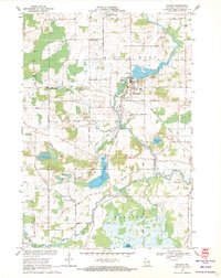
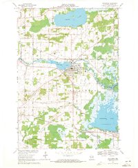
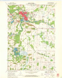 1969 Waupaca1972 Print · USGSWaupaca and its surrounding townships are captured in the late sixties as the area balanced its river-based industry with growing recreational lakefronts. Genealogists and local researchers can locate St Mary Magdalene Cem, the settlement of Little Hope, and the path of the Soo Line railroad.
 - 1969 Map of King, 1972 Print
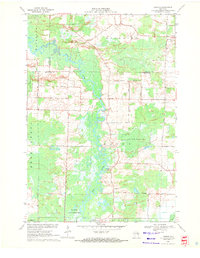
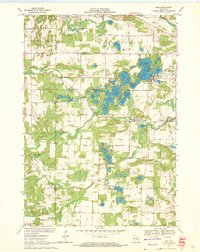 1969 King1972 Print · USGSWaupaca County lake country is captured here in the late sixties, showing the intricate chain of lakes around the community of King. Genealogists and local historians can trace rural roots through Badger Ch, Barton Sch, and the Pleasant Valley Cem.2 unique versions available
 - 1969 Map of Ogdensburg, 1972 Print
 1969 Ogdensburg1972 Print · USGSOgdensburg and the surrounding Waupaca County countryside are captured here in the late sixties, showcasing a landscape of glacial lakes and rural industry. Genealogists and local historians can locate the Ogdensburg Cemetery, trace the Green Bay and Western railroad, and identify early extractive sites like the Quarry.
 - 1969 Map of Scandinavia, 1972 Print
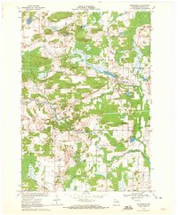
 1969 Scandinavia1972 Print · USGSScandinavia and its surrounding glacial lake country are captured in the late sixties as the village remained a rail-and-river hub. Genealogists can locate family-named sites like Bestul and Petersen alongside historical grounds at Salem Cem and Farmington Cem.2 unique versions available
End of results
Showing maps 1-22 of 22
Top cities of Waupaca County
- Waupaca historical maps
- Clintonville historical maps
- Weyauwega historical maps
- Manawa historical maps
- Marion historical maps
- Iola historical maps
See more
Frequently asked questions
- What are the different types of historical maps available for Waupaca County?
- What is the oldest map of Waupaca County?
- Where can I purchase historical maps of Waupaca County for my home or office?
- Where can I download high-res historical maps of Waupaca County?
- Are there historical topographic maps available for Waupaca County?
- Is there historical aerial imagery available for Waupaca County?
- Where are historical maps of Waupaca County sourced from?