2000s (21st Century) Maps of Lind, Wisconsin
Explore 4 historic maps of Lind from the 2000s (21st Century). These maps offer a rare glimpse into what life looked like during the 2000s — showing old roads, neighborhoods, homes, and landmarks that have changed or disappeared over time.
Whether you're researching your family's past, planning a metal detecting trip, or studying how Lind's landscape evolved across the 2000s, these high-resolution maps are a powerful tool for exploring the history of this region.
- Focus on a specific era: All maps on this page are from the 2000s, giving you a focused view of this time period.
- See what’s changed: Compare century-old streets, trails, and buildings to today's modern landscape using overlays and satellite layers.
- Research with precision: Use these maps for genealogy, historical research, land use analysis, or educational projects.
- View, download, or print: Maps are fully viewable online in high resolution, and can be downloaded or printed for your own records.
Start exploring Lind's history through authentic maps from the 2000s. This is your window into the past.
Lind, WI maps
(4)- 2022 Map of Poy Sippi, 2022 Print
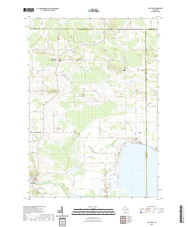 2022 Poy Sippi2022 Print · USGSPoy Sippi and the northern shores of Lake Poygan appear here in a landscape of small hamlets and winding waterways. Genealogists can trace family sites at Old German Lutheran Cem and Prellwitz Cem or explore the old settlements of Metz and Tustin.
 - 2022 Map of Weyauwega, 2022 Print
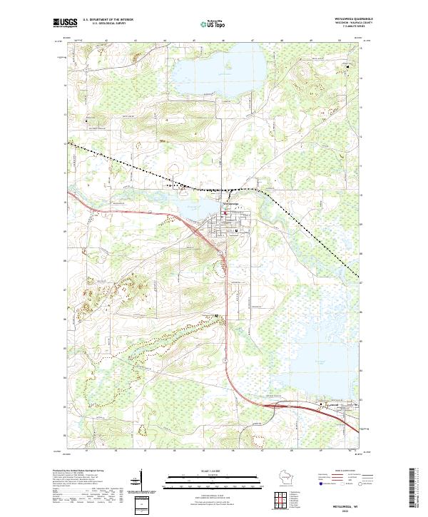 2022 Weyauwega2022 Print · USGSWeyauwega and the surrounding Waupaca County wetlands are captured here in the early twenty-first century as the river-and-lake system continues to shape the local geography. Researchers can trace family sites at Oakwood Cem or follow the water from White Lake down to Partridge Lake.
 - 2022 Map of Waupaca, 2022 Print
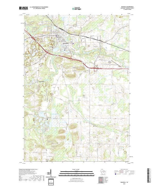 2022 Waupaca2022 Print · USGSWaupaca and its surrounding glacial lakes are shown here in the early twenty-first century as a well-developed regional center. Genealogists and historians can trace local family landmarks through Saint Mary Magdalene Cem, Lind Center Cem, and the prominent Waupaca County Courthouse.
 - 2022 Map of Saxeville, 2022 Print
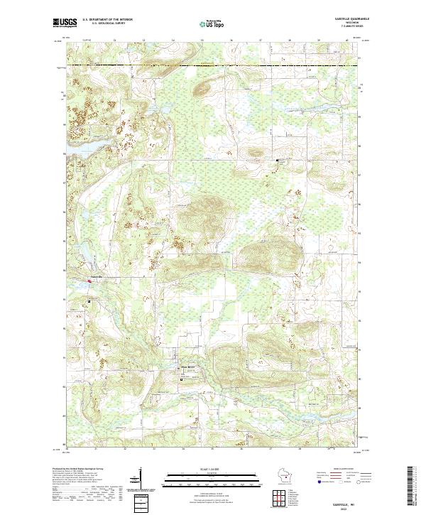 2022 Saxeville2022 Print · USGSSaxeville and Pine River anchor this central Wisconsin landscape during the early twenty-first century. Genealogists and local researchers can locate family burial sites at Hilltop Cem or Pine River Cem and trace the waterways of Hatton Creek and Mill Pond.
End of results
Showing maps 1-4 of 4
Top cities near Lind
- Waupaca historical maps
- Wautoma historical maps
- Redgranite historical maps
- Weyauwega historical maps
- Manawa historical maps
- Iola historical maps
See more
Frequently asked questions
- What are the different types of historical maps available for Lind?
- What is the oldest map of Lind?
- Where can I purchase historical maps of Lind for my home or office?
- Where can I download high-res historical maps of Lind?
- Are there historical topographic maps available for Lind?
- Is there historical aerial imagery available for Lind?
- Where are historical maps of Lind sourced from?