2020s Maps of Crook County, Wyoming
Explore 67 historic maps of Crook County from the 2020s. These maps offer a rare glimpse into what life looked like during the 2020s — showing old roads, neighborhoods, homes, and landmarks that have changed or disappeared over time.
Whether you're researching your family's past, planning a metal detecting trip, or studying how Crook County's landscape evolved across the 2020s, these high-resolution maps are a powerful tool for exploring the history of this region.
- Focus on a specific era: All maps on this page are from the 2020s, giving you a focused view of this time period.
- See what’s changed: Compare century-old streets, trails, and buildings to today's modern landscape using overlays and satellite layers.
- Research with precision: Use these maps for genealogy, historical research, land use analysis, or educational projects.
- View, download, or print: Maps are fully viewable online in high resolution, and can be downloaded or printed for your own records.
Start exploring Crook County's history through authentic maps from the 2020s. This is your window into the past.
Crook County, WY maps
(67)- 2020 Map of Stack Rocks, 2020 Print
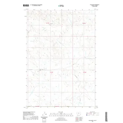 2020 Stack Rocks2020 Print · USGSCovers Crook County, including Carter County, United States, and other nearby areas
 - 2020 Map of Belle Creek South, 2020 Print
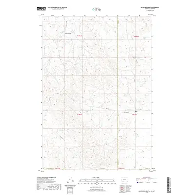 2020 Belle Creek South2020 Print · USGSCovers Crook County, including Ridge, Powder River County, and other nearby areas
 - 2021 Map of Middle Creek Butte, 2021 Print
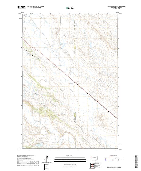 2021 Middle Creek Butte2021 Print · USGSThe high plains along the Wyoming and South Dakota border are shown here in the early twenty-first century. Researchers can trace industrial activity and water management across the state line via Bentonite Haul Rd and Oak Creek Reservoir.
 - 2021 Map of Old Baldy Mountain, 2021 Print
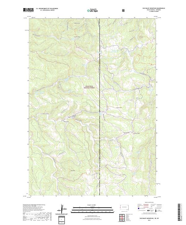 2021 Old Baldy Mountain2021 Print · USGSThe Black Hills high country on the South Dakota and Wyoming border is captured here in modern detail. Researchers can locate critical water sources like Lone Grave Spring and Balm of Gilead Spring or trace the canyons around Old Baldy Mtn.
 - 2021 Map of Tinton, 2021 Print
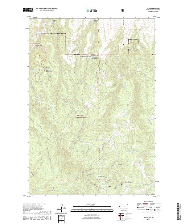 2021 Tinton2021 Print · USGSThe Black Hills highlands along the South Dakota and Wyoming border come into focus in this contemporary survey of the area around the old mining camp of Tinton. Researchers can trace local history through features like the Bear Gulch Cem, The Needles, and Beartown Hill.
 - 2021 Map of Slaughter Reservoir, 2021 Print
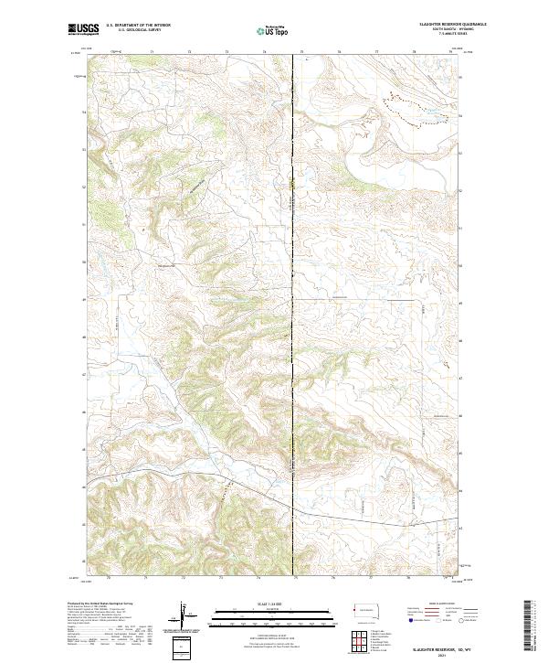 2021 Slaughter Reservoir2021 Print · USGSThe South Dakota and Wyoming border comes alive in the early 2020s, showing a landscape of high-plains ranching and complex watersheds. Researchers can trace the drainages of Hay Cr or locate rural landmarks like Norgrain Hill and the Slaughter Reservoir.
 - 2021 Map of Garland Hill, 2021 Print
 2021 Garland Hill2021 Print · USGSCrook County ranching country appears in high detail in the early 2020s, showcasing the intricate drainage systems of the high plains. Trace the path of the Little Missouri River and find landmarks like Garland Hill and Sand Spring.
 - 2021 Map of Moulton Creek, 2021 Print
 2021 Moulton Creek2021 Print · USGSCrook County at the Montana border is defined by its winding prairie drainages and cattle country at the turn of the twenty-first century. Researchers can trace the courses of N Fork Little Missouri River and find Thompson Creek Oilfield Airport near Signal Hill.
 - 2021 Map of Carlile, 2021 Print
 2021 Carlile2021 Print · USGSCrook County at the start of the 2020s shows a landscape of high-country divides and the northern waters of Keyhole Reservoir. Genealogists and researchers can trace local landforms and access roads such as Carlile, Thorn Divide, and Oil Butte.
 - 2021 Map of Iron Mountain, 2021 Print
 2021 Iron Mountain2021 Print · USGSCrook County's high divide country comes into focus in this recent survey of the Black Hills' western foothills. Genealogists and local historians can trace the paths of the Old Sundance Hwy and the terrain around Iron Mtn and Pine Ridge.
 - 2021 Map of Cedar Ridge, 2021 Print
 2021 Cedar Ridge2021 Print · USGSNortheastern Wyoming ranching country is shown here in the 2020s, defined by the winding course of the Little Missouri River. Researchers can trace old family land ties along Carrie Nation Cr, Driscoll Cr, and the namesake Cedar Ridge.
 - 2021 Map of Grasshopper Butte, 2021 Print
 2021 Grasshopper Butte2021 Print · USGSCrook County at the start of the 2020s shows the development of recreation and transport hubs near the Keyhole Reservoir shoreline. Researchers can trace local landmarks like Pine Haven Cem, the residential growth at Lower Pine Ridge, and prominent heights such as Grasshopper Butte.
 - 2021 Map of Rozet SE, 2021 Print
 2021 Rozet SE2021 Print · USGSThe borderlands of Crook and Campbell counties are captured here in 2021, showcasing a landscape of ranch roads and seasonal draws. Genealogists and researchers can trace local landmarks like Pleasant Valley Cem and Kaehne Ranch RD.
 - 2021 Map of Missouri Buttes, 2021 Print
 2021 Missouri Buttes2021 Print · USGSCrook County at the start of the 2020s remains a landscape of high ridges and critical water management. Researchers can locate family landmarks and topographic features like Missouri Buttes, Cedar Hill, and the Basin Reservoir Number One.
 - 2021 Map of Bonnie Reservoir, 2021 Print
 2021 Bonnie Reservoir2021 Print · USGSCrook County at the edge of the grasslands is documented here in the early twenty-first century. Researchers can trace land management patterns across Thunder Basin National Grassland and find local water sources like Bonnie Reservoir and Edgerton Reservoir.
 - 2021 Map of Edith Creek, 2021 Print
 2021 Edith Creek2021 Print · USGSCrook County ranch lands and historical cattle corridors are documented here in the early twenty-first century. Researchers can trace the path of the Texas Trl as it winds past Hanaway Draw and the headwaters of Edith Creek.
 - 2021 Map of Devils Tower, 2021 Print
 2021 Devils Tower2021 Print · USGSCrook County, Wyoming, is captured here in the early twenty-first century as a landscape defined by the iconic Devils Tower monolith. Researchers can trace local landmarks like the Tower Divide Cem, the settlement at Carlile Junction, and the winding Belle Fourche River.
 - 2021 Map of Storm Draw, 2021 Print
 2021 Storm Draw2021 Print · USGSCrook County, Wyoming, is captured in this modern survey of the High Plains as energy infrastructure meets the drainage of the Missouri River. Trace the remote Thompson Creek Oilfield Airport and the complex channels of Storm Draw and School Section Draw.
 - 2021 Map of Linden, 2021 Print
 2021 Linden2021 Print · USGSCrook County in the modern era remains a landscape of high ridges and named watersheds where ranching roots run deep. Genealogists and historians can trace old travel routes like Old Sundance Rd and find family-named landmarks including Nefsy Divide and Norris Divide.
 - 2021 Map of Antelope Gulch, 2021 Print
 2021 Antelope Gulch2021 Print · USGSCrossing the border between Wyoming and Montana, this contemporary survey captures a sparsely populated landscape shaped by resource extraction and cattle ranching. Researchers can trace the industrial routes of the Bentonite Haul Rd and find water landmarks like the T J Maupin Number 1 Reservoir.
 - 2021 Map of Rozet NE, 2021 Print
 2021 Rozet NE2021 Print · USGSNortheast Wyoming ranching country is shown here in the early twenty-first century, spanning the border of Campbell and Crook Counties. Researchers can trace the rugged topography of the Mitchell Creek Breaks and follow remote routes like Grey Dillinger Rd.
 - 2021 Map of Strawberry Hill, 2021 Print
 2021 Strawberry Hill2021 Print · USGSCrook County ranching lands and high-plains topography are documented here in the early twenty-first century. Researchers can trace land boundaries across Goldie Divide or locate water features like Foster Reservoir and Elkhorn Cr.
 - 2021 Map of Sugarloaf Mountain, 2021 Print
 2021 Sugarloaf Mountain2021 Print · USGSThe Bear Lodge Mountains in Crook County are shown in great detail during the early 2020s, highlighting the area's timbered peaks and vital water sources. Researchers can trace forest access via Truck Trail 1282 Trl and locate remote points like Hemler Reservoir and Dean Spring.
 - 2021 Map of Sheldon Creek, 2021 Print
 2021 Sheldon Creek2021 Print · USGSCrook County and the surrounding grasslands are captured here in the early twenty-first century. Researchers can locate Greenwood Cem and trace livestock water sources like Jeff Davis Reservoir and Inyan Kara Cr.
 - 2021 Map of New Haven, 2021 Print
 2021 New Haven2021 Print · USGSCrook County at the start of the 2020s remains a landscape of ranching roads and deeply etched draws. Researchers can locate the New Haven Cem and trace the winding paths of Music Cr through Sawmill Gulch toward Butte Divide.
Showing maps 1-25 of 67
Top cities of Crook County
- Sundance historical maps
- Moorcroft historical maps
- Pine Haven historical maps
- Hulett historical maps
- Beulah historical maps
Frequently asked questions
- What are the different types of historical maps available for Crook County?
- What is the oldest map of Crook County?
- Where can I purchase historical maps of Crook County for my home or office?
- Where can I download high-res historical maps of Crook County?
- Are there historical topographic maps available for Crook County?
- Is there historical aerial imagery available for Crook County?
- Where are historical maps of Crook County sourced from?