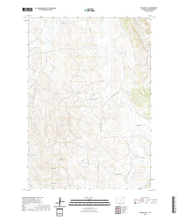
2021 Map of Garland Hill
USGS Topo · Published 2021About this map
The Little Missouri River meanders through this portion of Crook County, carving a landscape defined by an intricate network of drainage draws and isolated uplands. Centrally located, Garland Hill rises above the surrounding terrain, flanked by the Edsel Hills to the southwest. This area is characterized by its intermittent water sources, such as Sand Spring and Cottonwood Spring, which were vital for livestock and early ranching operations in this arid environment. The map captures a complex system of named topographic depressions, including Alkali Draw, Gumbo Draw, and Garland Draw, illustrating the erosional patterns common in the northeastern Wyoming plains. Rural connectivity is maintained via the New Haven-Oshoto Co Rd, which traverses the high ground between the river basin and the various creek drainages like Corral Cr and Cracker Cr.
Find a feature on this map
25 named features on this map. Tap any name to fly to it.
Don’t see what you’re looking for? This feature index may not catch every label — zoom into the map to look around manually.
Map Details
Editions of this 2021 Garland Hill Map
This is the sole edition of this map. No revisions or reprints were ever made.
Other maps of this area

1905 · Devils Tower
USGS Topo · 1:125,000

1954 · Missouri Buttes
USGS Topo · 1:24,000

1954 · Gillette
USGS Topo · 1:250,000

1955 · Gillette
USGS Topo · 1:250,000

1957 · Oshoto
USGS Topo · 1:62,500

1957 · Cedar Ridge
USGS Topo · 1:62,500

1958 · Gillette
USGS Topo · 1:250,000

1962 · Gillette
USGS Topo · 1:250,000
1972 · Bonnie Reservoir
USGS Topo · 1:24,000
1972 · Brislawn School
USGS Topo · 1:24,000