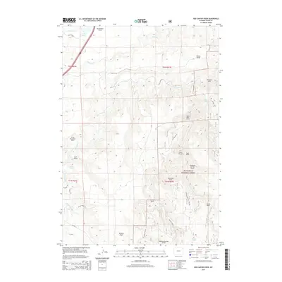
2015 Map of Red Canyon Creek
USGS Topo · Published 2015About this map
Black Hills National Forest land dominates this northeastern Wyoming landscape, where the high ridges of Williams Divide and Riflepit Divide carve through the terrain. The map captures a complex hydrological network defined by the Rocky Ford Reservoir and numerous named water sources like Sundance Cr, S Redwater Cr, and Red Canyon Cr. To the north, Government Valley provides a break in the elevation, while a series of deep draws and gulches, including Idol Gulch, Thompson Gulch, and Manhattan Gulch, reveal the erosional patterns characteristic of the Black Hills uplift. Local access is traced through a system of rural roads and forest routes such as Rifle Pit Rd, Moskee Rd, and Sand Creek Rd. For those researching local geography, the map identifies specific watering points like Cranberry Spring, Quail Spring, and Hamilton Spring that have long served as vital landmarks in this arid high-country environment.
Find a feature on this map
42 named features on this map. Tap any name to fly to it.
Don’t see what you’re looking for? This feature index may not catch every label — zoom into the map to look around manually.
Map Details
Editions of this 2015 Red Canyon Creek Map
This is the sole edition of this map. No revisions or reprints were ever made.
Other maps of this area

1898 · Sundance
USGS Topo · 1:125,000

1901 · Aladdin
USGS Topo · 1:125,000

1902 · Sundance
USGS Topo · 1:125,000

1903 · Aladdin
USGS Topo · 1:125,000

1954 · Gillette
USGS Topo · 1:250,000

1955 · Gillette
USGS Topo · 1:250,000

1958 · Gillette
USGS Topo · 1:250,000

1958 · Beulah
USGS Topo · 1:62,500

1958 · Tinton
USGS Topo · 1:62,500

1958 · Sundance
USGS Topo · 1:62,500