1958 Map of Sundance
USGS Topo · Published 1960About this map
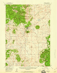
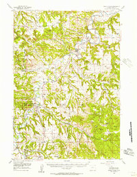
Sundance anchors this landscape within the Black Hills National Forest, situated at the foot of the distinctive Sundance Mountain. The 1958 field data highlights a region transitioning from its frontier roots toward mid-century infrastructure, evidenced by the proximity of the Historical Monument (Custer Expedition) to modern developments like a sewage disposal plant and various airstrips. Significant local history sites are scattered across the terrain, including the Mt Moriah Cem and the remote Houston Creek Sch. To the south, the Methodist Ch (in Wyo) is noted as a historical monument for being the site of the first rural Methodist church in Wyoming. The terrain is a mix of high peaks like O'Haver Peak and broad flats such as Beaver Flats, where the local economy is punctuated by the Buck Mine and several gravel pits.
Find a feature on this map
91 named features on this map. Tap any name to fly to it.
Don’t see what you’re looking for? This feature index may not catch every label — zoom into the map to look around manually.
Map Details
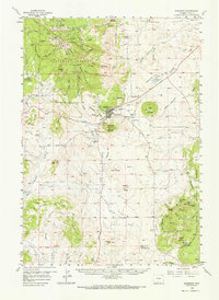
Editions of this 1958 Sundance Map
2 editions found
Other maps of this area

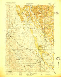
1898 · Sundance
USGS Topo · 1:125,000

1901 · Aladdin
USGS Topo · 1:125,000

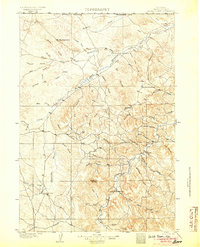
1902 · Sundance
USGS Topo · 1:125,000

1903 · Aladdin
USGS Topo · 1:125,000
1905 · Devils Tower
USGS Topo · 1:125,000
1918 · Moorcroft
USGS Topo · 1:125,000

1954 · Gillette
USGS Topo · 1:250,000
1955 · Devils Tower
USGS Topo · 1:62,500

1955 · Gillette
USGS Topo · 1:250,000
1957 · Nefsy Divide
USGS Topo · 1:62,500