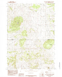
1984 Map of Inyan Kara Mountain
USGS Topo · Published 1984About this map
Inyan Kara Mountain dominates this portion of the Black Hills National Forest, rising above a complex network of drainages and ridges during the mid-1980s. This landscape, straddling the Crook and Weston county line, reveals a topography defined by significant peaks including Mount Tom, Strawberry Mountain, and Star Butte. The area is characterized by an intricate water system, where Kara Creek and Inyan Kara Creek flow through the northern reaches while the headwaters of Skull Creek and its West Fork emerge to the south. Other features like Cedar Ridge and Mason Creek further define this remote section of Wyoming. The map depicts a territory largely shaped by natural landmarks and primary forest boundaries, providing a clear view of the land's transition between elevated mountain peaks and the lower-lying creek beds that have guided travel and settlement in the region.
Find a feature on this map
15 named features on this map. Tap any name to fly to it.
Don’t see what you’re looking for? This feature index may not catch every label — zoom into the map to look around manually.
Map Details
Editions of this 1984 Inyan Kara Mountain Map
This is the sole edition of this map. No revisions or reprints were ever made.
Other maps of this area

1898 · Sundance
USGS Topo · 1:125,000

1902 · Sundance
USGS Topo · 1:125,000

1954 · Gillette
USGS Topo · 1:250,000

1955 · Gillette
USGS Topo · 1:250,000

1958 · Gillette
USGS Topo · 1:250,000
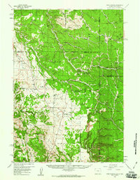
1958 · Four Corners
USGS Topo · 1:62,500
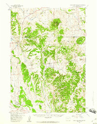
1958 · Inyan Kara Mountain
USGS Topo · 1:62,500

1958 · Tinton
USGS Topo · 1:62,500

1958 · Sundance
USGS Topo · 1:62,500

1962 · Gillette
USGS Topo · 1:250,000