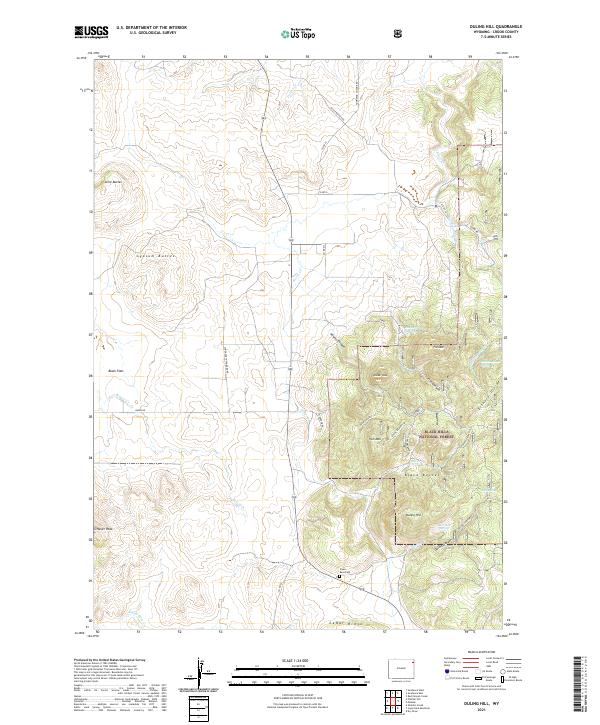
2021 Map of Duling Hill
USGS Topo · Published 2021About this map
Black Hills National Forest land dominates the eastern half of this 2021 survey, where the rugged topography of the Elkhorn Divide and Black Buttes creates a landscape defined by dramatic elevation changes. The high ground is anchored by several prominent summits, including Iron Mtn, Hooker Peak, and Fish Mtn, while the southern reaches are marked by Duling Hill and the deep incision of Duling Canyon. Genealogy and local history researchers will find the Inyan Kara Cem situated near the intersection of Ferderer RD and Co RD 62, a small point of human activity in an otherwise sparse rangeland.
Find a feature on this map
48 named features on this map. Tap any name to fly to it.
Don’t see what you’re looking for? This feature index may not catch every label — zoom into the map to look around manually.
Map Details
Editions of this 2021 Duling Hill Map
This is the sole edition of this map. No revisions or reprints were ever made.
Other maps of this area

1898 · Sundance
USGS Topo · 1:125,000

1902 · Sundance
USGS Topo · 1:125,000

1954 · Gillette
USGS Topo · 1:250,000

1955 · Gillette
USGS Topo · 1:250,000

1958 · Gillette
USGS Topo · 1:250,000
1958 · Four Corners
USGS Topo · 1:62,500
1958 · Inyan Kara Mountain
USGS Topo · 1:62,500

1958 · Tinton
USGS Topo · 1:62,500

1958 · Sundance
USGS Topo · 1:62,500

1962 · Gillette
USGS Topo · 1:250,000