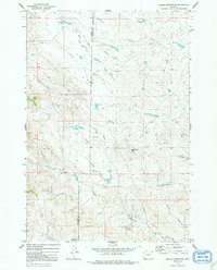
1972 Map of Bonnie Reservoir
USGS Topo · Published 1992About this map
The Campbell Co Crook Co boundary cuts through this high plains landscape, where water management and energy exploration define the terrain. Named water features like Bonnie Reservoir, Wengade Reservoir No 1, and Edgerton Reservoir highlight the importance of water storage in this drainage system, which feeds into the North Fork Little Missouri River and several ephemeral draws. Local landmarks such as Monument Hill and Horse Creek Arena offer concrete points of interest for historical research, while numerous Drill Hole locations and a prominent Pipeline illustrate the development of the region's natural resources. The map also traces the winding courses of Cracker Creek, Subatka Creek, and Driscoll Creek, providing a detailed look at the rural landscape and property lines that shaped this part of Wyoming during the early 1970s.
Find a feature on this map
16 named features on this map. Tap any name to fly to it.
Don’t see what you’re looking for? This feature index may not catch every label — zoom into the map to look around manually.
Map Details
Editions of this 1972 Bonnie Reservoir Map
2 editions found
Other maps of this area

1905 · Devils Tower
USGS Topo · 1:125,000

1954 · Gillette
USGS Topo · 1:250,000

1955 · Gillette
USGS Topo · 1:250,000

1957 · Oshoto
USGS Topo · 1:62,500

1957 · Cedar Ridge
USGS Topo · 1:62,500

1958 · Gillette
USGS Topo · 1:250,000

1962 · Gillette
USGS Topo · 1:250,000
1972 · Mitten Butte
USGS Topo · 1:24,000
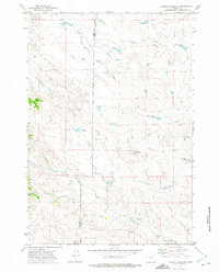
1972 · Bonnie Reservoir
USGS Topo · 1:24,000
1972 · Bowman Hill
USGS Topo · 1:24,000