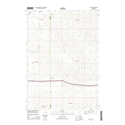
2015 Map of Rozet SE
USGS Topo · Published 2015About this map
Pleasant Valley Cem rests near the northern border of this high plains landscape, a primary marker for genealogists in this corner of Campbell County. The terrain is defined by a dense network of water management features and seasonal drainages, including the Raudsep Number 1 Reservoir, Keuhne Reservoir, and Phil Reservoir. These small impoundments are essential to the cattle ranching economy of the region, where roads like Kaehne Ranch Rd and Bertha Rd connect isolated homesteads across the drainage basins of Donkey Cr and Trail Cr. The map captures a moment in the mid-2010s where traditional ranching land use persists alongside the prominent east-west transportation corridor of Interstate 90. Prominent geographical landmarks like Little Pine Ridge and Wheat Draw provide context for the physical character of this Wyoming grassland.
Find a feature on this map
35 named features on this map. Tap any name to fly to it.
Don’t see what you’re looking for? This feature index may not catch every label — zoom into the map to look around manually.
Map Details
Editions of this 2015 Rozet SE Map
This is the sole edition of this map. No revisions or reprints were ever made.
Other maps of this area

1918 · Moorcroft
USGS Topo · 1:125,000

1918 · Moorcroft
USGS Topo · 1:62,500

1954 · Gillette
USGS Topo · 1:250,000

1955 · Gillette
USGS Topo · 1:250,000

1957 · Moorcroft
USGS Topo · 1:62,500

1958 · Gillette
USGS Topo · 1:250,000

1962 · Gillette
USGS Topo · 1:250,000

1971 · Coon Track Creek
USGS Topo · 1:24,000

1971 · Rozet
USGS Topo · 1:24,000
1971 · Rozet SE
USGS Topo · 1:24,000