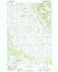
1984 Map of Arrowhead Reservoir
USGS Topo · Published 1991About this map
Pine Ridge dominates this corner of northeastern Wyoming, where the high plains meet a complex network of draws and canyons. Mapped based on 1979 field work, the landscape reveals a ranching and industrial geography defined by water access and drainage systems. Small named settlements like Wolfe, Stevens, and Philpott are situated near vital water sources or along topographical breaks.
Find a feature on this map
32 named features on this map. Tap any name to fly to it.
Don’t see what you’re looking for? This feature index may not catch every label — zoom into the map to look around manually.
Map Details
Editions of this 1984 Arrowhead Reservoir Map
2 editions found
Other maps of this area

1898 · Sundance
USGS Topo · 1:125,000

1902 · Sundance
USGS Topo · 1:125,000

1918 · Moorcroft
USGS Topo · 1:125,000

1954 · Gillette
USGS Topo · 1:250,000

1955 · Gillette
USGS Topo · 1:250,000

1957 · Nefsy Divide
USGS Topo · 1:62,500

1957 · Upton
USGS Topo · 1:62,500

1958 · Gillette
USGS Topo · 1:250,000
1958 · Inyan Kara Mountain
USGS Topo · 1:62,500

1958 · Sundance
USGS Topo · 1:62,500