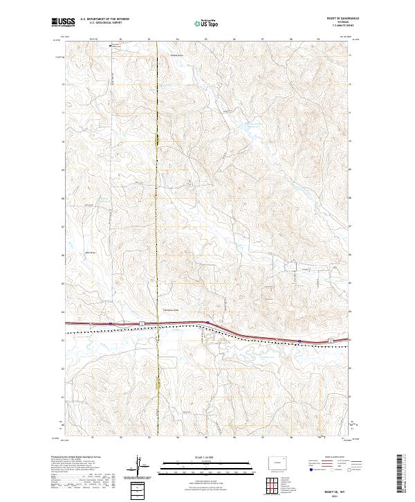
2021 Map of Rozet SE
USGS Topo · Published 2021About this map
Pleasant Valley Cem sits near the northern boundary of this high-plains landscape, overlooking a series of complex drainages that define the local geography. The map reveals the intricate network of seasonal waterways and draws, such as Wheat Draw, Thompson Cr, and Well Cr, which carve through the terrain between Campbell and Crook counties. This area is characterized by scattered ranching infrastructure and water management, evidenced by named features like the Roadsep Number Reservoir, Cherry Reservoir, and Cox Reservoir.
Find a feature on this map
35 named features on this map. Tap any name to fly to it.
Don’t see what you’re looking for? This feature index may not catch every label — zoom into the map to look around manually.
Map Details
Editions of this 2021 Rozet SE Map
This is the sole edition of this map. No revisions or reprints were ever made.
Other maps of this area

1918 · Moorcroft
USGS Topo · 1:125,000

1918 · Moorcroft
USGS Topo · 1:62,500

1954 · Gillette
USGS Topo · 1:250,000

1955 · Gillette
USGS Topo · 1:250,000

1957 · Moorcroft
USGS Topo · 1:62,500

1958 · Gillette
USGS Topo · 1:250,000

1962 · Gillette
USGS Topo · 1:250,000

1971 · Coon Track Creek
USGS Topo · 1:24,000

1971 · Rozet
USGS Topo · 1:24,000
1971 · Rozet SE
USGS Topo · 1:24,000