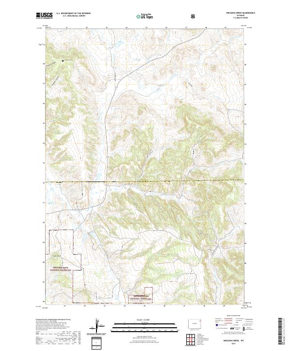
2021 Map of Sheldon Creek
USGS Topo · Published 2021About this map
Greenwood Cem sits in the northern reaches of this landscape where the high plains transition toward the Black Hills. The map documents a rural drainage network defined by the long courses of Inyan Kara Cr and Spring Cr, which carve through the undulating terrain near the Crook Co and Weston Co line. These seasonal waterways provided essential water for early cattle ranching in a region that remains largely open range.
Find a feature on this map
23 named features on this map. Tap any name to fly to it.
Don’t see what you’re looking for? This feature index may not catch every label — zoom into the map to look around manually.
Map Details
Editions of this 2021 Sheldon Creek Map
This is the sole edition of this map. No revisions or reprints were ever made.
Other maps of this area

1898 · Sundance
USGS Topo · 1:125,000

1902 · Sundance
USGS Topo · 1:125,000

1918 · Moorcroft
USGS Topo · 1:125,000

1954 · Gillette
USGS Topo · 1:250,000

1955 · Gillette
USGS Topo · 1:250,000

1957 · Nefsy Divide
USGS Topo · 1:62,500

1957 · Upton
USGS Topo · 1:62,500

1958 · Gillette
USGS Topo · 1:250,000
1958 · Inyan Kara Mountain
USGS Topo · 1:62,500

1958 · Sundance
USGS Topo · 1:62,500